
| Memorials | : | 0 |
| Location | : | Malle, Arrondissement Antwerpen, Belgium |
| Coordinate | : | 51.3013100, 4.6913200 |
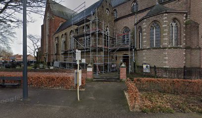
| Description | : | Location Information: The village of Westmalle is located east of the town of Antwerp off the E34/A13 which runs between Antwerp and Eindhoven, driving from Antwerp follow the E34 to the junction with the E313, then follow the E34 direction direction Eindhoven. Turn off at junction 20 Zoersel, at the T junction turn right on the N14 direction Zoersel, drive through the village and carry on along the N14 to the village of Oostmalle and the crossroads with the junction of the N12. Turn left onto the N12 direction Westmalle, on entering the village the town hall is on the... Read More |
frequently asked questions (FAQ):
-
Where is Westmalle Churchyard?
Westmalle Churchyard is located at Malle, Arrondissement Antwerpen ,Antwerp (Antwerpen) ,Belgium.
-
Westmalle Churchyard cemetery's updated grave count on graveviews.com?
0 memorials
-
Where are the coordinates of the Westmalle Churchyard?
Latitude: 51.3013100
Longitude: 4.6913200
Nearby Cemetories:
1. Oostmalle Cemetery
Malle, Arrondissement Antwerpen, Belgium
Coordinate: 51.3030200, 4.7267400
2. Zoersel Churchyard
Zoersel, Arrondissement Antwerpen, Belgium
Coordinate: 51.2671200, 4.7120900
3. Sint-Antonius Begraafplaats
Zoersel, Arrondissement Antwerpen, Belgium
Coordinate: 51.2816500, 4.6295100
4. Brecht Communal cemetery
Brecht, Arrondissement Antwerpen, Belgium
Coordinate: 51.3506500, 4.6494600
5. Rijkevorsel Centrum Cemetery
Rijkevorsel, Arrondissement Turnhout, Belgium
Coordinate: 51.3490300, 4.7532800
6. Halle-Zoersel Communal Cemetery
Zoersel, Arrondissement Antwerpen, Belgium
Coordinate: 51.2390400, 4.6495200
7. Sint-Job-in-'t-Goor Cemetery
Brecht, Arrondissement Antwerpen, Belgium
Coordinate: 51.2930500, 4.5802300
8. 's Gravenwezel Cemetery
Schilde, Arrondissement Antwerpen, Belgium
Coordinate: 51.2694400, 4.5603300
9. Schilde Cemetery
Schilde, Arrondissement Antwerpen, Belgium
Coordinate: 51.2314200, 4.5829500
10. Pulle Begraafplaats
Pulle, Arrondissement Antwerpen, Belgium
Coordinate: 51.2033104, 4.7154594
11. Beerse Communal Cemetery
Beerse, Arrondissement Turnhout, Belgium
Coordinate: 51.3231700, 4.8470310
12. Wuustwezel Churchyard
Wuustwezel, Arrondissement Antwerpen, Belgium
Coordinate: 51.3887500, 4.5992900
13. Brasschaat Maria Ter Heide Communal Cemetery
Brasschaat, Arrondissement Antwerpen, Belgium
Coordinate: 51.3199780, 4.5226980
14. Vorselaar Communal Cemetery
Vorselaar, Arrondissement Turnhout, Belgium
Coordinate: 51.2050700, 4.7700800
15. Oelegem Cemetery
Ranst, Arrondissement Antwerpen, Belgium
Coordinate: 51.2101053, 4.5962416
16. Sint-Katharinakerk
Hoogstraten, Arrondissement Turnhout, Belgium
Coordinate: 51.4008900, 4.7620700
17. Wuustwezel Gooreind Churchyard
Wuustwezel, Arrondissement Antwerpen, Belgium
Coordinate: 51.3581900, 4.5414800
18. Hoogstraten Cemetery
Hoogstraten, Arrondissement Turnhout, Belgium
Coordinate: 51.4002500, 4.7678700
19. Sint-Pieterskerk
Vorselaar, Arrondissement Turnhout, Belgium
Coordinate: 51.2025400, 4.7710400
20. Brasschaat Centrum Communal Cemetery
Brasschaat, Arrondissement Antwerpen, Belgium
Coordinate: 51.2921500, 4.5055640
21. Viersel Churchyard
Zandhoven, Arrondissement Antwerpen, Belgium
Coordinate: 51.1872400, 4.6491700
22. Minderhout Cemetery
Hoogstraten, Arrondissement Turnhout, Belgium
Coordinate: 51.4150700, 4.7611700
23. Merksplas Communal Cemetery
Merksplas, Arrondissement Turnhout, Belgium
Coordinate: 51.3612800, 4.8635400
24. Wijnegem Communal Cemetery
Wijnegem, Arrondissement Antwerpen, Belgium
Coordinate: 51.2282900, 4.5263600