
| Memorials | : | 0 |
| Location | : | Kayenta, Navajo County, USA |
| Coordinate | : | 36.7236310, -110.2630760 |
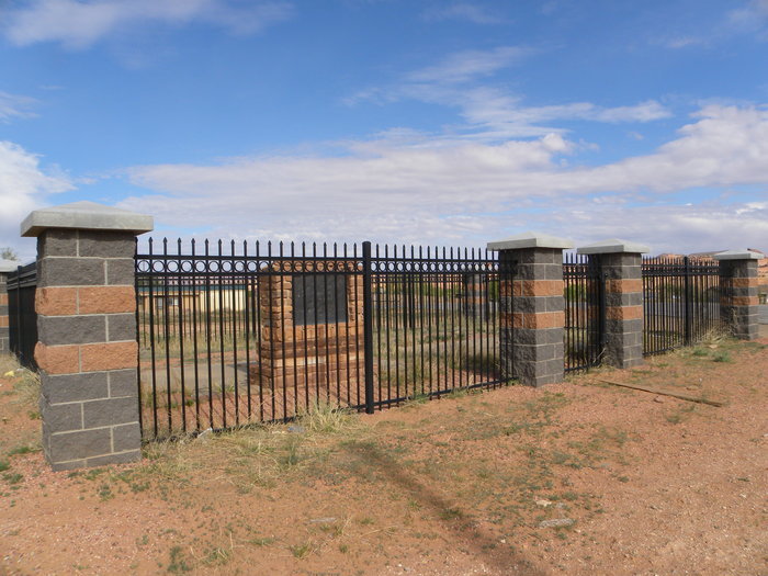
| Description | : | Family cemetery of the owners of the Wetherill and Colville Trading Post and Lodge. The road in front of the cemetery is named for the Betatakin Ruin discovered by John Wetherill in 1909. |
frequently asked questions (FAQ):
-
Where is Wetherill Cemetery?
Wetherill Cemetery is located at Betatakin Rd. Kayenta, Navajo County ,Arizona , 86033USA.
-
Wetherill Cemetery cemetery's updated grave count on graveviews.com?
0 memorials
-
Where are the coordinates of the Wetherill Cemetery?
Latitude: 36.7236310
Longitude: -110.2630760
Nearby Cemetories:
1. Kayenta Community Cemetery
Kayenta, Navajo County, USA
Coordinate: 36.7257100, -110.2336700
2. Black Mesa Cemetery
Navajo County, USA
Coordinate: 36.5614300, -110.5006100
3. Chilchinbeto Cemetery
Chilchinbeto, Navajo County, USA
Coordinate: 36.5247222, -110.0736111
4. Monument Valley Cemetery
San Juan County, USA
Coordinate: 37.0266800, -110.1977300
5. Dennehotso Community Cemetery
Dennehotso, Apache County, USA
Coordinate: 36.8079090, -109.8884020
6. Shonto Cemetery
Shonto, Navajo County, USA
Coordinate: 36.5986250, -110.6474120
7. Tes Nes Iah Cemetery
Apache County, USA
Coordinate: 36.9434300, -109.7091300
8. Navajo Mountain Cemetery
San Juan County, USA
Coordinate: 37.0739175, -110.7426710
9. Mexican Water Community Cemetery
Mexican Water, Apache County, USA
Coordinate: 36.9710200, -109.6274600
10. Pinon Cemetery
Pinon, Navajo County, USA
Coordinate: 36.1063430, -110.2194640
11. Navajo Nation Cemetery
Red Lake, Coconino County, USA
Coordinate: 36.3252880, -110.8586850
12. Black Mountain Community Cemetery
Apache County, USA
Coordinate: 36.1280770, -109.8809250
13. Tonalea Community Cemetery
Coconino County, USA
Coordinate: 36.3275210, -110.9573010
14. Immanuel Mission Cemetery
Coyote Springs, Apache County, USA
Coordinate: 36.8033170, -109.3964770
15. White Rock Point Cemetery
Tselakai Dezza, San Juan County, USA
Coordinate: 37.2237010, -109.6055910
16. Tselani Springs Cemetery
Apache County, USA
Coordinate: 36.0445070, -109.8698450
17. Chinle Cemetery
Chinle, Apache County, USA
Coordinate: 36.1715690, -109.5969040
18. Sunrise Cemetery
San Juan County, USA
Coordinate: 37.0650200, -109.3772200
19. Red Mesa Community Cemetery
San Juan County, USA
Coordinate: 37.0650200, -109.3771100
20. Bluff Cemetery
Bluff, San Juan County, USA
Coordinate: 37.2877998, -109.5541992
21. Saint Christophers Cemetery
Bluff, San Juan County, USA
Coordinate: 37.2852700, -109.5128500
22. Del Muerto Community Cemetery
Del Muerto, Apache County, USA
Coordinate: 36.2019520, -109.4264780
23. Cove Cemetery
Cove, Apache County, USA
Coordinate: 36.5598680, -109.2181240
24. Yazzie Family Plot
Chinle, Apache County, USA
Coordinate: 36.0892700, -109.5490140