| Memorials | : | 2 |
| Location | : | Stemple, Carroll County, USA |
| Coordinate | : | 40.6156006, -81.1063995 |
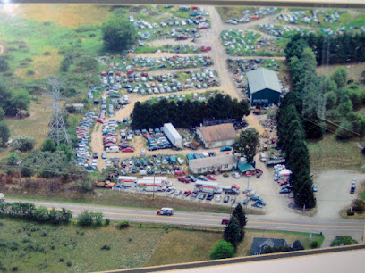
| Description | : | The cemetery is located in a pasture field about 500 feet south of Waynesville Road NE (Ohio State Route 171) about 700 feet west of its intersection with Canton Road NW (Ohio State Route 43). No stones remain. The cemetery is located in East Township, Carroll County, Ohio, and is # 1419 (Mennonite Cemetery / Wherry Cemetery) in “Ohio Cemeteries 1803-2003”, compiled by the Ohio Genealogical Society. The U.S. Geological Survey (USGS) Geographic Names Information System (GNIS) feature ID for the cemetery is 1047853 (Wherry Cemetery). |
frequently asked questions (FAQ):
-
Where is Wherry Cemetery?
Wherry Cemetery is located at Waynesville Road NE (Ohio State Route 171) Stemple, Carroll County ,Ohio , 44615USA.
-
Wherry Cemetery cemetery's updated grave count on graveviews.com?
2 memorials
-
Where are the coordinates of the Wherry Cemetery?
Latitude: 40.6156006
Longitude: -81.1063995
Nearby Cemetories:
1. Harsh-Swamp Cemetery
Carroll County, USA
Coordinate: 40.6413994, -81.0892029
2. County Home Cemetery
Carroll County, USA
Coordinate: 40.6175003, -81.0674973
3. New Harrisburg Cemetery
New Harrisburg, Carroll County, USA
Coordinate: 40.6208000, -81.1483002
4. Aller Family Cemetery
Carrollton, Carroll County, USA
Coordinate: 40.5879760, -81.0771540
5. Immaculate Heart of Mary Cemetery
Carrollton, Carroll County, USA
Coordinate: 40.5758010, -81.0955510
6. Pleasant Grove Cemetery
Carroll County, USA
Coordinate: 40.6589012, -81.1089020
7. Stuller Cemetery
Carroll County, USA
Coordinate: 40.6302986, -81.0513992
8. Baxters Ridge Cemetery
Carroll County, USA
Coordinate: 40.6068993, -81.1686020
9. Grandview Cemetery
Carrollton, Carroll County, USA
Coordinate: 40.5694008, -81.0828018
10. Champers Cemetery
Carrollton, Carroll County, USA
Coordinate: 40.5667610, -81.1178540
11. Pleasant Valley Cemetery
Carroll County, USA
Coordinate: 40.5764008, -81.1493988
12. Piecynski Farm Cemetery
Carrollton, Carroll County, USA
Coordinate: 40.5658690, -81.1224020
13. Westview Cemetery
Carrollton, Carroll County, USA
Coordinate: 40.5663986, -81.0852966
14. Devils Half Acre Cemetery
Oneida, Carroll County, USA
Coordinate: 40.6697006, -81.1235962
15. Chestnut Knob Cemetery
Carroll County, USA
Coordinate: 40.6772003, -81.0886002
16. Still Fork Church Cemetery
Carroll County, USA
Coordinate: 40.6719017, -81.0505981
17. Woods Cemetery
Carroll County, USA
Coordinate: 40.6377983, -81.1947021
18. Stillfork Cemetery
Augusta, Carroll County, USA
Coordinate: 40.6720050, -81.0503730
19. Macedonia Cemetery
Carroll County, USA
Coordinate: 40.6217003, -81.1994019
20. McGuire Cemetery
Tabor, Carroll County, USA
Coordinate: 40.5518990, -81.1564026
21. Old Scott Cemetery
Carroll County, USA
Coordinate: 40.5483017, -81.1541977
22. Bird Cemetery
Carroll County, USA
Coordinate: 40.6761017, -81.0406036
23. Herrington Bethel Cemetery
Carroll County, USA
Coordinate: 40.6493988, -81.0128021
24. Mount Olivet Cemetery
Carroll County, USA
Coordinate: 40.5905991, -81.0081024

