
| Memorials | : | 228 |
| Location | : | Carrollton, Carroll County, USA |
| Coordinate | : | 40.5663986, -81.0852966 |
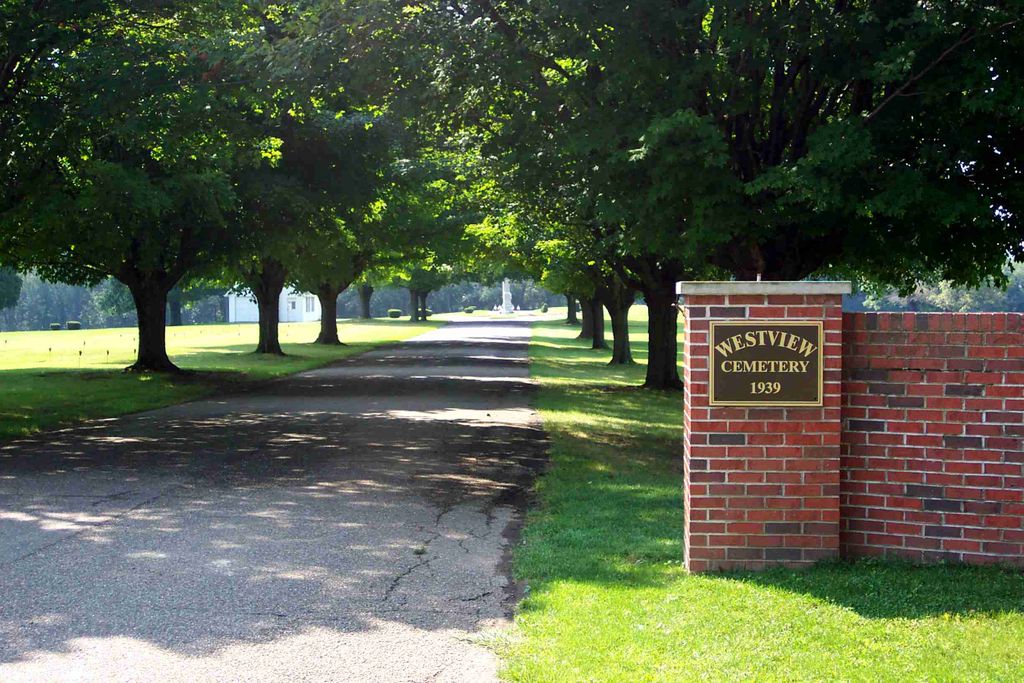
| Description | : | The cemetery is located at the southeast end of 4th Street. The cemetery was established in 1939. The cemetery is located in the city of Carrolltown, Center Township, Carroll County, Ohio, and is # 1404 (Carrollton Westview Cemetery) in “Ohio Cemeteries 1803-2003”, compiled by the Ohio Genealogical Society. The cemetery is registered with the Ohio Division of Real Estate and Professional Licensing (ODRE) as the Westview Cemetery with registration license number CGR.0000981223. The U.S. Geological Survey (USGS) Geographic Names Information System (GNIS) feature ID for the cemetery is 1047833 (Westview Cemetery). |
frequently asked questions (FAQ):
-
Where is Westview Cemetery?
Westview Cemetery is located at 4th Street SE Carrollton, Carroll County ,Ohio , 44615USA.
-
Westview Cemetery cemetery's updated grave count on graveviews.com?
224 memorials
-
Where are the coordinates of the Westview Cemetery?
Latitude: 40.5663986
Longitude: -81.0852966
Nearby Cemetories:
1. Grandview Cemetery
Carrollton, Carroll County, USA
Coordinate: 40.5694008, -81.0828018
2. Immaculate Heart of Mary Cemetery
Carrollton, Carroll County, USA
Coordinate: 40.5758010, -81.0955510
3. Aller Family Cemetery
Carrollton, Carroll County, USA
Coordinate: 40.5879760, -81.0771540
4. Champers Cemetery
Carrollton, Carroll County, USA
Coordinate: 40.5667610, -81.1178540
5. Piecynski Farm Cemetery
Carrollton, Carroll County, USA
Coordinate: 40.5658690, -81.1224020
6. Mount Pleasant Cemetery
Carrollton, Carroll County, USA
Coordinate: 40.5238991, -81.1003036
7. Lee Cemetery
Carroll County, USA
Coordinate: 40.5391998, -81.0314026
8. Pleasant Valley Cemetery
Carroll County, USA
Coordinate: 40.5764008, -81.1493988
9. Wherry Cemetery
Stemple, Carroll County, USA
Coordinate: 40.6156006, -81.1063995
10. Denver George Haddock Family Cemetery
Carrollton, Carroll County, USA
Coordinate: 40.5443880, -81.0227370
11. County Home Cemetery
Carroll County, USA
Coordinate: 40.6175003, -81.0674973
12. Old Scott Cemetery
Carroll County, USA
Coordinate: 40.5483017, -81.1541977
13. McGuire Cemetery
Tabor, Carroll County, USA
Coordinate: 40.5518990, -81.1564026
14. Seceders Cemetery
Carroll County, USA
Coordinate: 40.5332985, -81.1446991
15. Downing Cemetery
Carroll County, USA
Coordinate: 40.5567017, -81.0117035
16. Green Hill Cemetery
Carroll County, USA
Coordinate: 40.5303001, -81.0246964
17. Scotts Cemetery
Carroll County, USA
Coordinate: 40.5386009, -81.1556015
18. Farnsworth Cemetery
Carroll County, USA
Coordinate: 40.5385017, -81.1567001
19. Mount Olivet Cemetery
Carroll County, USA
Coordinate: 40.5905991, -81.0081024
20. Moorehead Cemetery
Carroll County, USA
Coordinate: 40.5449982, -81.0033035
21. Stuller Cemetery
Carroll County, USA
Coordinate: 40.6302986, -81.0513992
22. New Harrisburg Cemetery
New Harrisburg, Carroll County, USA
Coordinate: 40.6208000, -81.1483002
23. Harsh-Swamp Cemetery
Carroll County, USA
Coordinate: 40.6413994, -81.0892029
24. Baxters Ridge Cemetery
Carroll County, USA
Coordinate: 40.6068993, -81.1686020