
| Memorials | : | 0 |
| Location | : | Madras, Jefferson County, USA |
| Coordinate | : | 44.7057200, -121.2260600 |
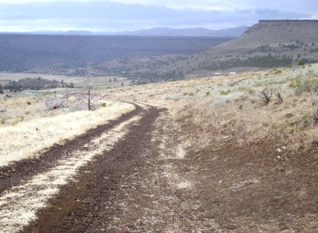
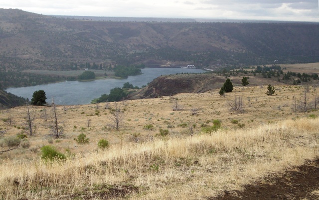
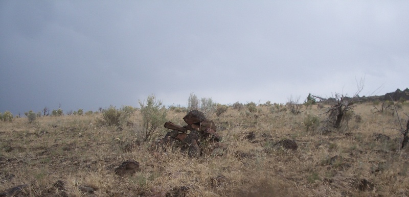
| Description | : | This lone burial is located about half a mile up the canyon from Negro Brown Ranch. The location is in sight of Pelton Dam in the area of the former town of Vanora (historical site). This is in the center of Section 7 off Highway 26. A range fire in 1941 apparently destroyed the marker, but the site is believed to be marked by a pile of rocks. In the spring of 1885, "Whistling Smith" was found frozen to death here and was buried at the spot where he was found. (Source: "Oregon Burial Site Guide" p. 411.) |
frequently asked questions (FAQ):
-
Where is Whistling Smith Burial Site?
Whistling Smith Burial Site is located at T10S R13E S7 Madras, Jefferson County ,Oregon ,USA.
-
Whistling Smith Burial Site cemetery's updated grave count on graveviews.com?
0 memorials
-
Where are the coordinates of the Whistling Smith Burial Site?
Latitude: 44.7057200
Longitude: -121.2260600
Nearby Cemetories:
1. Milo Gard Cemetery
Madras, Jefferson County, USA
Coordinate: 44.7085991, -121.1877975
2. Kalama Cemetery
Jefferson County, USA
Coordinate: 44.7492400, -121.2751500
3. Seekseequa Cemetery
Jefferson County, USA
Coordinate: 44.6707993, -121.2930984
4. Tenino Cemetery
Warm Springs, Jefferson County, USA
Coordinate: 44.7556000, -121.2791977
5. Seekseequa Cemetery
Jefferson County, USA
Coordinate: 44.6767006, -121.3125000
6. Round Butte Cemetery
Jefferson County, USA
Coordinate: 44.6366997, -121.2097015
7. Warm Springs Agency Cemetery
Warm Springs, Jefferson County, USA
Coordinate: 44.7714005, -121.2733002
8. Dry Creek Cemetery
Warm Springs, Jefferson County, USA
Coordinate: 44.7971992, -121.2478027
9. Mount Jefferson Memorial Park
Madras, Jefferson County, USA
Coordinate: 44.6458015, -121.1074982
10. Brownhill Children Burial Site
Gateway, Jefferson County, USA
Coordinate: 44.7800680, -121.1071010
11. Sagebrush Springs Lost Meek Campsite
Gateway, Jefferson County, USA
Coordinate: 44.7499940, -121.0568900
12. Methodist Hill Cemetery
Metolius, Jefferson County, USA
Coordinate: 44.5639000, -121.2091980
13. Hot Springs Cemetery
Wasco County, USA
Coordinate: 44.8513985, -121.1541977
14. Kampfer Family Cemetery
Gateway, Jefferson County, USA
Coordinate: 44.7981830, -121.0254010
15. James Edwards Burial Site
Willowdale, Jefferson County, USA
Coordinate: 44.7702607, -121.0028482
16. Culver IOOF Cemetery
Culver, Jefferson County, USA
Coordinate: 44.5344009, -121.1691971
17. Richardson Family Ranch Cemetery
Madras, Jefferson County, USA
Coordinate: 44.7327200, -120.9757900
18. John Pearce Burial Site
Willowdale, Jefferson County, USA
Coordinate: 44.6545390, -120.9659690
19. John Ellsworth McCoy Burial Site
Madras, Jefferson County, USA
Coordinate: 44.6241140, -120.9503750
20. Hay Creek Cemetery
Jefferson County, USA
Coordinate: 44.6282997, -120.9467010
21. Grandview Cemetery
Jefferson County, USA
Coordinate: 44.4944000, -121.3707962
22. Lost Meek Rimrock Springs Burial Site
Grizzly, Jefferson County, USA
Coordinate: 44.4954450, -121.0546000
23. Simnasho Cemetery
Wasco County, USA
Coordinate: 44.9481010, -121.3206024
24. Gray Butte Cemetery
Culver, Jefferson County, USA
Coordinate: 44.4626007, -121.0992966