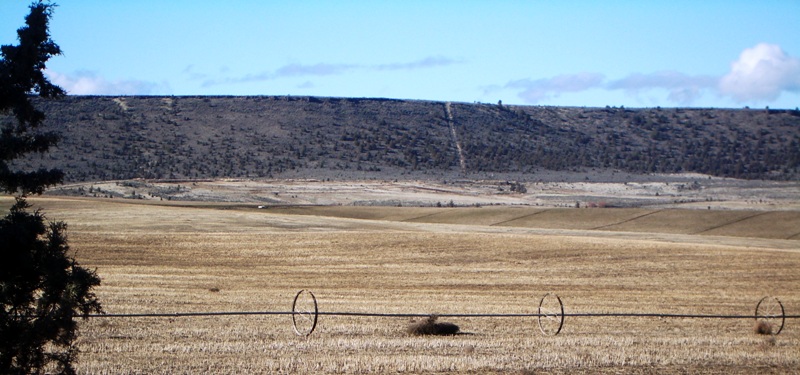
| Memorials | : | 0 |
| Location | : | Gateway, Jefferson County, USA |
| Coordinate | : | 44.7499940, -121.0568900 |
| Description | : | At this site, the two parties of the Lost Meek Wagon Train rejoined each other, having split into two groups at Wagontire. Samuel Parker's diary noted: "September 25 [1845] Traveled all that day and all that nite and struck water about 10 on the 26 day. 65 codent get to water and water was taken to them. 32 in number. Heare we beried 6 persons." About 200 wagons camped until Sunday, September 28. More continued to perish on their desperate journey to reach The Dalles. Commemorative sign located along Eagle Lane. |
frequently asked questions (FAQ):
-
Where is Sagebrush Springs Lost Meek Campsite?
Sagebrush Springs Lost Meek Campsite is located at T9S R14E Sec. 28 - Sign located on south side of NE Eagle Gateway, Jefferson County ,Oregon ,USA.
-
Sagebrush Springs Lost Meek Campsite cemetery's updated grave count on graveviews.com?
0 memorials
-
Where are the coordinates of the Sagebrush Springs Lost Meek Campsite?
Latitude: 44.7499940
Longitude: -121.0568900
Nearby Cemetories:
1. James Edwards Burial Site
Willowdale, Jefferson County, USA
Coordinate: 44.7702607, -121.0028482
2. Brownhill Children Burial Site
Gateway, Jefferson County, USA
Coordinate: 44.7800680, -121.1071010
3. Kampfer Family Cemetery
Gateway, Jefferson County, USA
Coordinate: 44.7981830, -121.0254010
4. Richardson Family Ranch Cemetery
Madras, Jefferson County, USA
Coordinate: 44.7327200, -120.9757900
5. Milo Gard Cemetery
Madras, Jefferson County, USA
Coordinate: 44.7085991, -121.1877975
6. Mount Jefferson Memorial Park
Madras, Jefferson County, USA
Coordinate: 44.6458015, -121.1074982
7. John Pearce Burial Site
Willowdale, Jefferson County, USA
Coordinate: 44.6545390, -120.9659690
8. Hot Springs Cemetery
Wasco County, USA
Coordinate: 44.8513985, -121.1541977
9. Whistling Smith Burial Site
Madras, Jefferson County, USA
Coordinate: 44.7057200, -121.2260600
10. Dry Creek Cemetery
Warm Springs, Jefferson County, USA
Coordinate: 44.7971992, -121.2478027
11. Hay Creek Cemetery
Jefferson County, USA
Coordinate: 44.6282997, -120.9467010
12. John Ellsworth McCoy Burial Site
Madras, Jefferson County, USA
Coordinate: 44.6241140, -120.9503750
13. Kalama Cemetery
Jefferson County, USA
Coordinate: 44.7492400, -121.2751500
14. Warm Springs Agency Cemetery
Warm Springs, Jefferson County, USA
Coordinate: 44.7714005, -121.2733002
15. Round Butte Cemetery
Jefferson County, USA
Coordinate: 44.6366997, -121.2097015
16. Tenino Cemetery
Warm Springs, Jefferson County, USA
Coordinate: 44.7556000, -121.2791977
17. Seekseequa Cemetery
Jefferson County, USA
Coordinate: 44.6707993, -121.2930984
18. Seekseequa Cemetery
Jefferson County, USA
Coordinate: 44.6767006, -121.3125000
19. Woods Cemetery
Jefferson County, USA
Coordinate: 44.7372017, -120.7583008
20. Methodist Hill Cemetery
Metolius, Jefferson County, USA
Coordinate: 44.5639000, -121.2091980
21. Maupin Cemetery
Ashwood, Jefferson County, USA
Coordinate: 44.7731018, -120.7536011
22. Culver IOOF Cemetery
Culver, Jefferson County, USA
Coordinate: 44.5344009, -121.1691971
23. Annie Cleek Burial Site
Grizzly, Jefferson County, USA
Coordinate: 44.5096230, -120.9429640
24. Lost Meek Rimrock Springs Burial Site
Grizzly, Jefferson County, USA
Coordinate: 44.4954450, -121.0546000


