
| Memorials | : | 2 |
| Location | : | Archers Lodge, Johnston County, USA |
| Coordinate | : | 35.6940575, -78.3750381 |
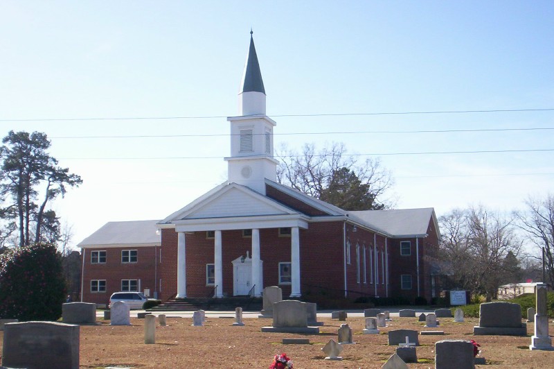
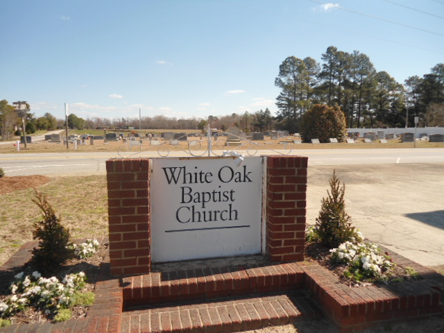
| Description | : | Archer Lodge Missionary Baptist Church was founded in 1859. In 1883 the name was changed to White Oak Baptist Church after the stand of white oak trees on the property. |
frequently asked questions (FAQ):
-
Where is White Oak Baptist Church Cemetery?
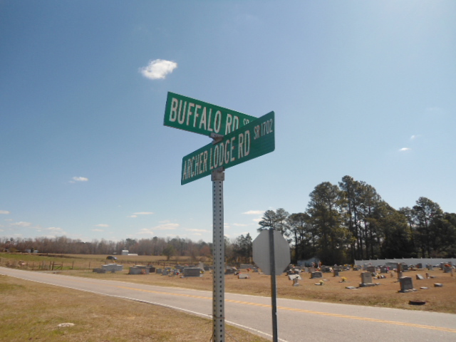
White Oak Baptist Church Cemetery is located at 13943 Buffalo Road Archers Lodge, Johnston County ,North Carolina ,USA.
-
White Oak Baptist Church Cemetery cemetery's updated grave count on graveviews.com?
2 memorials
-
Where are the coordinates of the White Oak Baptist Church Cemetery?
Latitude: 35.6940575
Longitude: -78.3750381
Nearby Cemetories:
1. Jesse Wall Cemetery
Archers Lodge, Johnston County, USA
Coordinate: 35.6950640, -78.3763900
2. Wall Family Cemetery
Archers Lodge, Johnston County, USA
Coordinate: 35.6904500, -78.3764490
3. Parker Family Cemetery
Archers Lodge, Johnston County, USA
Coordinate: 35.7077537, -78.3844034
4. Ruffin J. Castleberry Cemetery
Clayton, Johnston County, USA
Coordinate: 35.6703900, -78.3892900
5. Henry Anderson Cemetery
Johnston County, USA
Coordinate: 35.7220140, -78.3507050
6. O'Neal and Williams Cemetery
Archers Lodge, Johnston County, USA
Coordinate: 35.6996900, -78.3331300
7. Needham H. Whitley Cemetery
Archers Lodge, Johnston County, USA
Coordinate: 35.7129900, -78.3385650
8. Gay Cemetery
Johnston County, USA
Coordinate: 35.6758003, -78.4197006
9. Raeford Williamson Cemetery
Clayton, Johnston County, USA
Coordinate: 35.7115730, -78.3287500
10. Salem Primitive Baptist Church Cemetery
Archers Lodge, Johnston County, USA
Coordinate: 35.7283974, -78.3447037
11. Clyde's Chapel Baptist Church Cemetery
Archers Lodge, Johnston County, USA
Coordinate: 35.7360611, -78.3869324
12. Berry Woodard Cemetery
Clayton, Johnston County, USA
Coordinate: 35.7053700, -78.3235600
13. Batten Cemetery
Johnston County, USA
Coordinate: 35.6543999, -78.3206024
14. Bunn Raines Thompson
Emit, Johnston County, USA
Coordinate: 35.7146000, -78.3015800
15. Bunker Hill Cemetery
Clayton, Johnston County, USA
Coordinate: 35.6619400, -78.4470900
16. Wilders Community Cemetery
Archers Lodge, Johnston County, USA
Coordinate: 35.7248710, -78.3015190
17. Doub Family Cemetery
Wake County, USA
Coordinate: 35.7406006, -78.4368973
18. Corinth Baptist Church Cemetery
Johnston County, USA
Coordinate: 35.7287710, -78.2987720
19. Eason Cemetery
Johnston County, USA
Coordinate: 35.6885986, -78.2869034
20. Bell-McCullers Cemetery
Clayton, Johnston County, USA
Coordinate: 35.6811000, -78.4639690
21. Good Hope Baptist Church Cemetery
Knightdale, Wake County, USA
Coordinate: 35.7424730, -78.4441540
22. J.W.M. Jones Cemetery
Clayton, Johnston County, USA
Coordinate: 35.6243730, -78.4087540
23. John D. Eason Cemetery
Clayton, Johnston County, USA
Coordinate: 35.6423180, -78.3072750
24. Powhatan Church Cemetery
Clayton, Johnston County, USA
Coordinate: 35.6215600, -78.4081790