
| Memorials | : | 2 |
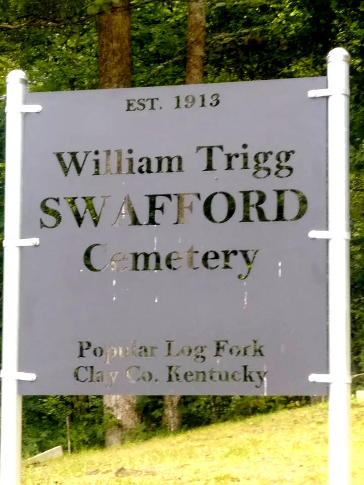
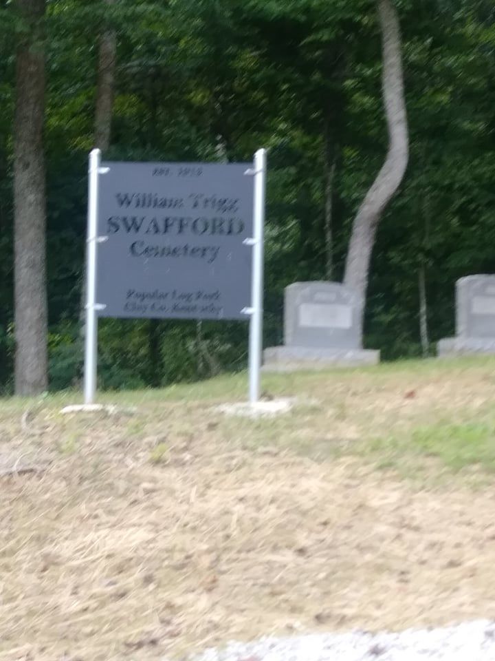
| Location | : | Ogle, Clay County, USA |
| Coordinate | : | 37.0214367, -83.7312182 |
| Description | : | Go to HWY 1524 then turn on Otter Creek Road. Stay straight on Otter Creek Road until you see a sign saids Swafford Branch Road turn go to the head of the holler and go up a hill and it is behide the Swafford Cemetery. |
frequently asked questions (FAQ):
-
Where is William Trigg Swafford Cemetery?
William Trigg Swafford Cemetery is located at Ogle, Clay County ,Kentucky ,USA.
-
William Trigg Swafford Cemetery cemetery's updated grave count on graveviews.com?
2 memorials
-
Where are the coordinates of the William Trigg Swafford Cemetery?
Latitude: 37.0214367
Longitude: -83.7312182
Nearby Cemetories:
1. Swafford Cemetery
Ogle, Clay County, USA
Coordinate: 37.0213800, -83.7308600
2. Old Swafford
Ogle, Clay County, USA
Coordinate: 37.0250720, -83.7184370
3. Duff Cemetery
Ogle, Clay County, USA
Coordinate: 37.0293190, -83.7129090
4. Buzzard Creek Cemetery
Manchester, Clay County, USA
Coordinate: 37.0459251, -83.7499364
5. Sizemore-Asher Cemetery
Lincoln, Clay County, USA
Coordinate: 37.0491650, -83.7456360
6. Abner-Stewart Cemetery
Bluehole, Clay County, USA
Coordinate: 37.0491650, -83.7456820
7. Wiley Smith Cemetery
Lincoln, Clay County, USA
Coordinate: 37.0519350, -83.7386780
8. Mayfork Community Cemetery
Otter Creek, Clay County, USA
Coordinate: 37.0295986, -83.6934598
9. Reid Cemetery
Lincoln, Clay County, USA
Coordinate: 37.0587300, -83.7398300
10. Swafford Branch Cemetery
Lincoln, Clay County, USA
Coordinate: 37.0597800, -83.7239600
11. Mills Cemetery
Brightshade, Clay County, USA
Coordinate: 36.9909940, -83.6926450
12. Harrison Smith Cemetery
Hammond, Knox County, USA
Coordinate: 36.9919000, -83.7768140
13. Napier Cemetery
Lincoln, Clay County, USA
Coordinate: 37.0728420, -83.7292790
14. Scalf Family Cemetery
Hammond, Knox County, USA
Coordinate: 36.9707230, -83.7184170
15. Ted Woods Cemetery
Ogle, Clay County, USA
Coordinate: 37.0543800, -83.6774900
16. John Woods Sr. Cemetery
Brightshade, Clay County, USA
Coordinate: 37.0569200, -83.6790100
17. Ruth Cemetery
Lincoln, Clay County, USA
Coordinate: 37.0777300, -83.7424300
18. Charlie Hubbard Cemetery
Goose Rock, Clay County, USA
Coordinate: 37.0682980, -83.6886840
19. Smallwood Cemetery
Brightshade, Clay County, USA
Coordinate: 37.0363130, -83.6608080
20. Gregory Cemetery
Knox County, USA
Coordinate: 36.9866982, -83.7900009
21. Andy Hubbard Cemetery
Brightshade, Clay County, USA
Coordinate: 37.0275400, -83.6584200
22. Downey Cemetery
Bluehole, Clay County, USA
Coordinate: 37.0800200, -83.7345200
23. Farmer Smith Cemetery
Goose Rock, Clay County, USA
Coordinate: 37.0519130, -83.6679080
24. Speed Smith Cemetery
Ogle, Clay County, USA
Coordinate: 37.0534900, -83.6667700