| Memorials | : | 0 |
| Location | : | Bowling Green, Clay County, USA |
| Coordinate | : | 39.3858200, -87.0503200 |
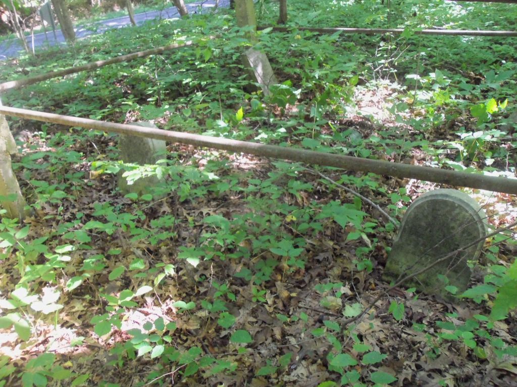
| Description | : | This cemetery is located in Washington Township (NE quadrant of the NW quadrant of the NW quadrant of Section 23 Township 11N Range 6W) on the south side of Indiana State Highway 46 about 0.2 miles east of N County Road 300 E. The cemetery sits on top of a small hill in the woods and has 5 stones, only 3 of which are readable. There is a small fence around the stones. Indiana Cemetery Locations, Volume 4, published by the Indiana Genealogical Society (April 2009), gives the primary cemetery name as Williams Cemetery. The cemetery is listed... Read More |
frequently asked questions (FAQ):
-
Where is Williams Cemetery?
Williams Cemetery is located at Indiana State Highway 46 Bowling Green, Clay County ,Indiana , 47840USA.
-
Williams Cemetery cemetery's updated grave count on graveviews.com?
0 memorials
-
Where are the coordinates of the Williams Cemetery?
Latitude: 39.3858200
Longitude: -87.0503200
Nearby Cemetories:
1. Sloan Cemetery
Washington Township, Clay County, USA
Coordinate: 39.3753000, -87.0439000
2. Killion Cemetery
Bowling Green, Clay County, USA
Coordinate: 39.3931007, -87.0355988
3. Clay County Poor Farm Cemetery
Center Point, Clay County, USA
Coordinate: 39.3711320, -87.0433790
4. Grimes Cemetery
Clay County, USA
Coordinate: 39.3860779, -87.0912018
5. Bowling Green Cemetery
Bowling Green, Clay County, USA
Coordinate: 39.3856888, -87.0073395
6. Zenor Cemetery
Clay County, USA
Coordinate: 39.3680992, -87.0117035
7. Swalley Cemetery
Bowling Green, Clay County, USA
Coordinate: 39.3522797, -87.0343475
8. Fairview Cemetery
Bowling Green, Clay County, USA
Coordinate: 39.3689000, -87.0081020
9. Center Point Cemetery
Center Point, Clay County, USA
Coordinate: 39.4178848, -87.0738297
10. Orman Cemetery
Bowling Green, Clay County, USA
Coordinate: 39.3458000, -87.0283000
11. Ashboro-Moss Cemetery
Ashboro, Clay County, USA
Coordinate: 39.3978700, -87.1095700
12. Snoddy Cemetery
Clay County, USA
Coordinate: 39.3574982, -86.9978027
13. Mustard Cemetery
Poland, Clay County, USA
Coordinate: 39.4222000, -87.0003000
14. Stephens Cemetery
Owen County, USA
Coordinate: 39.3379240, -87.0148030
15. Funk Cemetery
Clay County, USA
Coordinate: 39.3443985, -87.0008011
16. Sixmile Cemetery
Clay County, USA
Coordinate: 39.3568993, -86.9863968
17. Saint John's Cemetery
Brazil, Clay County, USA
Coordinate: 39.4443130, -87.0429688
18. Kaelber Cemetery
Clay County, USA
Coordinate: 39.4455986, -87.0667038
19. Rizley Cemetery
Clay County, USA
Coordinate: 39.4375000, -87.0008000
20. Baumunk Cemetery
Saline City, Clay County, USA
Coordinate: 39.3432999, -87.1130981
21. Mount Zion Cemetery
Bowling Green, Clay County, USA
Coordinate: 39.3636400, -86.9697400
22. Cole Cemetery
Harrison Township, Clay County, USA
Coordinate: 39.3211600, -87.0729500
23. Deeter Cemetery
Ashboro, Clay County, USA
Coordinate: 39.4074340, -87.1364310
24. Schoppenhorst Cemetery
Poland, Clay County, USA
Coordinate: 39.4103000, -86.9614000


