
| Memorials | : | 0 |
| Location | : | Carrollton, Carroll County, USA |
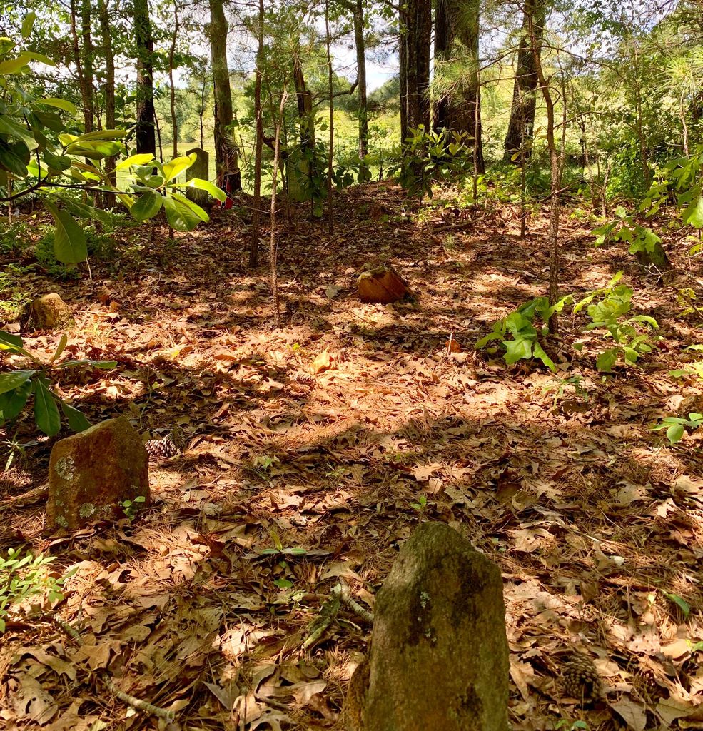
| Description | : | Williams Family Cemetery is located on private property, in Carrollton, Carroll County, Georgia, USA on what was originally known as Land Lot 118, in District 5, of Carroll County, Georgia, still owned today by the Jordan Family through Joel Casper Williams, son of Thomas Barnes WILLIAMS and his wife, Hannah Pinson WILLIAMS. Many graves in this cemetery are marked with field stones. |
frequently asked questions (FAQ):
-
Where is Williams Family Cemetery?
Williams Family Cemetery is located at Carrollton, Carroll County, USA.
-
Williams Family Cemetery cemetery's updated grave count on graveviews.com?
0 memorials
Nearby Cemetories:
1. Church at Carrollton Cemetery
Abilene, Carroll County, USA
Coordinate: 33.6112090, -85.2017780
2. Chappell Family Cemetery
Carroll County, USA
Coordinate: 33.6506720, -85.2124070
3. Community Bible Church Cemetery
Carroll County, USA
Coordinate: 33.6556380, -85.2048750
4. Craven-Gentry Cemetery
Carroll County, USA
Coordinate: 33.6355700, -85.1865800
5. Crawford
Carroll County, USA
Coordinate: 33.6046982, -84.9214020
6. Cross Plains Baptist Church Cemetery
Cross Plains, Carroll County, USA
Coordinate: 33.6362740, -84.9793450
7. Gilley Cemetery
Cross Plains, Carroll County, USA
Coordinate: 33.6317010, -84.9728320
8. Hinesley Cemetery
Cross Plains, Carroll County, USA
9. Mount Carmel Church Cemetery
Cross Plains, Carroll County, USA
Coordinate: 33.5687180, -84.8654040
10. Wilson Chapel Cemetery
Cross Plains, Carroll County, USA
Coordinate: 33.5708010, -84.8264360
11. Mount Calvary Cemetery
Carroll County, USA
Coordinate: 33.5696390, -84.8545250
12. Entrekin Cemetery
Mount Zion, Carroll County, USA
Coordinate: 33.5668500, -84.8338560
13. Holmes Cemetery
Mount Zion, Carroll County, USA
Coordinate: 33.6112090, -85.2017780
14. McBurnett Cemetery
Mount Zion, Carroll County, USA
Coordinate: 33.6506720, -85.2124070
15. Mincey Cemetery
Mount Zion, Carroll County, USA
Coordinate: 33.6556380, -85.2048750
16. Mount Zion United Methodist Cemetery
Mount Zion, Carroll County, USA
Coordinate: 33.6355700, -85.1865800
17. Bright Star Cemetery
Carroll County, USA
Coordinate: 33.6046982, -84.9214020
18. Brown Cemetery
Sand Hill, Carroll County, USA
Coordinate: 33.6362740, -84.9793450
19. Poplar Springs United Methodist Church Cemetery
Sand Hill, Carroll County, USA
Coordinate: 33.6317010, -84.9728320
20. Burson Family Cemetery
Carroll County, USA
21. Holland Mills Cemetery
Byers Crossroads, Carroll County, USA
Coordinate: 33.5687180, -84.8654040
22. Neal Cemetery
Byers Crossroads, Carroll County, USA
Coordinate: 33.5708010, -84.8264360
23. Richards Cemetery
Byers Crossroads, Carroll County, USA
Coordinate: 33.5696390, -84.8545250
24. Word Cemetery
Byers Crossroads, Carroll County, USA
Coordinate: 33.5668500, -84.8338560