
| Memorials | : | 0 |
| Location | : | Villa Rica, Carroll County, USA |
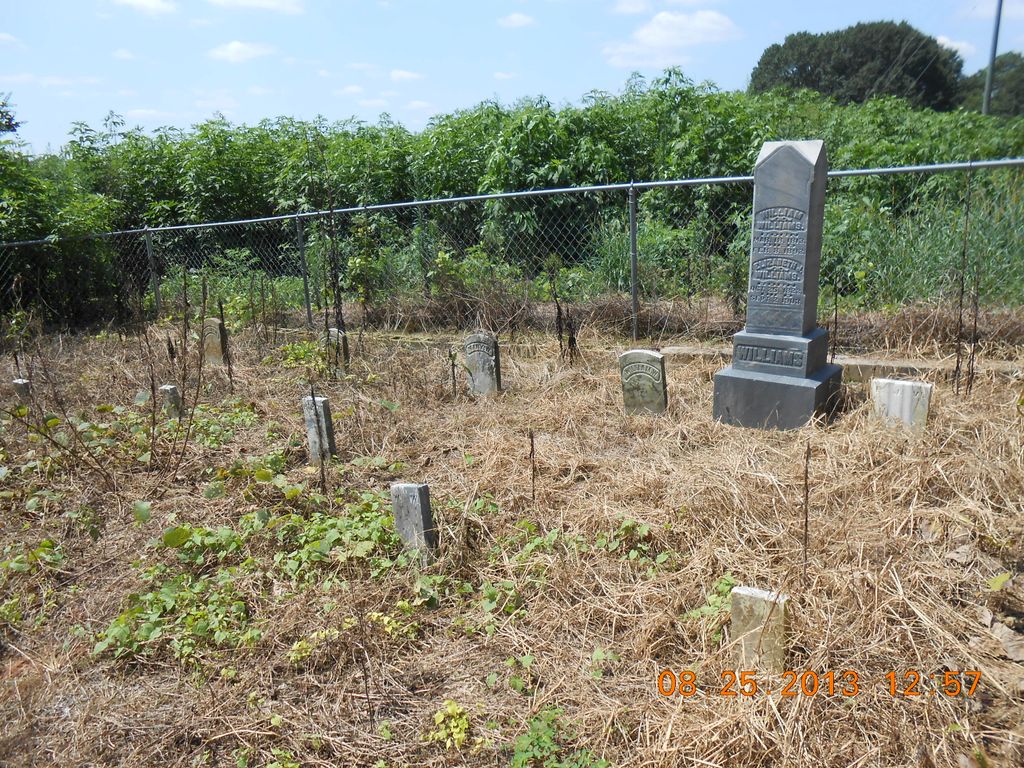
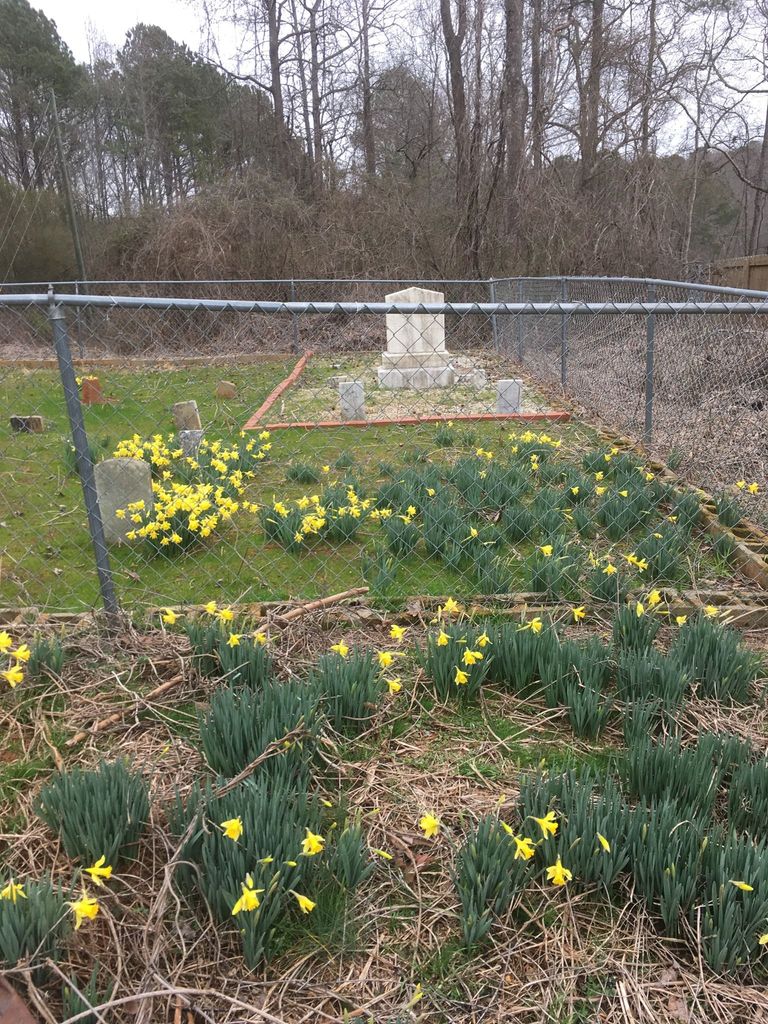
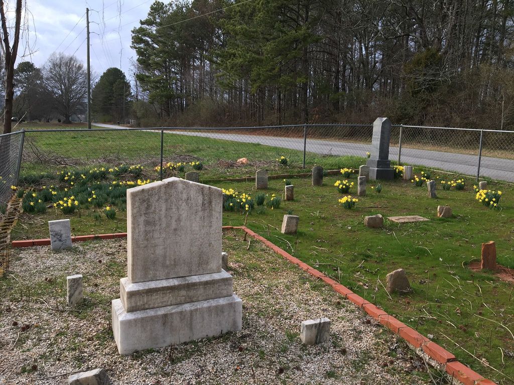
| Description | : | This eleven grave family cemetery is home to 5 adult and 6 children's graves. It sits beside Bay Springs Road, between Bay Springs Middle School and the crossroad with Daniel Road in the Flat Rock Community area of Villa Rica, Carroll County, Georgia. The first marked grave was buried in 1856 and the last marked grave was buried in 1935. Surrounded by a chain link fence, the photos show the beautiful jonquils and daffodils that cover it in the spring, but all is covered by troubling kudzu during the summer until the frost. |
frequently asked questions (FAQ):
-
Where is Williams-Harper Cemetery?
Williams-Harper Cemetery is located at No GPS information available Add GPSBay Springs Road Villa Rica, Carroll County ,Georgia ,USA.
-
Williams-Harper Cemetery cemetery's updated grave count on graveviews.com?
0 memorials
Nearby Cemetories:
1. Church at Carrollton Cemetery
Abilene, Carroll County, USA
Coordinate: 33.6112090, -85.2017780
2. Chappell Family Cemetery
Carroll County, USA
Coordinate: 33.6506720, -85.2124070
3. Community Bible Church Cemetery
Carroll County, USA
Coordinate: 33.6556380, -85.2048750
4. Craven-Gentry Cemetery
Carroll County, USA
Coordinate: 33.6355700, -85.1865800
5. Crawford
Carroll County, USA
Coordinate: 33.6046982, -84.9214020
6. Cross Plains Baptist Church Cemetery
Cross Plains, Carroll County, USA
Coordinate: 33.6362740, -84.9793450
7. Gilley Cemetery
Cross Plains, Carroll County, USA
Coordinate: 33.6317010, -84.9728320
8. Hinesley Cemetery
Cross Plains, Carroll County, USA
9. Mount Carmel Church Cemetery
Cross Plains, Carroll County, USA
Coordinate: 33.5687180, -84.8654040
10. Wilson Chapel Cemetery
Cross Plains, Carroll County, USA
Coordinate: 33.5708010, -84.8264360
11. Mount Calvary Cemetery
Carroll County, USA
Coordinate: 33.5696390, -84.8545250
12. Entrekin Cemetery
Mount Zion, Carroll County, USA
Coordinate: 33.5668500, -84.8338560
13. Holmes Cemetery
Mount Zion, Carroll County, USA
Coordinate: 33.6112090, -85.2017780
14. McBurnett Cemetery
Mount Zion, Carroll County, USA
Coordinate: 33.6506720, -85.2124070
15. Mincey Cemetery
Mount Zion, Carroll County, USA
Coordinate: 33.6556380, -85.2048750
16. Mount Zion United Methodist Cemetery
Mount Zion, Carroll County, USA
Coordinate: 33.6355700, -85.1865800
17. Bright Star Cemetery
Carroll County, USA
Coordinate: 33.6046982, -84.9214020
18. Brown Cemetery
Sand Hill, Carroll County, USA
Coordinate: 33.6362740, -84.9793450
19. Poplar Springs United Methodist Church Cemetery
Sand Hill, Carroll County, USA
Coordinate: 33.6317010, -84.9728320
20. Burson Family Cemetery
Carroll County, USA
21. Holland Mills Cemetery
Byers Crossroads, Carroll County, USA
Coordinate: 33.5687180, -84.8654040
22. Neal Cemetery
Byers Crossroads, Carroll County, USA
Coordinate: 33.5708010, -84.8264360
23. Richards Cemetery
Byers Crossroads, Carroll County, USA
Coordinate: 33.5696390, -84.8545250
24. Word Cemetery
Byers Crossroads, Carroll County, USA
Coordinate: 33.5668500, -84.8338560