
| Memorials | : | 0 |
| Location | : | Birmingham, Jefferson County, USA |
| Coordinate | : | 33.5815800, -86.7054610 |
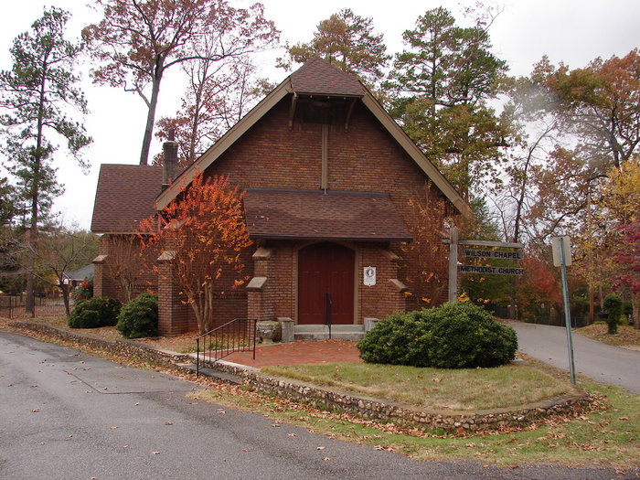
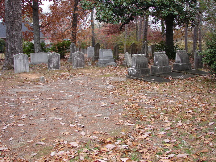
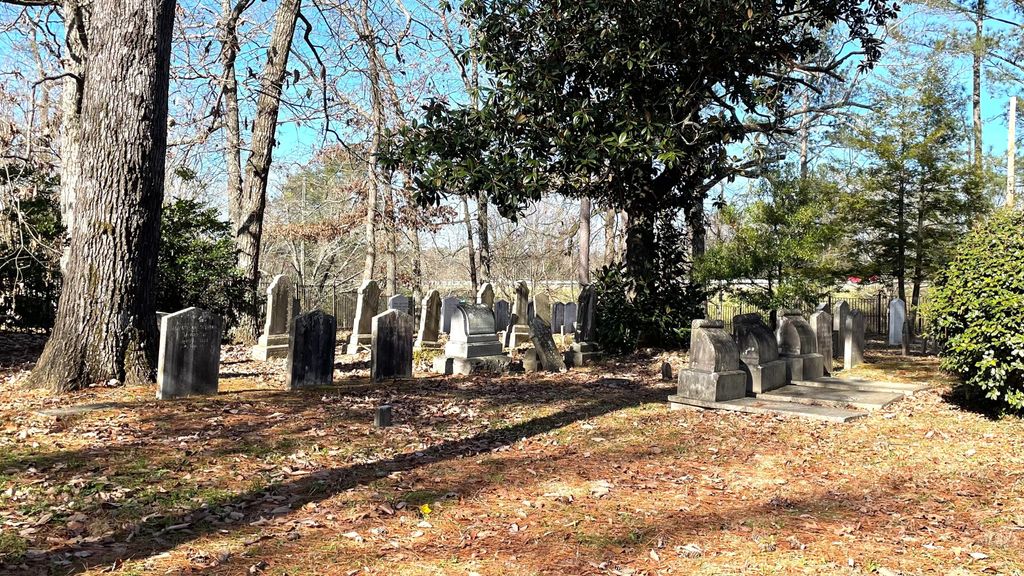
| Description | : | The Chapel and Cemetery are on land granted to Audley Hamilton 1810 by President Monroe. |
frequently asked questions (FAQ):
-
Where is Wilson Chapel Cemetery?
Wilson Chapel Cemetery is located at 412 Cumberland Road in Roebuck Community Birmingham, Jefferson County ,Alabama ,USA.
-
Wilson Chapel Cemetery cemetery's updated grave count on graveviews.com?
0 memorials
-
Where are the coordinates of the Wilson Chapel Cemetery?
Latitude: 33.5815800
Longitude: -86.7054610
Nearby Cemetories:
1. Zion Memorial Gardens
Birmingham, Jefferson County, USA
Coordinate: 33.5908050, -86.7225660
2. Higgins Cemetery
Jefferson County, USA
Coordinate: 33.5881004, -86.7249985
3. Huffman Methodist Church Cemetery
Birmingham, Jefferson County, USA
Coordinate: 33.5966301, -86.6913910
4. East Lake Cemetery
Birmingham, Jefferson County, USA
Coordinate: 33.5621986, -86.7266998
5. Bass Cemetery
Irondale, Jefferson County, USA
Coordinate: 33.5744019, -86.6733017
6. Unnamed African American Cemetery
Birmingham, Jefferson County, USA
Coordinate: 33.5438772, -86.7203427
7. Earltown Cemetery
Jefferson County, USA
Coordinate: 33.5513992, -86.6733017
8. Reed Cemetery
Grayson Valley, Jefferson County, USA
Coordinate: 33.6186500, -86.6714800
9. Greenwood Cemetery
Birmingham, Jefferson County, USA
Coordinate: 33.5522003, -86.7528000
10. Bush Cemetery
Jefferson County, USA
Coordinate: 33.5327988, -86.7144012
11. Phillips Family Cemetery (Defunct)
Birmingham, Jefferson County, USA
Coordinate: 33.5439600, -86.6651580
12. Forest Hill Cemetery
Birmingham, Jefferson County, USA
Coordinate: 33.5485992, -86.7542038
13. Wood Cemetery
Birmingham, Jefferson County, USA
Coordinate: 33.5427246, -86.7507935
14. Alton Cemetery
Birmingham, Jefferson County, USA
Coordinate: 33.5801470, -86.6357270
15. Pawnee Missionary Baptist Church Cemetery
Birmingham, Jefferson County, USA
Coordinate: 33.6302170, -86.7480170
16. Inglenook Cemetery
Jefferson County, USA
Coordinate: 33.5630989, -86.7778015
17. Ellard Family Cemetery
Jefferson County, USA
Coordinate: 33.6054780, -86.6331570
18. New Hope Cemetery
Irondale, Jefferson County, USA
Coordinate: 33.5281219, -86.6607361
19. McElwain Baptist Cemetery
Birmingham, Jefferson County, USA
Coordinate: 33.5186005, -86.7296982
20. Chalkville Baptist Church Cemetery
Chalkville, Jefferson County, USA
Coordinate: 33.6377983, -86.6594009
21. Forest Crest Cemetery
Birmingham, Jefferson County, USA
Coordinate: 33.5505524, -86.6313629
22. McCombs Cemetery
Irondale, Jefferson County, USA
Coordinate: 33.5592003, -86.6267014
23. Saint Francis Xavier Catholic Church Columbarium
Birmingham, Jefferson County, USA
Coordinate: 33.5161100, -86.7421910
24. Green Cemetery
Pinson, Jefferson County, USA
Coordinate: 33.6545660, -86.7176840