
| Memorials | : | 0 |
| Location | : | Cliff, Floyd County, USA |
| Coordinate | : | 37.7006980, -82.7698800 |
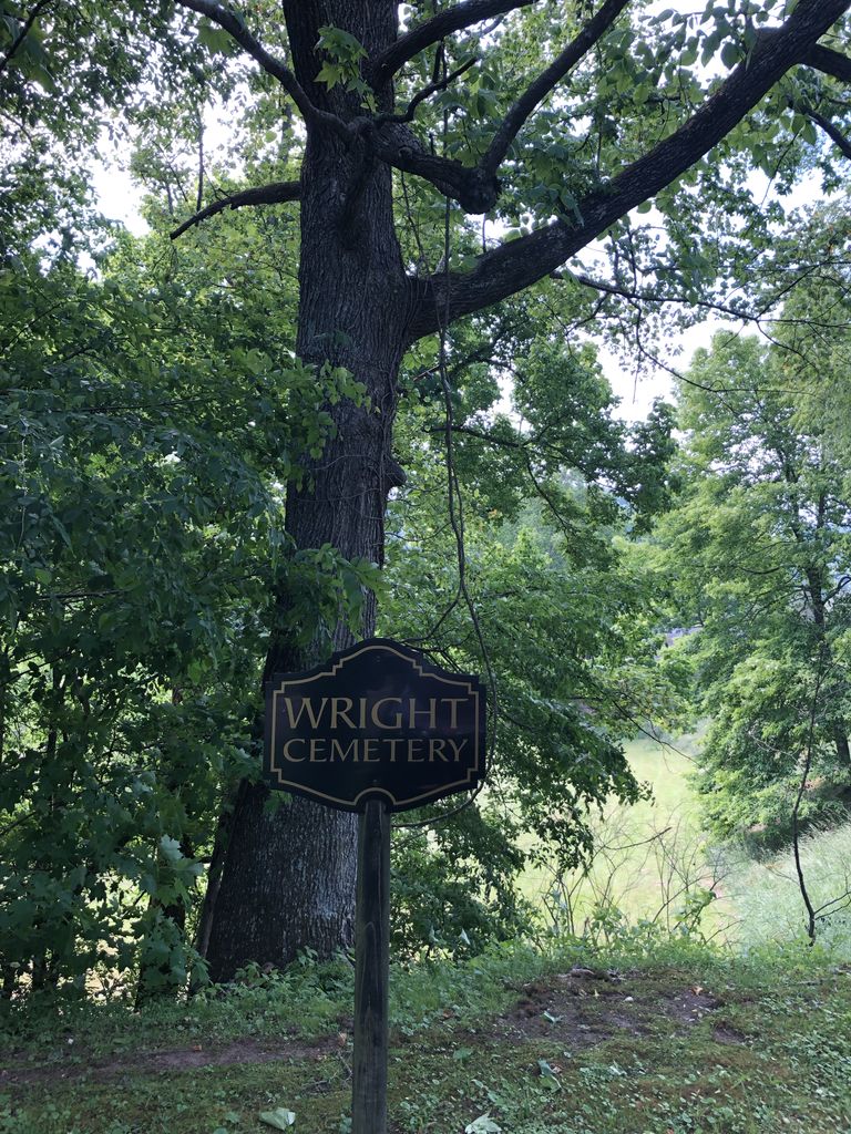
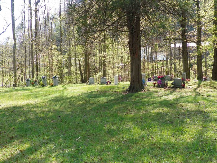
| Description | : | This cemetery is located on land previously owned by Edgar Wright. When he sold the land, the cemetery was excluded from the deed and is jointly owned by his children. The cemetery is located on the left side of Stephens Branch Rd when driving from Prestonsburg. All internments are listed. |
frequently asked questions (FAQ):
-
Where is Wright Cemetery #3?
Wright Cemetery #3 is located at Stephens Branch Rd Cliff, Floyd County ,Kentucky ,USA.
-
Wright Cemetery #3 cemetery's updated grave count on graveviews.com?
0 memorials
-
Where are the coordinates of the Wright Cemetery #3?
Latitude: 37.7006980
Longitude: -82.7698800
Nearby Cemetories:
1. Moore Family Cemetery #6
Cliff, Floyd County, USA
Coordinate: 37.7017220, -82.7762220
2. Bayes Branch Cemetery
Bays Branch, Floyd County, USA
Coordinate: 37.7233200, -82.7666600
3. Collins Cemetery #3
Auxier, Floyd County, USA
Coordinate: 37.7324371, -82.7589569
4. Wells Cemetery
Auxier, Floyd County, USA
Coordinate: 37.7338630, -82.7612640
5. Childers Family Cemetery
Auxier, Floyd County, USA
Coordinate: 37.7375228, -82.7529582
6. Childers Family Cemetery
Auxier, Floyd County, USA
Coordinate: 37.7393278, -82.7580566
7. Auxier Cemetery #5
Hagerhill, Johnson County, USA
Coordinate: 37.7434700, -82.7688330
8. Samuel Auxier
Hagerhill, Johnson County, USA
Coordinate: 37.7435370, -82.7688410
9. Auxier Cemetery #1
Johnson County, USA
Coordinate: 37.7483360, -82.7831970
10. East Point Cemetery
East Point, Johnson County, USA
Coordinate: 37.7333260, -82.8218070
11. Walker Hayden Family Cemetery
East Point, Johnson County, USA
Coordinate: 37.7333260, -82.8218079
12. Nathaniel Auxier Cemetery
Hagerhill, Johnson County, USA
Coordinate: 37.7523040, -82.7821980
13. Elijab B. Arms Cemetery
East Point, Johnson County, USA
Coordinate: 37.7447280, -82.8116050
14. John D Music Cemetery
East Point, Johnson County, USA
Coordinate: 37.7530260, -82.8009610
15. Blair Cemetery
Johnson County, USA
Coordinate: 37.7514000, -82.8281021
16. Fitzpatrick Cemetery #3
Floyd County, USA
Coordinate: 37.6511960, -82.8337280
17. Jeff DeRossett Cemetery
Bull Creek, Floyd County, USA
Coordinate: 37.6300011, -82.7600021
18. Adams Cemetery
East Point, Johnson County, USA
Coordinate: 37.7594430, -82.8209060
19. Fitzpatrick Cemetery #2
Floyd County, USA
Coordinate: 37.6510220, -82.8395640
20. Hale Family Cemetery
Bonanza, Floyd County, USA
Coordinate: 37.6920370, -82.8640040
21. Bonanza Cemetery
Bonanza, Floyd County, USA
Coordinate: 37.6906830, -82.8644440
22. Amos Leslie Cemetery
Emma, Floyd County, USA
Coordinate: 37.6439900, -82.7063600
23. Hackworth Family Cemetery_80 Bonanza Drive
Bonanza, Floyd County, USA
Coordinate: 37.6908780, -82.8648530
24. Fishbaugh Cemetery
East Point, Johnson County, USA
Coordinate: 37.7636860, -82.8321020