| Memorials | : | 0 |
| Location | : | Zevenhuizen, Leek Municipality, Netherlands |
| Coordinate | : | 53.1269100, 6.3480300 |
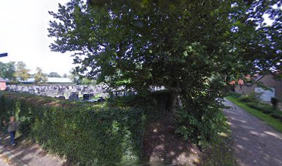
| Description | : | Zevenhuizen, a village in the commune of Leek, is 25 kilometres south-west of Groningen, on a minor road to Leek and Hanlewijk. The cemetery is about 200 metres west of the Protestant church, which lies on the western side of the road to Leek. In the south-eastern part, incorporated in a permanent Dutch Resistance memorial, are the graves of two airmen, one from Canada and one from New Zealand. |
frequently asked questions (FAQ):
-
Where is Zevenhuizen General Cemetery?
Zevenhuizen General Cemetery is located at Zevenhuizen, Leek Municipality ,Groningen ,Netherlands.
-
Zevenhuizen General Cemetery cemetery's updated grave count on graveviews.com?
0 memorials
-
Where are the coordinates of the Zevenhuizen General Cemetery?
Latitude: 53.1269100
Longitude: 6.3480300
Nearby Cemetories:
1. Niebert Begraafplaats
Niebert, Marum Municipality, Netherlands
Coordinate: 53.1623500, 6.3282800
2. Tolbert Protestant Cemetery
Tolbert, Leek Municipality, Netherlands
Coordinate: 53.1715200, 6.3654600
3. De Wilp Cemetery
De Wilp, Marum Municipality, Netherlands
Coordinate: 53.1231200, 6.2500100
4. Midwolde Cemetery
Midwolde, Leek Municipality, Netherlands
Coordinate: 53.1803100, 6.3924600
5. Marum Cemetery
Marum, Marum Municipality, Netherlands
Coordinate: 53.1461400, 6.2535900
6. Noordwijk Protestant Churchyard
Noordwijk, Marum Municipality, Netherlands
Coordinate: 53.1699300, 6.2567500
7. Begraafplaats Peize
Peize, Noordenveld Municipality, Netherlands
Coordinate: 53.1410679, 6.4883162
8. Begraafplaats Peize
Peize, Noordenveld Municipality, Netherlands
Coordinate: 53.1411443, 6.4885591
9. Begraafplaats Peize
Peize, Noordenveld Municipality, Netherlands
Coordinate: 53.1411443, 6.4885591
10. Roderwolde Cemetery
Roderwolde, Noordenveld Municipality, Netherlands
Coordinate: 53.1744600, 6.4692700
11. Norg General Cemetery
Norg, Noordenveld Municipality, Netherlands
Coordinate: 53.0683100, 6.4599100
12. Joodse Begraafplaats
Veenhuizen, Noordenveld Municipality, Netherlands
Coordinate: 53.0454289, 6.4082780
13. Opende Protestant Churchyard
Opende, Grootegast Municipality, Netherlands
Coordinate: 53.1736100, 6.2212900
14. Algemene Begraafplaats zgn 4e gesticht
Veenhuizen, Noordenveld Municipality, Netherlands
Coordinate: 53.0408212, 6.4082570
15. Doezum Kerkhof
Doezum, Grootegast Municipality, Netherlands
Coordinate: 53.2000600, 6.2485600
16. Sebaldeburen Churchyard
Sebaldeburen, Grootegast Municipality, Netherlands
Coordinate: 53.2204900, 6.3091900
17. Natuurbegraafplaats De Velden
Zuidvelde, Noordenveld Municipality, Netherlands
Coordinate: 53.0499017, 6.4498663
18. Zuidhorn New Cemetery
Zuidhorn, Zuidhorn Municipality, Netherlands
Coordinate: 53.2399900, 6.4111100
19. Zuidhorn Old Cemetery
Zuidhorn, Zuidhorn Municipality, Netherlands
Coordinate: 53.2430800, 6.4049200
20. Drachtstercompagnie Protestant Churchyard
Drachtstercompagnie, Smallingerland Municipality, Netherlands
Coordinate: 53.1353300, 6.1450000
21. Eelde General Cemetery
Eelde, Tynaarlo Municipality, Netherlands
Coordinate: 53.1351100, 6.5649200
22. Hoogkerk General Cemetery
Hoogkerk, Groningen Municipality, Netherlands
Coordinate: 53.2241600, 6.5000500
23. Leegkerk Cemetery
Leegkerk, Groningen Municipality, Netherlands
Coordinate: 53.2298700, 6.4904700
24. Grijpskerk Cemetery
Grijpskerk, Zuidhorn Municipality, Netherlands
Coordinate: 53.2627500, 6.3115500

