
| Memorials | : | 0 |
| Location | : | Roderwolde, Noordenveld Municipality, Netherlands |
| Coordinate | : | 53.1744600, 6.4692700 |
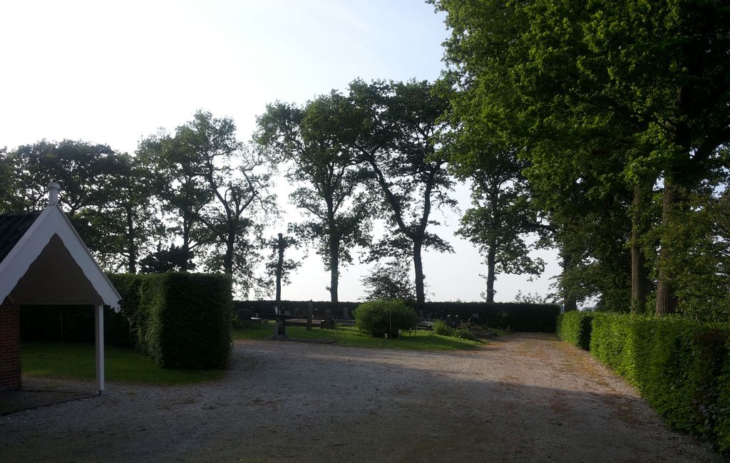
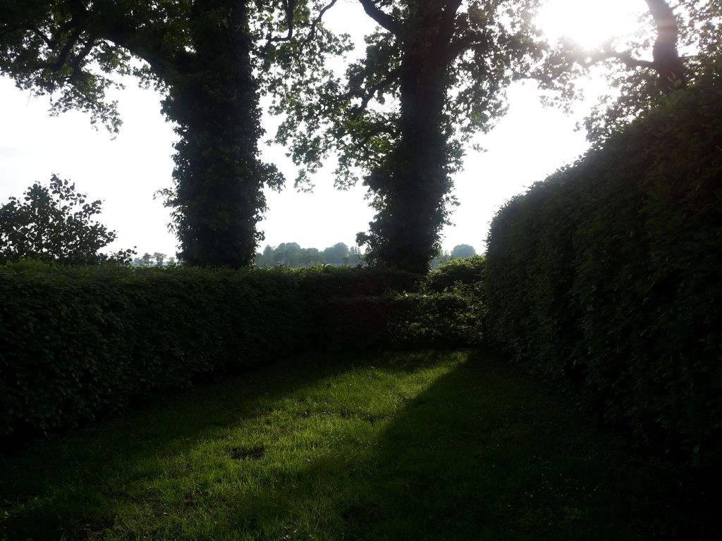
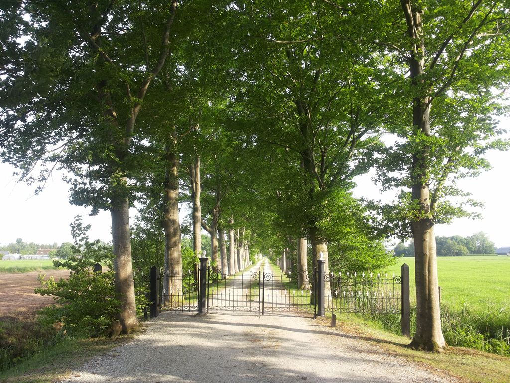
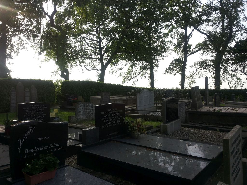
| Description | : | A small, secluded cemetery at the end of a long, tree-lined drive, the Roderwolde General Cemetery is surrounded by lush farm land. Small yellow signs adorn many graves, with requests asking for next of kin to make themselves known. As the cemetery is so small and the tradition of leasing burial space continues, families of the departed are asked to get in touch with the township in order to facilitate removal or continued interment. |
frequently asked questions (FAQ):
-
Where is Roderwolde Cemetery?
Roderwolde Cemetery is located at Pastorielaan Roderwolde, Noordenveld Municipality ,Drenthe ,Netherlands.
-
Roderwolde Cemetery cemetery's updated grave count on graveviews.com?
0 memorials
-
Where are the coordinates of the Roderwolde Cemetery?
Latitude: 53.1744600
Longitude: 6.4692700
Nearby Cemetories:
1. Begraafplaats Peize
Peize, Noordenveld Municipality, Netherlands
Coordinate: 53.1411443, 6.4885591
2. Begraafplaats Peize
Peize, Noordenveld Municipality, Netherlands
Coordinate: 53.1411443, 6.4885591
3. Begraafplaats Peize
Peize, Noordenveld Municipality, Netherlands
Coordinate: 53.1410679, 6.4883162
4. Midwolde Cemetery
Midwolde, Leek Municipality, Netherlands
Coordinate: 53.1803100, 6.3924600
5. Hoogkerk General Cemetery
Hoogkerk, Groningen Municipality, Netherlands
Coordinate: 53.2241600, 6.5000500
6. Leegkerk Cemetery
Leegkerk, Groningen Municipality, Netherlands
Coordinate: 53.2298700, 6.4904700
7. Tolbert Protestant Cemetery
Tolbert, Leek Municipality, Netherlands
Coordinate: 53.1715200, 6.3654600
8. Groningen Zuiderbegraafplaats
Groningen, Groningen Municipality, Netherlands
Coordinate: 53.2061100, 6.5720200
9. Eelde General Cemetery
Eelde, Tynaarlo Municipality, Netherlands
Coordinate: 53.1351100, 6.5649200
10. Zuidhorn New Cemetery
Zuidhorn, Zuidhorn Municipality, Netherlands
Coordinate: 53.2399900, 6.4111100
11. Joodse Begraafplaats Moesstraat
Groningen, Groningen Municipality, Netherlands
Coordinate: 53.2305560, 6.5505560
12. Groningen Noorderbegraafplaats
Groningen, Groningen Municipality, Netherlands
Coordinate: 53.2305500, 6.5523300
13. Esserveld General Cemetery
Groningen, Groningen Municipality, Netherlands
Coordinate: 53.1894200, 6.5928600
14. Crematorium Groningen
Groningen, Groningen Municipality, Netherlands
Coordinate: 53.2383066, 6.5448000
15. Zuidhorn Old Cemetery
Zuidhorn, Zuidhorn Municipality, Netherlands
Coordinate: 53.2430800, 6.4049200
16. Dorkwerd Cemetery
Dorkwerd, Groningen Municipality, Netherlands
Coordinate: 53.2504800, 6.5120500
17. Selwerderhof Cemetery
Groningen, Groningen Municipality, Netherlands
Coordinate: 53.2394500, 6.5534100
18. Begraafplaats Aduard
Aduard, Zuidhorn Municipality, Netherlands
Coordinate: 53.2569012, 6.4631144
19. Joodse Begraafplaats Iepenlaan
Groningen, Groningen Municipality, Netherlands
Coordinate: 53.2402780, 6.5544440
20. Niebert Begraafplaats
Niebert, Marum Municipality, Netherlands
Coordinate: 53.1623500, 6.3282800
21. Haren Eshof Cemetery
Haren, Haren Municipality, Netherlands
Coordinate: 53.1623800, 6.6124700
22. Zevenhuizen General Cemetery
Zevenhuizen, Leek Municipality, Netherlands
Coordinate: 53.1269100, 6.3480300
23. Begraafplaats Wierum
Wierumerschouw, Zuidhorn Municipality, Netherlands
Coordinate: 53.2683085, 6.5122962
24. Norg General Cemetery
Norg, Noordenveld Municipality, Netherlands
Coordinate: 53.0683100, 6.4599100