
| Memorials | : | 4 |
| Location | : | Alum Springs, Boyle County, USA |
| Coordinate | : | 37.5897680, -84.8429600 |
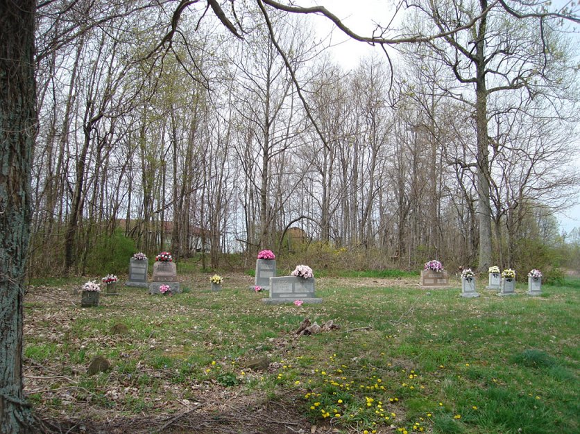
| Description | : | This is the Zion Hill A.M.E. Church Cemetery off Persimmon Knob Road, at the junction of Fitzgerald Lane and Boyle Lane. From the Junction City-Parksville Road, KY-300, turn south on Persimmon Knob Road. There are 23 identified graves and approximately 100 others. Some people known to be buried here are identified by name. In early 20th Century records, this is sometimes called the "Persimmon Knob Colored Church Cemetery." Records for this cemetery are found in the book Boyle County, Kentucky, Cemetery Records, 1792-1992, compiled by the Boyle County Genealogical Association, 1992, revised and enlarged 2008. |
frequently asked questions (FAQ):
-
Where is Zion Hill AME Church Cemetery?
Zion Hill AME Church Cemetery is located at Alum Springs, Boyle County ,Kentucky ,USA.
-
Zion Hill AME Church Cemetery cemetery's updated grave count on graveviews.com?
3 memorials
-
Where are the coordinates of the Zion Hill AME Church Cemetery?
Latitude: 37.5897680
Longitude: -84.8429600
Nearby Cemetories:
1. Jones Cemetery
Alum Springs, Boyle County, USA
Coordinate: 37.5882550, -84.8399880
2. Gray Cemetery
Alum Springs, Boyle County, USA
Coordinate: 37.6041000, -84.8364000
3. Caldwell Cemetery #02
Boyle County, USA
Coordinate: 37.6029440, -84.8328210
4. Kennedy Cemetery
Parksville, Boyle County, USA
Coordinate: 37.5978700, -84.8604700
5. McDonald Center Church Cemetery
Junction City, Boyle County, USA
Coordinate: 37.5835900, -84.8623400
6. Clems Chapel
Alum Springs, Boyle County, USA
Coordinate: 37.5938900, -84.8667900
7. May Cemetery #01
Wilsonville, Boyle County, USA
Coordinate: 37.5963180, -84.8662250
8. Clemmons Cemetery
Alum Springs, Boyle County, USA
Coordinate: 37.5830180, -84.8662090
9. Old Mount Freeman Cemetery
Alum Springs, Boyle County, USA
Coordinate: 37.5697200, -84.8570600
10. Wilson Station Cemetery
Alum Springs, Boyle County, USA
Coordinate: 37.6033859, -84.8193054
11. Old Parksville Cemetery
Parksville, Boyle County, USA
Coordinate: 37.6112060, -84.8633340
12. Moore Cemetery
Parksville, Boyle County, USA
Coordinate: 37.6110530, -84.8636770
13. Wilsonville Chapel AME Church Cemetery
Wilsonville, Boyle County, USA
Coordinate: 37.5940400, -84.8780700
14. Worldstown Cemetery
Junction City, Boyle County, USA
Coordinate: 37.5856200, -84.8069600
15. Andrews Graveyard
Wilsonville, Boyle County, USA
Coordinate: 37.5951291, -84.8787390
16. Wilson Cemetery #5
Junction City, Boyle County, USA
Coordinate: 37.5755630, -84.8091420
17. Caldwell-Irvine Cemetery
Danville, Boyle County, USA
Coordinate: 37.6240350, -84.8509720
18. Carrier Cemetery
Parksville, Boyle County, USA
Coordinate: 37.5953100, -84.8898000
19. Parksville Cemetery
Parksville, Boyle County, USA
Coordinate: 37.5980500, -84.8907400
20. Wilson Cemetery #4
Boyle County, USA
Coordinate: 37.5628014, -84.8807983
21. Junction City Cemetery
Junction City, Boyle County, USA
Coordinate: 37.5760700, -84.7921000
22. Saint Francis Cemetery
Junction City, Boyle County, USA
Coordinate: 37.5476750, -84.8591952
23. Germantown-Saint Patrick Cemetery
Junction City, Boyle County, USA
Coordinate: 37.5460850, -84.8581410
24. Rains Cemetery
Needmore, Boyle County, USA
Coordinate: 37.6271480, -84.8781390