
| Memorials | : | 8 |
| Location | : | Rowan County, USA |
| Coordinate | : | 35.5208700, -80.2567200 |
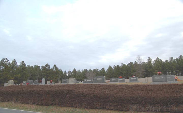
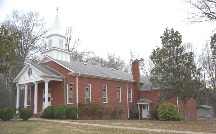
| Description | : | Zion United Methodist Church Cemetery 15055 Stokes Ferry Rd. Richfield, NC 28137 Phone # 704-279-5267 Zion Methodist Church is located at 15055 Stokes Ferry Road in Richfield, NC. From Salisbury, follow Stokes Ferry Road approximately 15 miles and the Church is located on the right. The cemetery is directly across the street. Zion Methodist Church was established in 1856. Originally called Walnut Grove, the name was changed... Read More |
frequently asked questions (FAQ):
-
Where is Zion United Methodist Church Cemetery?
Zion United Methodist Church Cemetery is located at 15055 Stokes Ferry Rd. (SR 1004) Rowan County ,North Carolina ,USA.
-
Zion United Methodist Church Cemetery cemetery's updated grave count on graveviews.com?
6 memorials
-
Where are the coordinates of the Zion United Methodist Church Cemetery?
Latitude: 35.5208700
Longitude: -80.2567200

Nearby Cemetories:
1. Luthers Lutheran Church Cemetery
Rowan County, USA
Coordinate: 35.5167000, -80.2470400
2. Richard Parker Family Cemetery
Gold Hill, Rowan County, USA
Coordinate: 35.5188360, -80.2256660
3. Parker Memorial Baptist Church Cemetery
Richfield, Stanly County, USA
Coordinate: 35.4913330, -80.2462630
4. Jacob Miller Family Cemetery
Gold Hill, Rowan County, USA
Coordinate: 35.5092700, -80.2214400
5. Antioch Baptist Church Cemetery
Rowan County, USA
Coordinate: 35.5082210, -80.2216850
6. Morgan Cemetery
Salisbury, Rowan County, USA
Coordinate: 35.5520287, -80.2778702
7. East Corinth Baptist Church Cemetery
Gold Hill, Rowan County, USA
Coordinate: 35.5567200, -80.2815300
8. Reed Graveyard
Gold Hill, Rowan County, USA
Coordinate: 35.5507160, -80.2127270
9. Flat Creek Primitive Baptist Church Cemetery
Rowan County, USA
Coordinate: 35.5564690, -80.2196655
10. Wesley Chapel United Methodist Church Cemetery
Misenheimer, Stanly County, USA
Coordinate: 35.4729250, -80.2902670
11. Ellis-Frye Cemetery on the Old Reeves Place
Newsom, Davidson County, USA
Coordinate: 35.5370500, -80.1917800
12. Open Door Baptist Church Cemetery
Richfield, Stanly County, USA
Coordinate: 35.4701200, -80.2879500
13. Mattons Grove UMC Cemetery
Misenheimer, Stanly County, USA
Coordinate: 35.4736214, -80.3025894
14. Crowell Family Cemetery
New London, Stanly County, USA
Coordinate: 35.4661603, -80.2115827
15. Wyatts Grove Missionary Baptist Church Cemetery
Rowan County, USA
Coordinate: 35.5874939, -80.2533646
16. Gold Hill Wesleyan Church Cemetery
Gold Hill, Rowan County, USA
Coordinate: 35.5353600, -80.3378620
17. Poole Town Fire Department Cemetery
Pooletown, Rowan County, USA
Coordinate: 35.5876120, -80.2434230
18. Bean-Wyatt Cemetery
Rowan County, USA
Coordinate: 35.5863419, -80.2253036
19. Cox Cemetery
Jackson Hill, Davidson County, USA
Coordinate: 35.5655690, -80.1891100
20. Ritchie-Frick Cemetery
Richfield, Stanly County, USA
Coordinate: 35.4492333, -80.2770833
21. Richard Stoker Family Cemetery
New London, Stanly County, USA
Coordinate: 35.4638600, -80.1973200
22. Tuckertown Cemetery
Uwharrie, Montgomery County, USA
Coordinate: 35.4859700, -80.1725100
23. Gold Hill Cemetery
Gold Hill, Rowan County, USA
Coordinate: 35.5022011, -80.3510971
24. Newsom Cemetery
Davidson County, USA
Coordinate: 35.5463982, -80.1641998