
| Memorials | : | 0 |
| Location | : | Zundert, Zundert Municipality, Netherlands |
| Coordinate | : | 51.4716600, 4.6644300 |
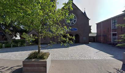
| Description | : | Zundert is a village 17 kilometres south of Breda, on the main Breda Antwerp road. The churchyard is on the northern edge of the village, about 50 metres east of the Gemeente House. |
frequently asked questions (FAQ):
-
Where is Zundert Protestant Churchyard?
Zundert Protestant Churchyard is located at Zundert, Zundert Municipality ,Noord-Brabant ,Netherlands.
-
Zundert Protestant Churchyard cemetery's updated grave count on graveviews.com?
0 memorials
-
Where are the coordinates of the Zundert Protestant Churchyard?
Latitude: 51.4716600
Longitude: 4.6644300
Nearby Cemetories:
1. Roman Catholic Cemetery Klein Zundert
Klein-Zundert, Zundert Municipality, Netherlands
Coordinate: 51.4813640, 4.6555256
2. R.K.Abdij Maria Toevlucht
Klein-Zundert, Zundert Municipality, Netherlands
Coordinate: 51.4771808, 4.6376681
3. Roman Catholic Cemetery Sint Bavo Parish
Zundert Municipality, Netherlands
Coordinate: 51.5142580, 4.7002220
4. Kerkhof H. Cornelius
Achtmaal, Zundert Municipality, Netherlands
Coordinate: 51.4533160, 4.5828415
5. Begraafplaats Schijf
Schijf, Rucphen Municipality, Netherlands
Coordinate: 51.4978952, 4.5591589
6. Begraafplaats Sprundel
Sprundel, Rucphen Municipality, Netherlands
Coordinate: 51.5360801, 4.6035448
7. Minderhout Cemetery
Hoogstraten, Arrondissement Turnhout, Belgium
Coordinate: 51.4150700, 4.7611700
8. Meerle Churchyard
Hoogstraten, Arrondissement Turnhout, Belgium
Coordinate: 51.4741700, 4.8037100
9. Etten-Leur Cemetery
Etten-Leur Municipality, Netherlands
Coordinate: 51.5603076, 4.6457993
10. Begraafplaats Rucphen
Rucphen, Rucphen Municipality, Netherlands
Coordinate: 51.5279365, 4.5526156
11. Wuustwezel Churchyard
Wuustwezel, Arrondissement Antwerpen, Belgium
Coordinate: 51.3887500, 4.5992900
12. Kerkhof St. Willebrord
Sint Willebrord, Rucphen Municipality, Netherlands
Coordinate: 51.5517370, 4.5889150
13. Begraafplaats RK Kerk Heilige Moeder Gods
Effen, Breda Municipality, Netherlands
Coordinate: 51.5541678, 4.7332827
14. Sint-Katharinakerk
Hoogstraten, Arrondissement Turnhout, Belgium
Coordinate: 51.4008900, 4.7620700
15. Hoogstraten Cemetery
Hoogstraten, Arrondissement Turnhout, Belgium
Coordinate: 51.4002500, 4.7678700
16. Essen Horendonk Communal Cemetery
Essen, Arrondissement Antwerpen, Belgium
Coordinate: 51.4694900, 4.5039100
17. Begraafplaats Zegestede
Roosendaal, Roosendaal Municipality, Netherlands
Coordinate: 51.5338500, 4.5113600
18. Princenhage Cemetery
Princenhage, Breda Municipality, Netherlands
Coordinate: 51.5762400, 4.7392600
19. Ulvenhout Roman Catholic Cemetery
Ulvenhout, Breda Municipality, Netherlands
Coordinate: 51.5525900, 4.7961100
20. Breda De Bieberg Begraafplaats
Breda, Breda Municipality, Netherlands
Coordinate: 51.5576400, 4.7885300
21. Breda Begraafplaats Haagveld
Breda, Breda Municipality, Netherlands
Coordinate: 51.5791800, 4.7469830
22. Breda Zuylen Roman Catholic Cemetery
Breda, Breda Municipality, Netherlands
Coordinate: 51.5793400, 4.7489700
23. Essen Centrum Cemetery
Essen, Arrondissement Antwerpen, Belgium
Coordinate: 51.4681100, 4.4699800
24. Brecht Communal cemetery
Brecht, Arrondissement Antwerpen, Belgium
Coordinate: 51.3506500, 4.6494600