
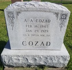
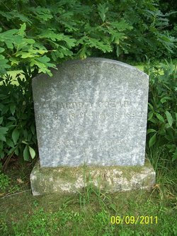
Aaron Austin Cozad
| Birth | : | 16 Feb 1845 West Lebanon, Warren County, Indiana, USA |
| Death | : | 29 Jan 1929 Pleasanton, Decatur County, Iowa, USA |
| Burial | : | Emmanuel Churchyard, Holcombe, Metropolitan Borough of Bury, England |
| Coordinate | : | 53.6463000, -2.3293400 |
| Plot | : | 2 3-12 |
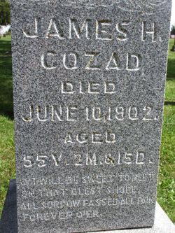
| Description | : | Company K. 39th Iowa Volunteer Infantry. |
frequently asked questions (FAQ):
-
Where is Aaron Austin Cozad's memorial?
Aaron Austin Cozad's memorial is located at: Emmanuel Churchyard, Holcombe, Metropolitan Borough of Bury, England.
-
When did Aaron Austin Cozad death?
Aaron Austin Cozad death on 29 Jan 1929 in Pleasanton, Decatur County, Iowa, USA
-
Where are the coordinates of the Aaron Austin Cozad's memorial?
Latitude: 53.6463000
Longitude: -2.3293400
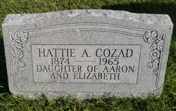
Family Members:
Parent

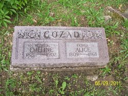
Spouse
Siblings


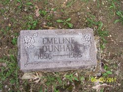
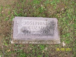
Children
Flowers:


Nearby Cemetories:
1. Emmanuel Churchyard
Holcombe, Metropolitan Borough of Bury, England
Coordinate: 53.6463000, -2.3293400
2. Ramsbottom Cemetery
Ramsbottom, Metropolitan Borough of Bury, England
Coordinate: 53.6372986, -2.3271000
3. St. John-in-the-Wilderness Churchyard
Shuttleworth, Metropolitan Borough of Bury, England
Coordinate: 53.6556300, -2.3046500
4. St. John in the Wilderness Shuttleworrth
Walmersley, Metropolitan Borough of Bury, England
Coordinate: 53.6557090, -2.3037740
5. Stubbins Congregational Chapelyard
Rossendale Borough, England
Coordinate: 53.6626600, -2.3110700
6. Rowlands Methodist Churchyard
Summerseat, Metropolitan Borough of Bury, England
Coordinate: 53.6294360, -2.3102920
7. Greenmount United Reformed Churchyard
Greenmount, Metropolitan Borough of Bury, England
Coordinate: 53.6254581, -2.3381465
8. St Mary Churchyard
Hawkshaw, Metropolitan Borough of Bury, England
Coordinate: 53.6307270, -2.3636210
9. Hawkshaw Methodist Church Cemetery
Hawkshaw, Metropolitan Borough of Bury, England
Coordinate: 53.6313490, -2.3674190
10. St Anne Churchyard
Tottington, Metropolitan Borough of Bury, England
Coordinate: 53.6161499, -2.3409030
11. Edenfield Parish Churchyard
Ramsbottom, Metropolitan Borough of Bury, England
Coordinate: 53.6742799, -2.3069304
12. Park Chapel
Walmersley, Metropolitan Borough of Bury, England
Coordinate: 53.6205060, -2.2958590
13. St. John's Churchyard
Tottington, Metropolitan Borough of Bury, England
Coordinate: 53.6141180, -2.3400670
14. Christ Church Churchyard
Walmersley, Metropolitan Borough of Bury, England
Coordinate: 53.6193360, -2.2964630
15. Christ Church Churchyard
Bury, Metropolitan Borough of Bury, England
Coordinate: 53.6194570, -2.2960140
16. Congregational Churchyard
Affetside, Metropolitan Borough of Bury, England
Coordinate: 53.6175200, -2.3705800
17. Methodist Church Churchyard
Edgworth, Blackburn with Darwen Unitary Authority, England
Coordinate: 53.6424280, -2.3962830
18. Edgworth Congregational Chapelyard
Edgworth, Blackburn with Darwen Unitary Authority, England
Coordinate: 53.6476280, -2.3967210
19. Saint Thomas Churchyard
Helmshore, Rossendale Borough, England
Coordinate: 53.6870400, -2.3300000
20. St. Anne's Churchyard
Chapeltown, Blackburn with Darwen Unitary Authority, England
Coordinate: 53.6371710, -2.4030440
21. St. James Churchyard
Bury, Metropolitan Borough of Bury, England
Coordinate: 53.5996770, -2.3214600
22. All Saints Churchyard
Elton, Metropolitan Borough of Bury, England
Coordinate: 53.5965000, -2.3118000
23. Tottington Road Methodist Church Churchyard
Harwood, Metropolitan Borough of Bolton, England
Coordinate: 53.6079190, -2.3904960
24. Haslingden Cemetery
Haslingden, Rossendale Borough, England
Coordinate: 53.6989500, -2.3427700