
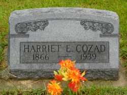

Harriet Elizabeth Walker Cozad
| Birth | : | 15 Nov 1866 Pleasanton, Decatur County, Iowa, USA |
| Death | : | 20 Apr 1939 Pleasanton, Decatur County, Iowa, USA |
| Burial | : | Emmanuel Churchyard, Holcombe, Metropolitan Borough of Bury, England |
| Coordinate | : | 53.6463000, -2.3293400 |
| Plot | : | 2 3-11 |
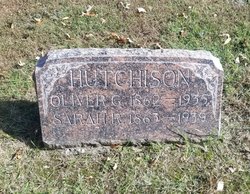
| Description | : | I'm suggesting the changes to Harriet Elizabeth Walker Hutchison Cozad's memorial based on her death certificate, and also information found in various locations, including the book "History of Decatur County" which I found on Ancestry.com, but may exist elsewhere. If you have access, a link to the ancestry page concerning her marriages is here: https://www.ancestry.com/mediaui-viewer/tree/104644570/person/260045985928/media/85ff9cd5-b752-48f9-8363-bfbf06aa5570?_phsrc=uxs39587&_phstart=successSource Thanks! Heather Contributor: H V (48791785) And here's another link on Ancestry.com which is the record for the marriage of Harriet E Walker Hutchinson [sic] (should be Hutchison) to Aaron A Cozad, son of A Cozad and Alice Swank. https://www.ancestry.com/interactive/8823/42563_fp030872_0116-00035/903645320?backurl=https://www.ancestry.com/family-tree/person/tree/163720095/person/412131975481/facts/citation/1122183439546/edit/record H V Contributor:... Read More |
frequently asked questions (FAQ):
-
Where is Harriet Elizabeth Walker Cozad's memorial?
Harriet Elizabeth Walker Cozad's memorial is located at: Emmanuel Churchyard, Holcombe, Metropolitan Borough of Bury, England.
-
When did Harriet Elizabeth Walker Cozad death?
Harriet Elizabeth Walker Cozad death on 20 Apr 1939 in Pleasanton, Decatur County, Iowa, USA
-
Where are the coordinates of the Harriet Elizabeth Walker Cozad's memorial?
Latitude: 53.6463000
Longitude: -2.3293400
Family Members:
Parent
Spouse
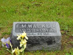
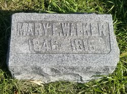
Siblings
Flowers:


Nearby Cemetories:
1. Emmanuel Churchyard
Holcombe, Metropolitan Borough of Bury, England
Coordinate: 53.6463000, -2.3293400
2. Ramsbottom Cemetery
Ramsbottom, Metropolitan Borough of Bury, England
Coordinate: 53.6372986, -2.3271000
3. St. John-in-the-Wilderness Churchyard
Shuttleworth, Metropolitan Borough of Bury, England
Coordinate: 53.6556300, -2.3046500
4. St. John in the Wilderness Shuttleworrth
Walmersley, Metropolitan Borough of Bury, England
Coordinate: 53.6557090, -2.3037740
5. Stubbins Congregational Chapelyard
Rossendale Borough, England
Coordinate: 53.6626600, -2.3110700
6. Rowlands Methodist Churchyard
Summerseat, Metropolitan Borough of Bury, England
Coordinate: 53.6294360, -2.3102920
7. Greenmount United Reformed Churchyard
Greenmount, Metropolitan Borough of Bury, England
Coordinate: 53.6254581, -2.3381465
8. St Mary Churchyard
Hawkshaw, Metropolitan Borough of Bury, England
Coordinate: 53.6307270, -2.3636210
9. Hawkshaw Methodist Church Cemetery
Hawkshaw, Metropolitan Borough of Bury, England
Coordinate: 53.6313490, -2.3674190
10. St Anne Churchyard
Tottington, Metropolitan Borough of Bury, England
Coordinate: 53.6161499, -2.3409030
11. Edenfield Parish Churchyard
Ramsbottom, Metropolitan Borough of Bury, England
Coordinate: 53.6742799, -2.3069304
12. Park Chapel
Walmersley, Metropolitan Borough of Bury, England
Coordinate: 53.6205060, -2.2958590
13. St. John's Churchyard
Tottington, Metropolitan Borough of Bury, England
Coordinate: 53.6141180, -2.3400670
14. Christ Church Churchyard
Walmersley, Metropolitan Borough of Bury, England
Coordinate: 53.6193360, -2.2964630
15. Christ Church Churchyard
Bury, Metropolitan Borough of Bury, England
Coordinate: 53.6194570, -2.2960140
16. Congregational Churchyard
Affetside, Metropolitan Borough of Bury, England
Coordinate: 53.6175200, -2.3705800
17. Methodist Church Churchyard
Edgworth, Blackburn with Darwen Unitary Authority, England
Coordinate: 53.6424280, -2.3962830
18. Edgworth Congregational Chapelyard
Edgworth, Blackburn with Darwen Unitary Authority, England
Coordinate: 53.6476280, -2.3967210
19. Saint Thomas Churchyard
Helmshore, Rossendale Borough, England
Coordinate: 53.6870400, -2.3300000
20. St. Anne's Churchyard
Chapeltown, Blackburn with Darwen Unitary Authority, England
Coordinate: 53.6371710, -2.4030440
21. St. James Churchyard
Bury, Metropolitan Borough of Bury, England
Coordinate: 53.5996770, -2.3214600
22. All Saints Churchyard
Elton, Metropolitan Borough of Bury, England
Coordinate: 53.5965000, -2.3118000
23. Tottington Road Methodist Church Churchyard
Harwood, Metropolitan Borough of Bolton, England
Coordinate: 53.6079190, -2.3904960
24. Haslingden Cemetery
Haslingden, Rossendale Borough, England
Coordinate: 53.6989500, -2.3427700