
| Birth | : | 16 May 1911 Hankinson, Richland County, North Dakota, USA |
| Death | : | 5 Nov 1979 Oakland, Alameda County, California, USA |
| Burial | : | Camellia Memorial Lawn Cemetery, Sacramento, Sacramento County, USA |
| Coordinate | : | 38.5242004, -121.3097000 |
| Plot | : | Section C, Row 34, Space 7 |
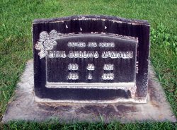
| Inscription | : | US ARMY WORLD WAR II |
| Description | : | According to his WWII draft registration record, Aaron Douglas Kiel was born on 16 May 1911 in Hankinson, Richland, ND. His parents were Robert Conrad Kiel and Emily Sofia Blad. He is with his parents in the US census records for 1920 and 1930. He was married twice. His record is already linked to the record of his first wife, Effie Marie Huggins. That marriage ended in divorce in 1945. According to the MT marriage records, he married Viola Meserve on 2 Dec 1944 in Missoula, Missoula, MT. This is interesting, because his 1st marriage had not... Read More |
frequently asked questions (FAQ):
-
Where is Aaron Douglas Kiel's memorial?
Aaron Douglas Kiel's memorial is located at: Camellia Memorial Lawn Cemetery, Sacramento, Sacramento County, USA.
-
When did Aaron Douglas Kiel death?
Aaron Douglas Kiel death on 5 Nov 1979 in Oakland, Alameda County, California, USA
-
Where are the coordinates of the Aaron Douglas Kiel's memorial?
Latitude: 38.5242004
Longitude: -121.3097000
Family Members:
Flowers:


Nearby Cemetories:
1. Camellia Memorial Lawn Cemetery
Sacramento, Sacramento County, USA
Coordinate: 38.5242004, -121.3097000
2. Bellview Cemetery
Sacramento, Sacramento County, USA
Coordinate: 38.5153580, -121.3257446
3. Quiet Haven Memorial Park Cemetery
Sacramento, Sacramento County, USA
Coordinate: 38.5109711, -121.3245621
4. Greater Sacramento Muslim Cemetery
Sacramento, Sacramento County, USA
Coordinate: 38.5128300, -121.2616800
5. Sacramento Pet Cemetery
Sacramento, Sacramento County, USA
Coordinate: 38.4815870, -121.3402080
6. Chua Phuoc Thien Temple Columbarium
Sacramento, Sacramento County, USA
Coordinate: 38.4555400, -121.3345500
7. Kilgore Cemetery
Rancho Cordova, Sacramento County, USA
Coordinate: 38.5978012, -121.2683029
8. Tinh Xa Ngoc An Temple Columbarium
Sacramento, Sacramento County, USA
Coordinate: 38.5190200, -121.4159500
9. Elder Creek Cemetery
Florin, Sacramento County, USA
Coordinate: 38.5111008, -121.4169006
10. Union Cemetery
Sacramento County, USA
Coordinate: 38.4477997, -121.2619019
11. Saint Michaels Episcopal Church Columbarium
Carmichael, Sacramento County, USA
Coordinate: 38.6042800, -121.3547200
12. Sacramento County Cemetery
Sacramento County, USA
Coordinate: 38.5267900, -121.4233700
13. Sacramento County Veterans Memorial Cemetery
Sacramento, Sacramento County, USA
Coordinate: 38.5252838, -121.4239120
14. Sacramento County Hospital Cemetery
Sacramento, Sacramento County, USA
Coordinate: 38.5289300, -121.4239100
15. Russian Orthodox Cemetery
Sacramento, Sacramento County, USA
Coordinate: 38.5268800, -121.4244300
16. Saint Mary's Catholic Cemetery and Mausoleum
Sacramento, Sacramento County, USA
Coordinate: 38.5298900, -121.4261200
17. Pleasant Grove Cemetery
Elk Grove, Sacramento County, USA
Coordinate: 38.4302220, -121.3107670
18. Carmichael Presbyterian Church Columbarium
Carmichael, Sacramento County, USA
Coordinate: 38.6179500, -121.3324500
19. Sloughhouse Pioneer Cemetery
Sloughhouse, Sacramento County, USA
Coordinate: 38.4950130, -121.1916080
20. Saint Marks Methodist Church Memorial Tree
Sacramento, Sacramento County, USA
Coordinate: 38.6076500, -121.3750680
21. Kim Quang Temple Columbarium
Sacramento, Sacramento County, USA
Coordinate: 38.5996600, -121.3904700
22. Sacramento Memorial Lawn Cemetery
Sacramento, Sacramento County, USA
Coordinate: 38.5146484, -121.4380341
23. Home of Peace Cemetery
Sacramento, Sacramento County, USA
Coordinate: 38.5137558, -121.4382782
24. San Joaquin Cemetery
Sacramento, Sacramento County, USA
Coordinate: 38.4387665, -121.4034653