
| Memorials | : | 271 |
| Location | : | Sacramento County, USA |
| Coordinate | : | 38.5267900, -121.4233700 |
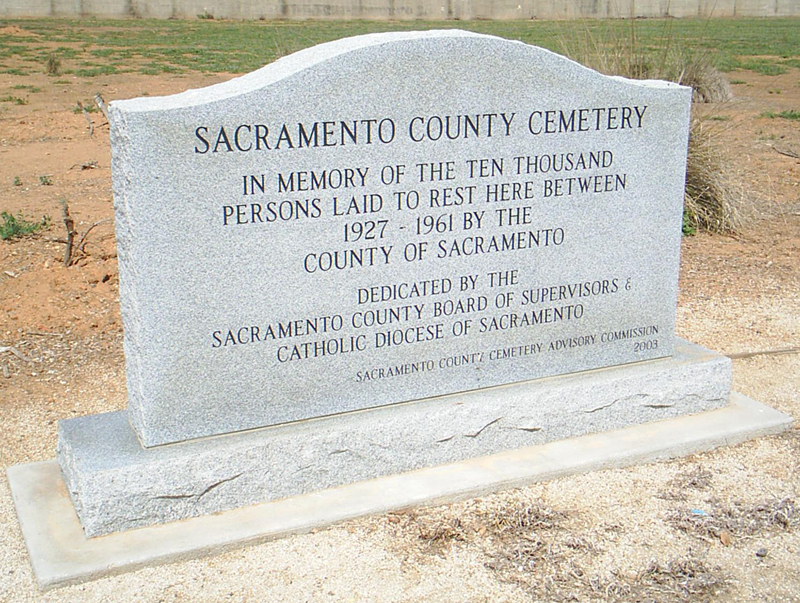
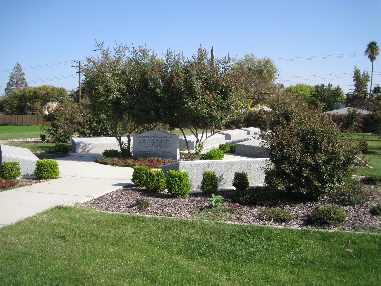
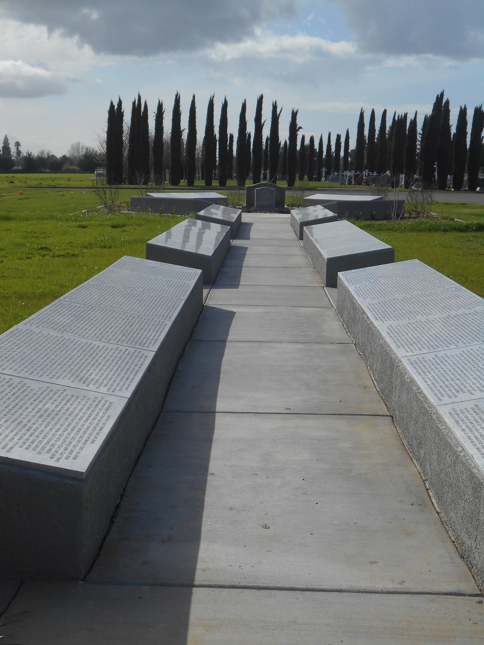
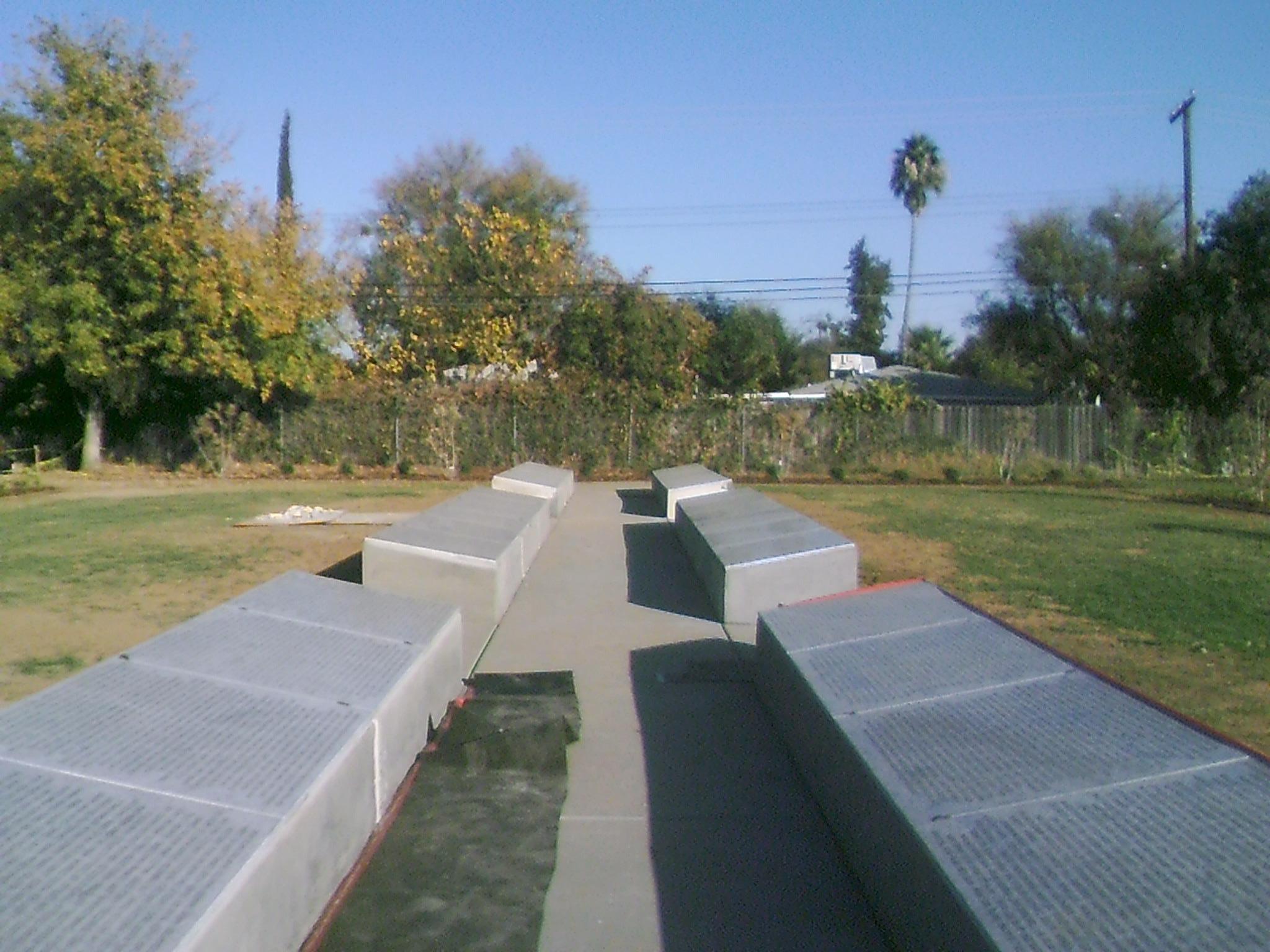
| Description | : | Sacramento County Cemetery was once called Potters' Field and was a contiguous plot of land next to St. Mary's Catholic Cemetery. The land was originally managed by the County of Sacramento and between 1927-1961 at least 10,000 indigent persons were laid to rest there. In the 1970s the County of Sacramento and St. Mary's agreed that St. Mary's would take over the management of the indigent burials. In 2008, in order to consolidate space, the 10,000 bodies in the Potter's Field area were moved a short distance away to an area now known as Good Samaritan Lawn. The names of... Read More |
frequently asked questions (FAQ):
-
Where is Sacramento County Cemetery?
Sacramento County Cemetery is located at Sacramento County ,California ,USA.
-
Sacramento County Cemetery cemetery's updated grave count on graveviews.com?
257 memorials
-
Where are the coordinates of the Sacramento County Cemetery?
Latitude: 38.5267900
Longitude: -121.4233700
Nearby Cemetories:
1. Russian Orthodox Cemetery
Sacramento, Sacramento County, USA
Coordinate: 38.5268800, -121.4244300
2. Sacramento County Veterans Memorial Cemetery
Sacramento, Sacramento County, USA
Coordinate: 38.5252838, -121.4239120
3. Sacramento County Hospital Cemetery
Sacramento, Sacramento County, USA
Coordinate: 38.5289300, -121.4239100
4. Saint Mary's Catholic Cemetery and Mausoleum
Sacramento, Sacramento County, USA
Coordinate: 38.5298900, -121.4261200
5. Tinh Xa Ngoc An Temple Columbarium
Sacramento, Sacramento County, USA
Coordinate: 38.5190200, -121.4159500
6. Elder Creek Cemetery
Florin, Sacramento County, USA
Coordinate: 38.5111008, -121.4169006
7. Sacramento Memorial Lawn Cemetery
Sacramento, Sacramento County, USA
Coordinate: 38.5146484, -121.4380341
8. Home of Peace Cemetery
Sacramento, Sacramento County, USA
Coordinate: 38.5137558, -121.4382782
9. Saint Rose Cemetery (Defunct)
Sacramento, Sacramento County, USA
Coordinate: 38.5208015, -121.4672012
10. East Lawn Memorial Park
Sacramento, Sacramento County, USA
Coordinate: 38.5612960, -121.4492760
11. Pho Minh Temple Columbarium
Sacramento, Sacramento County, USA
Coordinate: 38.5340100, -121.4769000
12. New Helvetia Cemetery (Defunct)
Sacramento, Sacramento County, USA
Coordinate: 38.5731600, -121.4639900
13. Saint Joseph Cemetery
Sacramento, Sacramento County, USA
Coordinate: 38.5574989, -121.4835968
14. Trinity Episcopal Cathedral Columbarium
Sacramento, Sacramento County, USA
Coordinate: 38.5705500, -121.4723770
15. Odd Fellows Lawn Cemetery and Mausoleum
Sacramento, Sacramento County, USA
Coordinate: 38.5585000, -121.5011000
16. Buddhist Church of Sacramento Nokotsudo
Sacramento, Sacramento County, USA
Coordinate: 38.5639300, -121.4978400
17. Masonic Lawn Cemetery
Sacramento, Sacramento County, USA
Coordinate: 38.5604720, -121.5032600
18. Sacramento City Cemetery
Sacramento, Sacramento County, USA
Coordinate: 38.5636864, -121.5009537
19. Sunset Hill Cemetery
Sacramento, Sacramento County, USA
Coordinate: 38.5608000, -121.5037300
20. California State Capitol
Sacramento, Sacramento County, USA
Coordinate: 38.5760994, -121.4931488
21. National Shrine of Our Lady of Guadalupe Crypt
Sacramento, Sacramento County, USA
Coordinate: 38.5704800, -121.5014400
22. Bellview Cemetery
Sacramento, Sacramento County, USA
Coordinate: 38.5153580, -121.3257446
23. Kim Quang Temple Columbarium
Sacramento, Sacramento County, USA
Coordinate: 38.5996600, -121.3904700
24. Quiet Haven Memorial Park Cemetery
Sacramento, Sacramento County, USA
Coordinate: 38.5109711, -121.3245621