
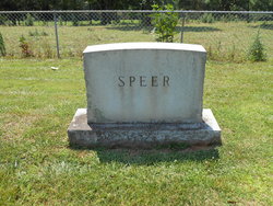
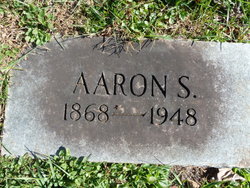
Aaron Smith Speer
| Birth | : | 12 Oct 1868 Yadkin County, North Carolina, USA |
| Death | : | 13 Jan 1949 Boonville, Yadkin County, North Carolina, USA |
| Burial | : | Mennonite Brethren Cemetery, Enid, Garfield County, USA |
| Coordinate | : | 36.4637900, -97.8605300 |
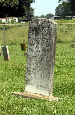
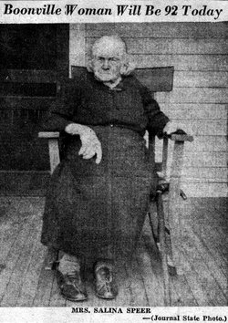
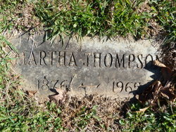
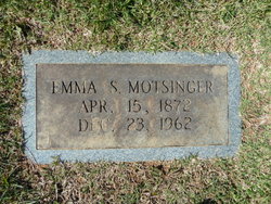
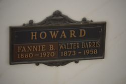
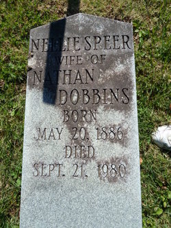
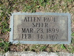
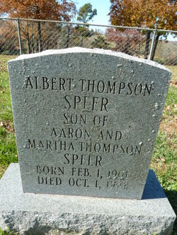
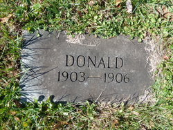
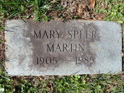
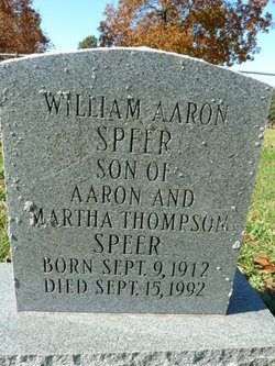
| Description | : | Son of James Monroe Speer & Salena Frances Dozier Oldest of eleven children; 7 sisters & 3 brothers ************************************** 1871 Emma Elizabeth (Motsinger)***see below 1873 Dora Bell d. 1879 1875 Fannie Jane d. 1879 1877 William Oscar 1880 Fannie Bell (Howard) 1881 James Alfonso***see below 1884 Lillian Carr (Royer) 1886 Nellie May (Dobbins)***see below 1888 Merla America (Critcher) (Wilkins) 1891 Edward Pickney ***see below Married Martha Cleveland "Mattie" Thompson 16 Mar 1898 Surry Co, NC Father of eight children; 1 daughter & 7 sons ******************************************** 1899 Allen Paul***see below 1901 Albert Thompson***see below 1903 Donald***see... Read More |
frequently asked questions (FAQ):
-
Where is Aaron Smith Speer's memorial?
Aaron Smith Speer's memorial is located at: Mennonite Brethren Cemetery, Enid, Garfield County, USA.
-
When did Aaron Smith Speer death?
Aaron Smith Speer death on 13 Jan 1949 in Boonville, Yadkin County, North Carolina, USA
-
Where are the coordinates of the Aaron Smith Speer's memorial?
Latitude: 36.4637900
Longitude: -97.8605300
Family Members:
Parent
Spouse
Siblings
Children
Flowers:


Nearby Cemetories:
1. Mennonite Brethren Cemetery
Enid, Garfield County, USA
Coordinate: 36.4637900, -97.8605300
2. Memorial Park Cemetery
Enid, Garfield County, USA
Coordinate: 36.4585991, -97.8685989
3. Enid State School Cemetery
Enid, Garfield County, USA
Coordinate: 36.4326900, -97.8370800
4. Calvary Catholic Cemetery
Enid, Garfield County, USA
Coordinate: 36.4200900, -97.8789800
5. Enid Cemetery
Enid, Garfield County, USA
Coordinate: 36.4199295, -97.8803329
6. Chisholm Trail Burial Park
Enid, Garfield County, USA
Coordinate: 36.4632500, -97.7921900
7. Banner Hill Cemetery
Garfield County, USA
Coordinate: 36.4627500, -97.9425300
8. Saint Matthews Episcopal Church Columbarium
Enid, Garfield County, USA
Coordinate: 36.3980590, -97.8847090
9. First United Methodist Church Columbarium
Enid, Garfield County, USA
Coordinate: 36.3976370, -97.8837560
10. Breckinridge Lutheran Cemetery
Breckinridge, Garfield County, USA
Coordinate: 36.4632988, -97.7474976
11. Kremlin Cemetery
Kremlin, Garfield County, USA
Coordinate: 36.5494003, -97.8131027
12. Bethany Cemetery
Enid, Garfield County, USA
Coordinate: 36.3619003, -97.8097000
13. Paradise Cemetery
Breckinridge, Garfield County, USA
Coordinate: 36.4336014, -97.7018967
14. Hillsdale Cemetery
Hillsdale, Garfield County, USA
Coordinate: 36.5652800, -97.9701700
15. Zion Lutheran Cemetery
Fairmont, Garfield County, USA
Coordinate: 36.3749400, -97.7297400
16. Rose Hill Cemetery
Carrier, Garfield County, USA
Coordinate: 36.4782753, -98.0322952
17. Trinity Lutheran Cemetery
Enid, Garfield County, USA
Coordinate: 36.4195300, -98.0342500
18. Valley Center Cemetery
Pond Creek, Grant County, USA
Coordinate: 36.6081009, -97.8281021
19. Collett Cemetery
Fairmont, Garfield County, USA
Coordinate: 36.3683014, -97.7102966
20. Sunnyside Cemetery
Lahoma, Garfield County, USA
Coordinate: 36.3692017, -98.0500031
21. Baumagartner Cemetery
Lahoma, Garfield County, USA
Coordinate: 36.4194700, -98.0779100
22. Hackberry Cemetery
Garfield County, USA
Coordinate: 36.2822500, -97.8362700
23. Imo Cemetery
Drummond, Garfield County, USA
Coordinate: 36.3293991, -98.0156021
24. Lahoma Mennonite Cemetery
Lahoma, Garfield County, USA
Coordinate: 36.4256400, -98.0864800