
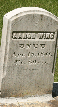
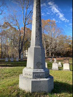
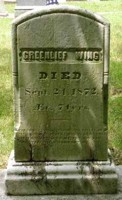
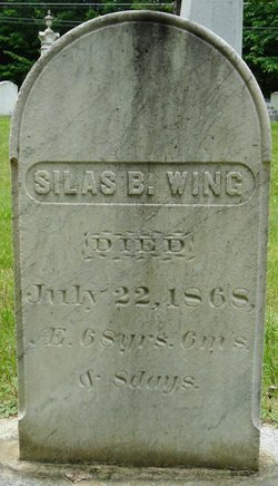
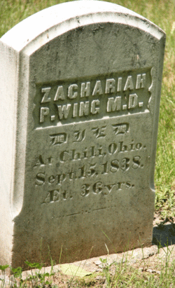
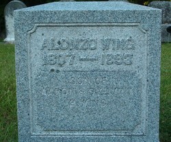
Aaron Wing
| Birth | : | 26 Mar 1761 Bourne, Barnstable County, Massachusetts, USA |
| Death | : | 18 Apr 1841 Wayne, Kennebec County, Maine, USA |
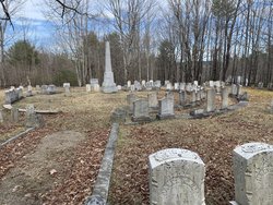
| Burial | : | Woodland Cemetery, Cleveland, Cuyahoga County, USA |
| Coordinate | : | 41.4900017, -81.6425018 |
| Plot | : | Section 4, lot 7 |
| Description | : | born at Pocasset, then in Sandwich but now in Bourne. |
frequently asked questions (FAQ):
-
Where is Aaron Wing's memorial?
Aaron Wing's memorial is located at: Woodland Cemetery, Cleveland, Cuyahoga County, USA.
-
When did Aaron Wing death?
Aaron Wing death on 18 Apr 1841 in Wayne, Kennebec County, Maine, USA
-
Where are the coordinates of the Aaron Wing's memorial?
Latitude: 41.4900017
Longitude: -81.6425018
Family Members:
Parent

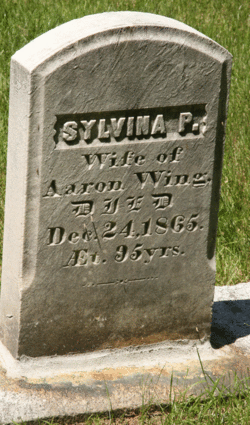
Spouse
Siblings
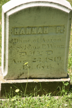
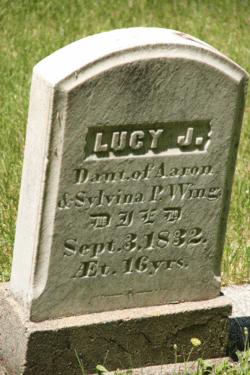
Children
Flowers:


Nearby Cemetories:
1. Woodland Cemetery
Cleveland, Cuyahoga County, USA
Coordinate: 41.4900017, -81.6425018
2. Saint John Cemetery
Cleveland, Cuyahoga County, USA
Coordinate: 41.4860992, -81.6408005
3. Saint Josephs Cemetery
Cleveland, Cuyahoga County, USA
Coordinate: 41.4869003, -81.6318970
4. Trinity Cathedral Crypt
Cleveland, Cuyahoga County, USA
Coordinate: 41.5013350, -81.6741750
5. Epworth Euclid United Methodist Church Columbarium
Euclid, Cuyahoga County, USA
Coordinate: 41.5058200, -81.6124990
6. Baxter Cemetery
Cleveland, Cuyahoga County, USA
Coordinate: 41.4596596, -81.6432800
7. Cleveland Museum of Natural History
Cleveland, Cuyahoga County, USA
Coordinate: 41.5115700, -81.6130905
8. Erie Street Cemetery
Cleveland, Cuyahoga County, USA
Coordinate: 41.4972687, -81.6831131
9. Church of the Covenant Columbarium
Cleveland, Cuyahoga County, USA
Coordinate: 41.5079200, -81.6068400
10. Cathedral of Saint John the Evangelist Crypt
Cleveland, Cuyahoga County, USA
Coordinate: 41.5026817, -81.6886139
11. Harvard Grove Cemetery
Cleveland, Cuyahoga County, USA
Coordinate: 41.4522040, -81.6471880
12. Ontario Street Cemetery (Defunct)
Cleveland, Cuyahoga County, USA
Coordinate: 41.4982200, -81.6920100
13. Soldiers and Sailors Monument
Cleveland, Cuyahoga County, USA
Coordinate: 41.4994965, -81.6928864
14. East Cleveland Township Cemetery
Cleveland, Cuyahoga County, USA
Coordinate: 41.5149994, -81.6010971
15. Lansing Cemetery
Cleveland, Cuyahoga County, USA
Coordinate: 41.4502983, -81.6492004
16. Lake View Cemetery
Cleveland, Cuyahoga County, USA
Coordinate: 41.5130997, -81.5982971
17. Old Stone Church Columbarium
Cleveland, Cuyahoga County, USA
Coordinate: 41.5004030, -81.6947480
18. Harvard Cemetery
Cleveland, Cuyahoga County, USA
Coordinate: 41.4485321, -81.6483917
19. Scranton Road Cemetery
Cleveland, Cuyahoga County, USA
Coordinate: 41.4733391, -81.6962891
20. Saint Pauls Episcopal Church Columbarium
Cleveland Heights, Cuyahoga County, USA
Coordinate: 41.4956350, -81.5812450
21. Fairmount Presbyterian Church Columbarium
Cleveland Heights, Cuyahoga County, USA
Coordinate: 41.4932930, -81.5801210
22. Monroe Street Cemetery
Cleveland, Cuyahoga County, USA
Coordinate: 41.4787700, -81.7066600
23. Calvary Cemetery
Cleveland, Cuyahoga County, USA
Coordinate: 41.4449900, -81.6147300
24. Mayfield Cemetery
Cleveland Heights, Cuyahoga County, USA
Coordinate: 41.5133018, -81.5821991