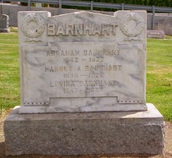
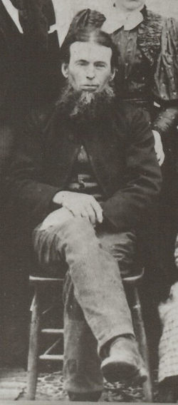
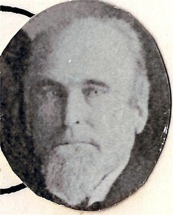
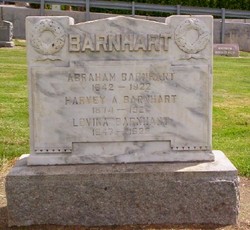
Abraham Barnhart
| Birth | : | 28 Apr 1842 |
| Death | : | 8 Jan 1922 |
| Burial | : | St. Peter's Churchyard, Newton-le-Willows, Metropolitan Borough of St Helens, England |
| Coordinate | : | 53.4559330, -2.6143730 |
| Plot | : | Row-4-S61-1 |
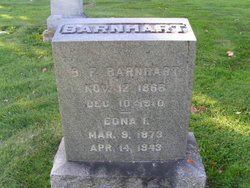
| Description | : | Additional Child: Benjamin Franklin Barnhart, 1866-1910--searching for his grave site Washington Death Certificate Name Abraham Barnhart Death date 08 Jan 1922 Death place Wenatchee, Chelan, Washington Gender Male Age at death 79 years 7 months 10 days Estimated birth year 1843 Marital status Married Spouse name Lovina Barnhardt Father name Daniel Barnhart Mother name Anna Winger Film number 1992887 Digital GS number 4221140 Image number 1652 Reference number 10 (Contributed by Teresa,46969893) |
frequently asked questions (FAQ):
-
Where is Abraham Barnhart's memorial?
Abraham Barnhart's memorial is located at: St. Peter's Churchyard, Newton-le-Willows, Metropolitan Borough of St Helens, England.
-
When did Abraham Barnhart death?
Abraham Barnhart death on 8 Jan 1922 in
-
Where are the coordinates of the Abraham Barnhart's memorial?
Latitude: 53.4559330
Longitude: -2.6143730
Family Members:
Parent
Spouse
Siblings
Children
Flowers:
Nearby Cemetories:
1. St. Peter's Churchyard
Newton-le-Willows, Metropolitan Borough of St Helens, England
Coordinate: 53.4559330, -2.6143730
2. Newton-le-Willows Cemetery
Newton-le-Willows, Metropolitan Borough of St Helens, England
Coordinate: 53.4471970, -2.6217090
3. St. Mary and St. John RC Churchyard
Newton-le-Willows, Metropolitan Borough of St Helens, England
Coordinate: 53.4559410, -2.6323930
4. Emmanuel Wargrave
Newton-le-Willows, Metropolitan Borough of St Helens, England
Coordinate: 53.4454500, -2.6277060
5. All Saints Roman Catholic Churchyard
Golborne, Metropolitan Borough of Wigan, England
Coordinate: 53.4745130, -2.5991750
6. St. Oswald Churchyard
Winwick, Warrington Unitary Authority, England
Coordinate: 53.4309200, -2.5972200
7. St. Luke's Churchyard
Lowton Common, Metropolitan Borough of Wigan, England
Coordinate: 53.4752100, -2.5805770
8. St James' Churchyard
Haydock, Metropolitan Borough of St Helens, England
Coordinate: 53.4679080, -2.6596350
9. Winwick Hospital Churchyard
Warrington Unitary Authority, England
Coordinate: 53.4265000, -2.6050000
10. St. Thomas' Churchyard
Golborne, Metropolitan Borough of Wigan, England
Coordinate: 53.4837560, -2.5917430
11. St Thomas' Churchyard (Heath Road Extension)
Ashton-In-Makerfield, Metropolitan Borough of Wigan, England
Coordinate: 53.4850470, -2.6345810
12. St Thomas Churchyard
Ashton-In-Makerfield, Metropolitan Borough of Wigan, England
Coordinate: 53.4856362, -2.6402671
13. St. Mary's Parish Churchyard
Lowton St Mary's, Metropolitan Borough of Wigan, England
Coordinate: 53.4763450, -2.5512350
14. St Mark Churchyard
Haydock, Metropolitan Borough of St Helens, England
Coordinate: 53.4658540, -2.6892980
15. Christ Church Churchyard
Warrington, Warrington Unitary Authority, England
Coordinate: 53.4376659, -2.5428132
16. Unitarian Chapel
Croft, Warrington Unitary Authority, England
Coordinate: 53.4345995, -2.5440079
17. St Peter's of Parr Churchyard
Parr, Metropolitan Borough of St Helens, England
Coordinate: 53.4543745, -2.7009772
18. Holy Trinity Churchyard
Ashton-In-Makerfield, Metropolitan Borough of Wigan, England
Coordinate: 53.4989280, -2.6688000
19. St. John the Evangelist Churchyard
Abram, Metropolitan Borough of Wigan, England
Coordinate: 53.5090290, -2.5941470
20. Risley Presbyterian Church Churchyard
Warrington Unitary Authority, England
Coordinate: 53.4322500, -2.5283880
21. Christ Church Graveyard
Padgate, Warrington Unitary Authority, England
Coordinate: 53.4072619, -2.5565873
22. St. Anne and Blessed Dominic Churchyard
St Helens, Metropolitan Borough of St Helens, England
Coordinate: 53.4330960, -2.7083700
23. Newchurch Parish Church
Culcheth, Warrington Unitary Authority, England
Coordinate: 53.4505900, -2.5105500
24. St. Barnabas Churchyard
Warrington Unitary Authority, England
Coordinate: 53.3920038, -2.6121106

