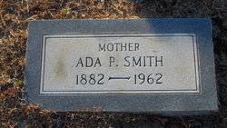
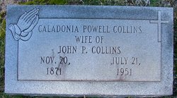
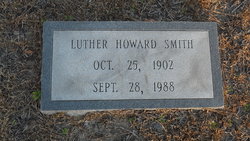
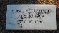
Ada Ella Powell Smith
| Birth | : | 18 Jul 1882 Effingham, Florence County, South Carolina, USA |
| Death | : | 12 Jun 1962 Marion, Marion County, South Carolina, USA |
| Burial | : | Spring Branch Cemetery, Spring Branch, Marion County, USA |
| Coordinate | : | 34.2425003, -79.3925018 |
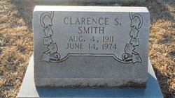
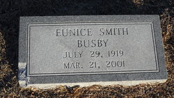
| Description | : | Daughter of William Tyler and Hannah Alice Phillips Powell, wife of Thomas Howard Smith. MARION - Mrs. Ada Powell Smith, 79, widow of Thomas H. Smith, died Tuesday after a short illness. Funeral services will be conducted at 11 a.m. Thursday at Smith Brothers Chapel by Rev. John Holland. Burial will be in Spring Branch Cemetery. Surviving are four daughters, Mrs. J. C. Galloway of Florence, Mrs. Thomas W. Kitchen of Greenville, Mrs. C. D. Evans of Marion and Mrs. R. L. Busby of Oklahoma City; four sons, Luther H. Smith of Marion, Thomas L. Smith of Stamford, Conn., Clarence S. Smith of... Read More |
frequently asked questions (FAQ):
-
Where is Ada Ella Powell Smith's memorial?
Ada Ella Powell Smith's memorial is located at: Spring Branch Cemetery, Spring Branch, Marion County, USA.
-
When did Ada Ella Powell Smith death?
Ada Ella Powell Smith death on 12 Jun 1962 in Marion, Marion County, South Carolina, USA
-
Where are the coordinates of the Ada Ella Powell Smith's memorial?
Latitude: 34.2425003
Longitude: -79.3925018
Family Members:
Parent
Spouse
Siblings
Children
Flowers:
Nearby Cemetories:
1. Spring Branch Cemetery
Spring Branch, Marion County, USA
Coordinate: 34.2425003, -79.3925018
2. Spring Branch Baptist Church Cemetery
Spring Branch, Marion County, USA
Coordinate: 34.2420998, -79.3957977
3. Greater Fork Chapel AME Church Cemetery
Marion, Marion County, USA
Coordinate: 34.2496986, -79.3929977
4. Wall Mausoleum
Marion, Marion County, USA
Coordinate: 34.2344800, -79.3823000
5. Saint Phillips United Methodist Church Cemetery
Spring Branch, Marion County, USA
Coordinate: 34.2491700, -79.4062600
6. Sunset Gardens Cemetery
Spring Branch, Marion County, USA
Coordinate: 34.2500300, -79.4057900
7. Moody-Berry Cemetery
Marion County, USA
Coordinate: 34.2564011, -79.3908005
8. End of the Road Cemetery
Marion, Marion County, USA
Coordinate: 34.2240620, -79.3912079
9. Moody Cemetery
Marion, Marion County, USA
Coordinate: 34.2548409, -79.4154968
10. Platt - Deer Cemetery
Marion, Marion County, USA
Coordinate: 34.2675876, -79.3959196
11. Gasque Cemetery
Marion County, USA
Coordinate: 34.2098000, -79.3971300
12. Bethlehem Freewill Baptist Church Cemetery
Marion, Marion County, USA
Coordinate: 34.2806200, -79.3820900
13. Lane Cemetery
Temperance Hill, Marion County, USA
Coordinate: 34.2860985, -79.3891983
14. Perritt Cemetery
Zion, Marion County, USA
Coordinate: 34.2533600, -79.3386700
15. Ebenezer Methodist Church Cemetery
Temperance Hill, Marion County, USA
Coordinate: 34.2858009, -79.4105988
16. Stewart Family Cemetery
Marion County, USA
Coordinate: 34.2888985, -79.3861008
17. Union Baptist Church Cemetery
Temperance Hill, Marion County, USA
Coordinate: 34.2871475, -79.3754730
18. Turner Cemetery
Marion County, USA
Coordinate: 34.2860985, -79.4163971
19. Bryant Cemetery
Marion County, USA
Coordinate: 34.2903800, -79.3764400
20. Lane Cemetery
Marion, Marion County, USA
Coordinate: 34.2337760, -79.3279730
21. Martin-Stephens Cemetery
Marion, Marion County, USA
Coordinate: 34.2331020, -79.3273400
22. Lee Cemetery
Marion County, USA
Coordinate: 34.2971992, -79.3918991
23. Christmas Cemetery
Sellers, Marion County, USA
Coordinate: 34.2841988, -79.4381027
24. Tyndall Cemetery
Dillon County, USA
Coordinate: 34.2942009, -79.3602982

