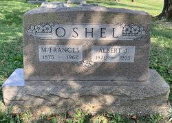
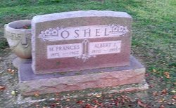
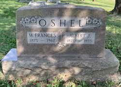
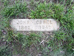
Albert J. Oshel
| Birth | : | 6 Sep 1870 Lafayette, Tippecanoe County, Indiana, USA |
| Death | : | 25 Apr 1955 Chanute, Neosho County, Kansas, USA |
| Burial | : | St. Mary the Virgin Parish Churchyard, Holy Island, Northumberland Unitary Authority, England |
| Coordinate | : | 55.6694200, -1.8016450 |
| Description | : | The Chanute Tribune, April 27, 1955, page 7 Albert J. Oshel, 84, of 1116 N. Garfield, died at 11:50 p.m. Tuesday at Neosho Memorial Hospital following an extended illness. He had been in failing health the last eight years. He was born Sept 6, 1870, at Lafayette, Ind. When he was six he came to Kansas with his parents, Jesse and Sarah Oshel, who located near Cottonwood Falls, later moving to La Harpe. He married Frances Purdy Oct 10, 1897, at Everette, Mo., and they began housekeeping at Gallaway, Mo. They... Read More |
frequently asked questions (FAQ):
-
Where is Albert J. Oshel's memorial?
Albert J. Oshel's memorial is located at: St. Mary the Virgin Parish Churchyard, Holy Island, Northumberland Unitary Authority, England.
-
When did Albert J. Oshel death?
Albert J. Oshel death on 25 Apr 1955 in Chanute, Neosho County, Kansas, USA
-
Where are the coordinates of the Albert J. Oshel's memorial?
Latitude: 55.6694200
Longitude: -1.8016450
Family Members:
Parent
Spouse
Siblings
Children
Flowers:
Nearby Cemetories:
1. St. Mary the Virgin Parish Churchyard
Holy Island, Northumberland Unitary Authority, England
Coordinate: 55.6694200, -1.8016450
2. Saint Nicholas Churchyard
Kyloe, Northumberland Unitary Authority, England
Coordinate: 55.6569000, -1.9188300
3. Kyloe Cemetery
Kyloe, Northumberland Unitary Authority, England
Coordinate: 55.6570310, -1.9191950
4. Saint Mary's Churchyard
Belford, Northumberland Unitary Authority, England
Coordinate: 55.5992600, -1.8292900
5. St. Aidan Churchyard
Bamburgh, Northumberland Unitary Authority, England
Coordinate: 55.6079810, -1.7183070
6. St John the Baptist Churchyard
Lowick, Northumberland Unitary Authority, England
Coordinate: 55.6501470, -1.9826250
7. Saint Hilda’s Churchyard
Lucker, Northumberland Unitary Authority, England
Coordinate: 55.5660400, -1.7597400
8. St. Anne's Churchyard
Ancroft, Northumberland Unitary Authority, England
Coordinate: 55.7000400, -1.9981800
9. Holy Cross Churchyard
Chatton, Northumberland Unitary Authority, England
Coordinate: 55.5474907, -1.9105738
10. Beadnell cemetery
Beadnell, Northumberland Unitary Authority, England
Coordinate: 55.5572940, -1.6398270
11. St Mary & St Michael Churchyard
Doddington, Northumberland Unitary Authority, England
Coordinate: 55.5837211, -2.0083409
12. Saint Ebba Churchyard
Beadnell, Northumberland Unitary Authority, England
Coordinate: 55.5566380, -1.6375270
13. Our Lady & St. Cuthbert's
Berwick-upon-Tweed, Northumberland Unitary Authority, England
Coordinate: 55.7695760, -1.9994210
14. St Maurice's Churchyard
Ellingham, Northumberland Unitary Authority, England
Coordinate: 55.5245000, -1.7245300
15. Berwick Parish Church
Berwick-upon-Tweed, Northumberland Unitary Authority, England
Coordinate: 55.7721130, -2.0010390
16. St. Peter's Parish Church
Chillingham, Northumberland Unitary Authority, England
Coordinate: 55.5273100, -1.9030830
17. All Saints Churchyard
Duddo, Northumberland Unitary Authority, England
Coordinate: 55.6859800, -2.0862900
18. Berwick-upon-Tweed Cemetery
Berwick-upon-Tweed, Northumberland Unitary Authority, England
Coordinate: 55.7799800, -2.0107500
19. St Michael and All Angels Churchyard
Ford, Northumberland Unitary Authority, England
Coordinate: 55.6301700, -2.0895430
20. St. Mary the Virgin Chapelyard
Etal, Northumberland Unitary Authority, England
Coordinate: 55.6481100, -2.1150200
21. Grey Family Cemetery
Fallodon, Northumberland Unitary Authority, England
Coordinate: 55.5058580, -1.6760530
22. Holy Trinity Churchyard
Embleton, Northumberland Unitary Authority, England
Coordinate: 55.4955790, -1.6360190
23. St Maurice Churchyard
Eglingham, Northumberland Unitary Authority, England
Coordinate: 55.4689000, -1.8336000
24. St. Michael Churchyard
Ilderton, Northumberland Unitary Authority, England
Coordinate: 55.4904200, -1.9743800

