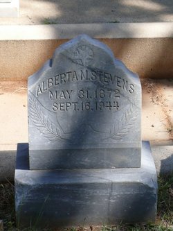
Alberta May “Bertie” Mitchell Stevens
| Birth | : | 31 May 1872 Newcastle, Placer County, California, USA |
| Death | : | 16 Sep 1944 Auburn, Placer County, California, USA |
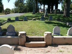
| Burial | : | Zoar Cemetery, Coal Grove, Lawrence County, USA |
| Coordinate | : | 38.5010986, -82.6280975 |
| Plot | : | Stevens plot, 239 |
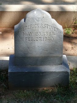
| Description | : | Wedding Bells - The Stevens-Mitchell Marriage Saturday--Nearly everyone in Auburn was surprised, and pleasantly too, last Saturday when they learned of the marriage of two of our young people in San Francisco that day. Miss Bertie Mitchell had been at the bay city for a week past, and Fred S. Stevens left on the train that morning. The wedding took place at the home of the bride's brother, E. A. Mitchell, and the ceremony was performed by the Rev. Dr. Briggs of the M. E. Church. The happy couple returned Sunday night and have taken up their home with the... Read More |
frequently asked questions (FAQ):
-
Where is Alberta May “Bertie” Mitchell Stevens's memorial?
Alberta May “Bertie” Mitchell Stevens's memorial is located at: Zoar Cemetery, Coal Grove, Lawrence County, USA.
-
When did Alberta May “Bertie” Mitchell Stevens death?
Alberta May “Bertie” Mitchell Stevens death on 16 Sep 1944 in Auburn, Placer County, California, USA
-
Where are the coordinates of the Alberta May “Bertie” Mitchell Stevens's memorial?
Latitude: 38.5010986
Longitude: -82.6280975
Family Members:
Flowers:
Nearby Cemetories:
1. Zoar Cemetery
Coal Grove, Lawrence County, USA
Coordinate: 38.5010986, -82.6280975
2. Crabtree Family Cemetery
Kitts Hill, Lawrence County, USA
Coordinate: 38.4907280, -82.6183990
3. Calvary Cemetery
Coal Grove, Lawrence County, USA
Coordinate: 38.5056000, -82.6474991
4. Newton Cemetery
Coal Grove, Lawrence County, USA
Coordinate: 38.5024986, -82.6492004
5. Woodland Cemetery
Ironton, Lawrence County, USA
Coordinate: 38.5069008, -82.6502991
6. Community Cemetery
Deering, Lawrence County, USA
Coordinate: 38.5010250, -82.6005050
7. Beech Grove Cemetery
Ashland, Boyd County, USA
Coordinate: 38.4802610, -82.6483320
8. Calvary Catholic Cemetery
Ashland, Boyd County, USA
Coordinate: 38.4742012, -82.6519012
9. Bethesda Cemetery
Ashland, Boyd County, USA
Coordinate: 38.4721500, -82.6491510
10. Sheeler Cemetery
Bellefonte, Greenup County, USA
Coordinate: 38.4962279, -82.6763369
11. Pollard Cemetery
Ashland, Boyd County, USA
Coordinate: 38.4717920, -82.6617380
12. Woods Family Cemetery
Deering, Lawrence County, USA
Coordinate: 38.5172300, -82.5819900
13. W.D. Kelly Cemetery
Ironton, Lawrence County, USA
Coordinate: 38.5284700, -82.6661200
14. Gannon Family Cemetery
Deering, Lawrence County, USA
Coordinate: 38.5145200, -82.5781800
15. Ashland Cemetery
Ashland, Boyd County, USA
Coordinate: 38.4597850, -82.6313980
16. Ice Creek Cemetery
Perry Township, Lawrence County, USA
Coordinate: 38.5024986, -82.5730972
17. Gallaher Cemetery
Ashland, Boyd County, USA
Coordinate: 38.4622820, -82.6524240
18. Fields Cemetery
Perry Township, Lawrence County, USA
Coordinate: 38.5247002, -82.5785980
19. Brubaker Cemetery
Perry Township, Lawrence County, USA
Coordinate: 38.4604840, -82.6021710
20. Sugar Creek Cemetery
Ironton, Lawrence County, USA
Coordinate: 38.5467700, -82.6282000
21. Melvin Cemetery
Perry Township, Lawrence County, USA
Coordinate: 38.5203018, -82.5710983
22. Allen Cemetery
Perry Township, Lawrence County, USA
Coordinate: 38.5071353, -82.5661099
23. Hecla Cemetery
Hecla, Lawrence County, USA
Coordinate: 38.5492700, -82.6433400
24. Allen Cemetery
Perry Township, Lawrence County, USA
Coordinate: 38.5293999, -82.5757980


