
| Birth | : | 18 Nov 1923 Aurora, Cloud County, Kansas, USA |
| Death | : | 18 Nov 1996 Concordia, Cloud County, Kansas, USA |
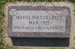
| Burial | : | Saint Peters Cemetery, Aurora, Cloud County, USA |
| Coordinate | : | 39.4763985, -97.5180969 |
| Description | : | Salina Journal - Nov 20, 1996 AURORA - Alfred Francis Collette, 73, Aurora, died Monday, Nov. 18, 1996, at the Cloud County Health Center, Concordia. Mr. Collette was born Nov. 18, 1923, at Aurora to William and Alexine LeBlanc Collette and was a lifelong resident of Cloud County. He was a retired operator of a motor grader for Cloud County Highway Department. He was a member of St. Peter's Catholic Church, Aurora, and an honorary member of the Knights of Columbus. He married Bernetha Dyson Feb. 13, 1945. She died Nov. 3, 1996. Survivors include seven sons, Don... Read More |
frequently asked questions (FAQ):
-
Where is Alfred Francis Collette's memorial?
Alfred Francis Collette's memorial is located at: Saint Peters Cemetery, Aurora, Cloud County, USA.
-
When did Alfred Francis Collette death?
Alfred Francis Collette death on 18 Nov 1996 in Concordia, Cloud County, Kansas, USA
-
Where are the coordinates of the Alfred Francis Collette's memorial?
Latitude: 39.4763985
Longitude: -97.5180969
Family Members:
Parent

Spouse
Siblings
Children
Flowers:


Nearby Cemetories:
1. Saint Peters Cemetery
Aurora, Cloud County, USA
Coordinate: 39.4763985, -97.5180969
2. Princeville Cemetery
Aurora, Cloud County, USA
Coordinate: 39.4672012, -97.5010986
3. Green Mound Cemetery
Rice, Cloud County, USA
Coordinate: 39.5248450, -97.5081630
4. Nelson Cemetery
Rice, Cloud County, USA
Coordinate: 39.5257988, -97.5410995
5. Sulphur Springs Cemetery
Aurora, Cloud County, USA
Coordinate: 39.4086610, -97.4986840
6. Pleasant View Cemetery
Ames, Cloud County, USA
Coordinate: 39.5346985, -97.4431000
7. French Presbyterian Church Cemetery
Cloud County, USA
Coordinate: 39.4395200, -97.4148290
8. Enterprise Cemetery
Cloud County, USA
Coordinate: 39.4230995, -97.6106033
9. Rice Cemetery
Rice, Cloud County, USA
Coordinate: 39.5614014, -97.5552979
10. Pleasant Hill Cemetery
Huscher, Cloud County, USA
Coordinate: 39.5093994, -97.6292038
11. Saint Joseph Cemetery
Saint Joseph, Cloud County, USA
Coordinate: 39.5074941, -97.4022328
12. Walnut Grove Cemetery
Cloud County, USA
Coordinate: 39.5699997, -97.4993973
13. Kindel Cemetery
Center Township, Cloud County, USA
Coordinate: 39.4519005, -97.6464005
14. Cedar Grove Cemetery
Clyde, Cloud County, USA
Coordinate: 39.5494003, -97.4056015
15. Oakland Union Cemetery
Miltonvale, Cloud County, USA
Coordinate: 39.3647003, -97.5824966
16. Smith Grave
Miltonvale, Cloud County, USA
Coordinate: 39.3645300, -97.4308700
17. Iwacura Cemetery
Morganville, Clay County, USA
Coordinate: 39.4550000, -97.3510000
18. Saint Concordia Cemetery
Concordia, Cloud County, USA
Coordinate: 39.5593800, -97.6503100
19. Pleasant Hill Cemetery
Concordia, Cloud County, USA
Coordinate: 39.5583000, -97.6639023
20. Nazareth Convent Cemetery
Concordia, Cloud County, USA
Coordinate: 39.5614000, -97.6612000
21. Mount Calvary Cemetery
Clyde, Cloud County, USA
Coordinate: 39.5917015, -97.4143982
22. Mount Hope Cemetery
Clyde, Cloud County, USA
Coordinate: 39.5969009, -97.4116974
23. Hall Cemetery
Cloud County, USA
Coordinate: 39.4455986, -97.7033005
24. Saint Peters Cemetery
Miltonvale, Cloud County, USA
Coordinate: 39.3652350, -97.6483570