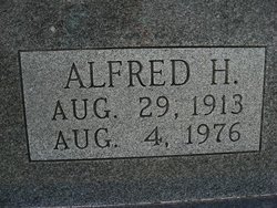
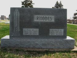
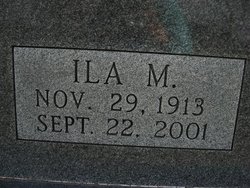
Alfred Henry Rhodes
| Birth | : | 29 Aug 1913 Auburn, Nemaha County, Nebraska, USA |
| Death | : | 4 Aug 1976 Pawnee City, Pawnee County, Nebraska, USA |
| Burial | : | St. John Bristol Road Cemetery, Bridgwater, Sedgemoor District, England |
| Coordinate | : | 51.1391470, -2.9901660 |
| Description | : | (Posted courtesy of the Table Rock Historical Society.) Table Rock Argus, Aug. 12, 1976. OBITUARY- ALFRED HENRY RHODES Alfred Henry Rhodes, son of James Marion and Loretta Belle Howell Rhodes was born August 27, 1913, at Auburn, Nebraska and passed away August 4, 1976 at his home in Pawnee City. On July 20, 1932, he was married to Ila Marie Stoll of Pawnee City. One son, James, was born to this union. As a young man he lived on a farm near Table Rock, attending Bratton Union Grade School and Table Rock High School. After he and Ila were married they made their home in Pawnee... Read More |
frequently asked questions (FAQ):
-
Where is Alfred Henry Rhodes's memorial?
Alfred Henry Rhodes's memorial is located at: St. John Bristol Road Cemetery, Bridgwater, Sedgemoor District, England.
-
When did Alfred Henry Rhodes death?
Alfred Henry Rhodes death on 4 Aug 1976 in Pawnee City, Pawnee County, Nebraska, USA
-
Where are the coordinates of the Alfred Henry Rhodes's memorial?
Latitude: 51.1391470
Longitude: -2.9901660
Family Members:
Flowers:
Nearby Cemetories:
1. St. John Bristol Road Cemetery
Bridgwater, Sedgemoor District, England
Coordinate: 51.1391470, -2.9901660
2. St John The Baptist Churchyard
Bridgwater, Sedgemoor District, England
Coordinate: 51.1311160, -2.9969910
3. Holy Trinity Churchyard
Chilton Trinity, Sedgemoor District, England
Coordinate: 51.1474390, -3.0072360
4. St. Mary's Churchyard
Bridgwater, Sedgemoor District, England
Coordinate: 51.1277430, -3.0050330
5. Bridgwater Baptist Church
Bridgwater, Sedgemoor District, England
Coordinate: 51.1272613, -3.0046282
6. Former Holy Trinity Churchyard
Bridgwater, Sedgemoor District, England
Coordinate: 51.1261850, -3.0021850
7. Gray Friar's
Bridgwater, Sedgemoor District, England
Coordinate: 51.1264260, -3.0065160
8. Quaker Burial Ground
Bridgwater, Sedgemoor District, England
Coordinate: 51.1261740, -3.0078020
9. St George Churchyard
Wembdon, Sedgemoor District, England
Coordinate: 51.1364420, -3.0171170
10. Wembdon Road Cemetery
Bridgwater, Sedgemoor District, England
Coordinate: 51.1280877, -3.0138897
11. Quantock Road Cemetery
Bridgwater, Sedgemoor District, England
Coordinate: 51.1284270, -3.0285630
12. Church of the Blessed Virgin Mary Churchyard
Chedzoy, Sedgemoor District, England
Coordinate: 51.1344600, -2.9429400
13. Saint Michael & All Angels Churchyard
Bawdrip, Sedgemoor District, England
Coordinate: 51.1517260, -2.9429330
14. Saint Michael and All Angels Churchyard
Puriton, Sedgemoor District, England
Coordinate: 51.1706000, -2.9735000
15. St Hugh's Church
Durleigh, Sedgemoor District, England
Coordinate: 51.1198090, -3.0375260
16. St. John The Baptist Churchyard
Pawlett, Sedgemoor District, England
Coordinate: 51.1789100, -3.0012650
17. Heathfield Cemetery
North Petherton, Sedgemoor District, England
Coordinate: 51.0957200, -3.0081100
18. Westonzoyland Cemetery New
Westonzoyland, Sedgemoor District, England
Coordinate: 51.1096271, -2.9349336
19. Blessed Virgin Mary Churchyard
Cannington, Sedgemoor District, England
Coordinate: 51.1500970, -3.0622850
20. Blessed Virgin Mary Churchyard
Woolavington, Sedgemoor District, England
Coordinate: 51.1704000, -2.9341000
21. St. Mary's Churchyard
Cossington, Sedgemoor District, England
Coordinate: 51.1580085, -2.9213149
22. Pawlett Methodist (Carter Memorial Wesleyan)
Pawlett, Sedgemoor District, England
Coordinate: 51.1845660, -3.0126480
23. Blessed Virgin Mary Extension Cemetery
Woolavington, Sedgemoor District, England
Coordinate: 51.1705660, -2.9329110
24. St. Mary Parish Churchyard
North Petherton, Sedgemoor District, England
Coordinate: 51.0920790, -3.0149060


