
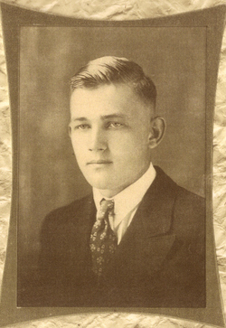
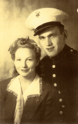

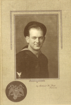
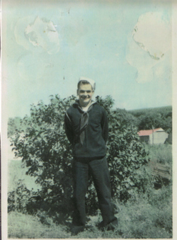
Alfred William “Bill” Raper
| Birth | : | 3 Oct 1920 Milaca, Mille Lacs County, Minnesota, USA |
| Death | : | 24 Sep 1999 Pawnee City, Pawnee County, Nebraska, USA |
| Burial | : | Old Church Cemetery, South Glastonbury, Hartford County, USA |
| Coordinate | : | 41.6814003, -72.6007996 |
| Description | : | Son of George Lyle and Emma (Faris) Raper, brother to Lucile, Joe, Jack, Shirley and Bob Raper. He was married to Elva Elizabeth LeSeur on February 18, 1943 at San Diego, California and to their union were born six children, Elizabeth, Edward, Barbra, Dora, Cora and Mary Raper. |
frequently asked questions (FAQ):
-
Where is Alfred William “Bill” Raper's memorial?
Alfred William “Bill” Raper's memorial is located at: Old Church Cemetery, South Glastonbury, Hartford County, USA.
-
When did Alfred William “Bill” Raper death?
Alfred William “Bill” Raper death on 24 Sep 1999 in Pawnee City, Pawnee County, Nebraska, USA
-
Where are the coordinates of the Alfred William “Bill” Raper's memorial?
Latitude: 41.6814003
Longitude: -72.6007996
Family Members:
Parent
Spouse

Siblings

Flowers:


Nearby Cemetories:
1. Old Church Cemetery
South Glastonbury, Hartford County, USA
Coordinate: 41.6814003, -72.6007996
2. Saint Augustine Cemetery
Glastonbury, Hartford County, USA
Coordinate: 41.6646996, -72.5952988
3. Green Cemetery
Glastonbury, Hartford County, USA
Coordinate: 41.7014008, -72.6053009
4. Old South Cemetery
South Glastonbury, Hartford County, USA
Coordinate: 41.6585999, -72.6042023
5. Saint John the Baptist Ukranian Catholic Cemetery
Glastonbury, Hartford County, USA
Coordinate: 41.6960983, -72.5733032
6. Saint Michaels Ukrainian Catholic Church Cemetery
Glastonbury, Hartford County, USA
Coordinate: 41.6962013, -72.5724030
7. Our Saviour Cemetery
Glastonbury, Hartford County, USA
Coordinate: 41.7033005, -72.5725021
8. Saint James Episcopal Church Memorial Garden
Glastonbury, Hartford County, USA
Coordinate: 41.7146200, -72.6101870
9. Saint James Cemetery
Glastonbury, Hartford County, USA
Coordinate: 41.7158012, -72.6078033
10. Center Cemetery
Rocky Hill, Hartford County, USA
Coordinate: 41.6605988, -72.6389008
11. Saint Andrews Church Memorial Garden
Rocky Hill, Hartford County, USA
Coordinate: 41.6671830, -72.6586290
12. Holy Cross Cemetery
Glastonbury, Hartford County, USA
Coordinate: 41.7166710, -72.5606613
13. Wassuc Cemetery
Glastonbury, Hartford County, USA
Coordinate: 41.6730995, -72.5389023
14. Wethersfield Village Cemetery
Wethersfield, Hartford County, USA
Coordinate: 41.7116013, -72.6499481
15. Neipsic Cemetery
Glastonbury, Hartford County, USA
Coordinate: 41.6972008, -72.5374985
16. Colonel Raymond F. Gates Memorial Cemetery
Rocky Hill, Hartford County, USA
Coordinate: 41.6512718, -72.6548615
17. Trinity Parish Memorial Garden
Wethersfield, Hartford County, USA
Coordinate: 41.7148190, -72.6522590
18. Rose Hill Memorial Park
Rocky Hill, Hartford County, USA
Coordinate: 41.6547012, -72.6588974
19. Old Eastbury Cemetery
Glastonbury, Hartford County, USA
Coordinate: 41.7043991, -72.5318985
20. Wethersfield State Prison Cemetery
Wethersfield, Hartford County, USA
Coordinate: 41.7195360, -72.6603130
21. Old South Cemetery
East Hartford, Hartford County, USA
Coordinate: 41.7356453, -72.6341324
22. Buckingham Cemetery
Glastonbury, Hartford County, USA
Coordinate: 41.7120094, -72.5229721
23. Hockanum Cemetery
East Hartford, Hartford County, USA
Coordinate: 41.7427864, -72.6344910
24. Sgt Herman Baker Jr. Grave Site
East Hartford, Hartford County, USA
Coordinate: 41.7498480, -72.6375890