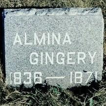
Almina C Doner Gingery
| Birth | : | 1836 Lexington, Stark County, Ohio, USA |
| Death | : | Nov 1871 Cass County, Iowa, USA |
| Burial | : | Davis Cemetery, Davis, Yolo County, USA |
| Coordinate | : | 38.5550003, -121.7260971 |
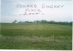
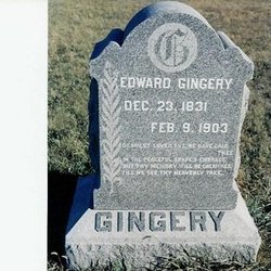
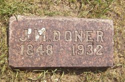
| Description | : | Almina C Doner was born in OH to French Canadian parents, Joseph and Mary Doner. The family moved to IN and then on to IA, where they settled. She married Edward Gingery, whose parents were German immigrants who also moved from OH to IA. Edward Gingery (whose parents changed their name from the German Gingerich) owned a large farm in the Atlantic area. The couple had 3 children, Joseph Lincoln who moved to CA, Charles who died in infancy and Mary Almina, who married John Ludwick Fritz, also of German decent. Almina C Doner was my 2nd great grandmother. |
frequently asked questions (FAQ):
-
Where is Almina C Doner Gingery's memorial?
Almina C Doner Gingery's memorial is located at: Davis Cemetery, Davis, Yolo County, USA.
-
When did Almina C Doner Gingery death?
Almina C Doner Gingery death on Nov 1871 in Cass County, Iowa, USA
-
Where are the coordinates of the Almina C Doner Gingery's memorial?
Latitude: 38.5550003
Longitude: -121.7260971
Family Members:
Parent
Spouse
Siblings
Flowers:
Nearby Cemetories:
1. Davis Cemetery
Davis, Yolo County, USA
Coordinate: 38.5550003, -121.7260971
2. Episcopal Church of Saint Martin Columbarium
Davis, Yolo County, USA
Coordinate: 38.5488870, -121.7611850
3. Tremont Cemetery
Dixon, Solano County, USA
Coordinate: 38.4940987, -121.7043991
4. Saint Joseph Cemetery
Woodland, Yolo County, USA
Coordinate: 38.6694400, -121.7842120
5. Woodland Cemetery
Woodland, Yolo County, USA
Coordinate: 38.6711006, -121.7846985
6. Dixon Cemetery
Dixon, Solano County, USA
Coordinate: 38.4354553, -121.8227005
7. Monument Hill Memorial Park
Woodland, Yolo County, USA
Coordinate: 38.6781020, -121.8566400
8. Sunset Hill Cemetery
Sacramento, Sacramento County, USA
Coordinate: 38.5608000, -121.5037300
9. Masonic Lawn Cemetery
Sacramento, Sacramento County, USA
Coordinate: 38.5604720, -121.5032600
10. Odd Fellows Lawn Cemetery and Mausoleum
Sacramento, Sacramento County, USA
Coordinate: 38.5585000, -121.5011000
11. Sacramento City Cemetery
Sacramento, Sacramento County, USA
Coordinate: 38.5636864, -121.5009537
12. National Shrine of Our Lady of Guadalupe Crypt
Sacramento, Sacramento County, USA
Coordinate: 38.5704800, -121.5014400
13. Buddhist Church of Sacramento Nokotsudo
Sacramento, Sacramento County, USA
Coordinate: 38.5639300, -121.4978400
14. Sacramento Valley National Cemetery
Dixon, Solano County, USA
Coordinate: 38.4167800, -121.8754000
15. California State Capitol
Sacramento, Sacramento County, USA
Coordinate: 38.5760994, -121.4931488
16. Holy Ascension Russian Orthodox Cemetery
Sacramento, Sacramento County, USA
Coordinate: 38.5846212, -121.4936736
17. Saint Joseph Cemetery
Sacramento, Sacramento County, USA
Coordinate: 38.5574989, -121.4835968
18. Cacheville Cemetery
Yolo, Yolo County, USA
Coordinate: 38.7378300, -121.8090200
19. Pho Minh Temple Columbarium
Sacramento, Sacramento County, USA
Coordinate: 38.5340100, -121.4769000
20. Trinity Episcopal Cathedral Columbarium
Sacramento, Sacramento County, USA
Coordinate: 38.5705500, -121.4723770
21. Winters Cemetery
Winters, Yolo County, USA
Coordinate: 38.5256004, -121.9777985
22. Gordon Family Cemetery
Esparto, Yolo County, USA
Coordinate: 38.6966060, -121.9151540
23. Saint Rose Cemetery (Defunct)
Sacramento, Sacramento County, USA
Coordinate: 38.5208015, -121.4672012
24. New Helvetia Cemetery (Defunct)
Sacramento, Sacramento County, USA
Coordinate: 38.5731600, -121.4639900


