
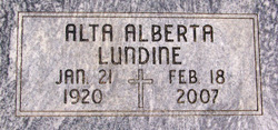
Alta Alberta Crapson Lundine
| Birth | : | 21 Jan 1920 Odense, Neosho County, Kansas, USA |
| Death | : | 18 Feb 2007 Chanute, Neosho County, Kansas, USA |
| Burial | : | St. Helen's Cemetery and Crematorium, St Helens, Metropolitan Borough of St Helens, England |
| Coordinate | : | 53.4678993, -2.7607000 |
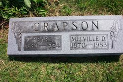
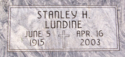
| Description | : | **************************** Published Chanute, KS ~ February 22, 2007 Alta Alberta Lundine, 87, of Chanute, KS, died Sunday, Feb. 18, 2007, at Neosho Memorial Regional Medical Center in Chanute, Kansas. The daughter of Melville Dow and Pearl (Parrott) Crapson, she was born Jan. 21, 1920, in Odense, Kansas. She was raised and attended school in the Chanute area. She married Stanley H. Lundine on June 6, 1944 in Chanute, Kansas. He preceded her in death April 16, 2003. She was a member of the Otterbein United Methodist Church. Survivors include a daughter, Christina Driver,... Read More |
frequently asked questions (FAQ):
-
Where is Alta Alberta Crapson Lundine's memorial?
Alta Alberta Crapson Lundine's memorial is located at: St. Helen's Cemetery and Crematorium, St Helens, Metropolitan Borough of St Helens, England.
-
When did Alta Alberta Crapson Lundine death?
Alta Alberta Crapson Lundine death on 18 Feb 2007 in Chanute, Neosho County, Kansas, USA
-
Where are the coordinates of the Alta Alberta Crapson Lundine's memorial?
Latitude: 53.4678993
Longitude: -2.7607000
Family Members:
Parent
Spouse
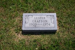
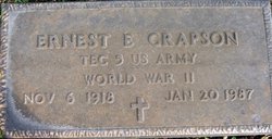
Siblings

Flowers:


Nearby Cemetories:
1. St. Helen's Cemetery and Crematorium
St Helens, Metropolitan Borough of St Helens, England
Coordinate: 53.4678993, -2.7607000
2. Windleshaw Chantry
St Helens, Metropolitan Borough of St Helens, England
Coordinate: 53.4672417, -2.7550773
3. Christ Church Churchyard
Eccleston, Metropolitan Borough of St Helens, England
Coordinate: 53.4542560, -2.7778900
4. Friends Meeting House, Hardshaw, St Helens
St Helens, Metropolitan Borough of St Helens, England
Coordinate: 53.4518340, -2.7320414
5. GreenAcres Cemetery
Rainford, Metropolitan Borough of St Helens, England
Coordinate: 53.4713530, -2.8064280
6. St Mary Roman Catholic Churchyard
Billinge, Metropolitan Borough of St Helens, England
Coordinate: 53.4909850, -2.7180090
7. All Saints Church
Rainford, Metropolitan Borough of St Helens, England
Coordinate: 53.5000210, -2.7870990
8. St Peter's of Parr Churchyard
Parr, Metropolitan Borough of St Helens, England
Coordinate: 53.4543745, -2.7009772
9. St Mark Churchyard
Haydock, Metropolitan Borough of St Helens, England
Coordinate: 53.4658540, -2.6892980
10. St Nicholas Churchyard
St Helens, Metropolitan Borough of St Helens, England
Coordinate: 53.4284660, -2.7213830
11. St. Anne and Blessed Dominic Churchyard
St Helens, Metropolitan Borough of St Helens, England
Coordinate: 53.4330960, -2.7083700
12. St. Mary the Virgin Churchyard
Prescot, Metropolitan Borough of Knowsley, England
Coordinate: 53.4284600, -2.8067000
13. Prescot Cemetery
Prescot, Metropolitan Borough of Knowsley, England
Coordinate: 53.4266620, -2.8081590
14. St Ann’s Graveyard
Rainhill, Metropolitan Borough of St Helens, England
Coordinate: 53.4157487, -2.7638276
15. St. Mary's Churchyard
Knowsley, Metropolitan Borough of Knowsley, England
Coordinate: 53.4561960, -2.8528580
16. St James' Churchyard
Haydock, Metropolitan Borough of St Helens, England
Coordinate: 53.4679080, -2.6596350
17. St Bartholomew's Churchyard
Rainhill, Metropolitan Borough of St Helens, England
Coordinate: 53.4076231, -2.7513287
18. Knowsley Cemetery
Knowsley, Metropolitan Borough of Knowsley, England
Coordinate: 53.4083240, -2.7847870
19. Holy Trinity Churchyard
Ashton-In-Makerfield, Metropolitan Borough of Wigan, England
Coordinate: 53.4989280, -2.6688000
20. St. Nicholas' Churchyard
Whiston, Metropolitan Borough of Knowsley, England
Coordinate: 53.4069736, -2.8028920
21. St James Roman Catholic Churchyard
Orrell, Metropolitan Borough of Wigan, England
Coordinate: 53.5300000, -2.7140000
22. St. Michael Churchyard
Huyton with Roby, Metropolitan Borough of Knowsley, England
Coordinate: 53.4139560, -2.8396720
23. Salem Churchyard
Orrell, Metropolitan Borough of Wigan, England
Coordinate: 53.5331572, -2.7107046
24. St Michael Churchyard Extension
Huyton with Roby, Metropolitan Borough of Knowsley, England
Coordinate: 53.4143310, -2.8418050