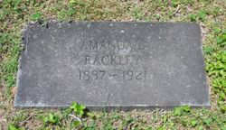
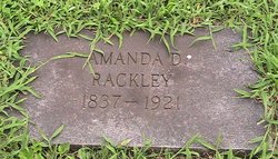
Amanda Delitha Rackley Stacy
| Birth | : | Jan 1837 Hollow Springs, Cannon County, Tennessee, USA |
| Death | : | Dec 1921 Bradyville, Cannon County, Tennessee, USA |
| Burial | : | Ecclesmachan Cemetery, Scotland |
| Coordinate | : | 55.9461400, -3.5096500 |
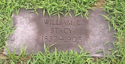
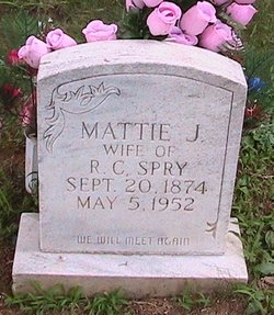
| Description | : | After the death of her husband Amanda, lived with her daughter, Mattie Jane Spry, near Hollow Springs (Cannon Co.,TN). William Edwin and Amanda had twelve children; seven survived A Memorial Dedication to William Edwin Stacy (1837-1905), Amanda Delitha Racley-Stacy (1837-1921), and Roxanna Stacy-Wilson (D. 1907). Descendants of William and Sarah Hanes Stacy gathered in 1984 at the Coffee County Junior High School in Manchester. The American and English pedigrees of the Stacy family were on display with charts of each of the twelve children of William and Sarah Stacy showing descendancy. Following the reuinion dinner, the family assembled at... Read More |
frequently asked questions (FAQ):
-
Where is Amanda Delitha Rackley Stacy's memorial?
Amanda Delitha Rackley Stacy's memorial is located at: Ecclesmachan Cemetery, Scotland.
-
When did Amanda Delitha Rackley Stacy death?
Amanda Delitha Rackley Stacy death on Dec 1921 in Bradyville, Cannon County, Tennessee, USA
-
Where are the coordinates of the Amanda Delitha Rackley Stacy's memorial?
Latitude: 55.9461400
Longitude: -3.5096500
Family Members:
Spouse
Children
Flowers:
Nearby Cemetories:
1. Ecclesmachan Cemetery
Scotland
Coordinate: 55.9461400, -3.5096500
2. Muiravonside Church of Scotland
Scotland
Coordinate: 55.9743440, -3.6742900
3. Penicuik Old Churchyard
Scotland
Coordinate: 55.8270580, -3.2193700
4. St. Serf's Priory
Scotland
Coordinate: 56.1876160, -3.3529760
5. Tullibody Old Kirkyard
Scotland
Coordinate: 56.1371705, -3.8353321
6. Tullibody Cemetery
Scotland
Coordinate: 56.1375500, -3.8356500
7. New Monkland Cemetery
Scotland
Coordinate: 55.8879340, -3.9972610
8. Cranstoun Parish Churchyard
Scotland
Coordinate: 55.8792400, -2.9860300
9. Riddrie Cemetery
Scotland
Coordinate: 55.8750700, -4.1823400
10. Cults Cemetery
Scotland
Coordinate: 56.2767906, -3.0565600
11. Largo Cemetery
Scotland
Coordinate: 56.2230510, -2.9332210
12. Abdie Churchyard
Scotland
Coordinate: 56.3338200, -3.1993100
13. Athelstaneford Parish Church Cemetery
Scotland
Coordinate: 55.9867390, -2.7499130
14. Cathcart Cemetery
Scotland
Coordinate: 55.8098500, -4.2673800
15. Strowan Churchyard
Scotland
Coordinate: 56.3684770, -3.9114120
16. Chapel Knowe and Cockburn's Tombe
Scotland
Coordinate: 55.4942625, -3.2214799
17. Creich Cemetery
Scotland
Coordinate: 56.3798110, -3.0912140
18. Redgorton Parish Churchyard
Scotland
Coordinate: 56.4385500, -3.4876000
19. Abercrombie Old Chapelyard
Scotland
Coordinate: 56.2210500, -2.7725053
20. Moneydie Parish Churchyard
Scotland
Coordinate: 56.4494600, -3.5165800
21. Longformacus Parish Church
Scotland
Coordinate: 55.8080300, -2.4898700
22. Invervar Graveyard Cladh Chunna's
Scotland
Coordinate: 56.6216000, -3.8671000
23. St Cuthbert Churchyard
Carham, Northumberland Unitary Authority, England
Coordinate: 55.6389230, -2.3238090
24. Drongan Cemetery
Scotland
Coordinate: 55.4389490, -4.4594050

