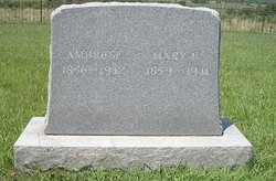
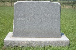
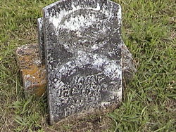
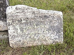
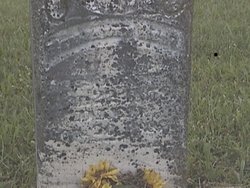
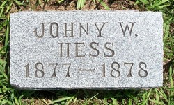
Ambrose Hess
| Birth | : | 22 May 1856 Washington County, Maryland, USA |
| Death | : | 9 Mar 1942 California, Moniteau County, Missouri, USA |
| Burial | : | Sparks Cemetery, Beatrice, Gage County, USA |
| Coordinate | : | 40.2485180, -96.8984970 |
| Description | : | Sources: The Central Missourian (Newspaper) Charles J. Hall. "The Hess Family In America," Privately published (1968) Tulsa, Oklahoma, page 68. [Photocopy of obituary date March 1942] HESS, Ambrose Funeral Services For Well-Known Citizen Held Wednesday Afternoon - Ambrose Hess, Dies at 85 Ambrose Hess, 85, for many years one of Moniteau County's best known farmers and stockmen, died at this home about four miles northeast of California late Monday evening. March 8, 1942. His death occurred on the farm where he had been raised since he came to Missouri with his parents when he was 10... Read More |
frequently asked questions (FAQ):
-
Where is Ambrose Hess's memorial?
Ambrose Hess's memorial is located at: Sparks Cemetery, Beatrice, Gage County, USA.
-
When did Ambrose Hess death?
Ambrose Hess death on 9 Mar 1942 in California, Moniteau County, Missouri, USA
-
Where are the coordinates of the Ambrose Hess's memorial?
Latitude: 40.2485180
Longitude: -96.8984970
Family Members:
Parent
Spouse
Siblings
Children
Flowers:
Nearby Cemetories:
1. Sparks Cemetery
Beatrice, Gage County, USA
Coordinate: 40.2485180, -96.8984970
2. Ellis Cemetery
Beatrice, Gage County, USA
Coordinate: 40.2260017, -96.8785019
3. Zion Lutheran Cemetery
Harbine, Jefferson County, USA
Coordinate: 40.2346610, -96.9350780
4. Kilpatrick Cemetery
Plymouth, Jefferson County, USA
Coordinate: 40.2919006, -96.9338989
5. First Trinity Lutheran Cemetery
Beatrice, Gage County, USA
Coordinate: 40.3053600, -96.8794400
6. Freeman Cemetery
Beatrice, Gage County, USA
Coordinate: 40.2966933, -96.8435666
7. Homestead National Historical Park
Beatrice, Gage County, USA
Coordinate: 40.2864800, -96.8271100
8. Harbine Cemetery
Harbine, Jefferson County, USA
Coordinate: 40.2042007, -96.9717026
9. Immanuel Lutheran Cemetery
Plymouth, Jefferson County, USA
Coordinate: 40.3075430, -96.9529750
10. First Mennonite Church Cemetery
Beatrice, Gage County, USA
Coordinate: 40.2856800, -96.8120500
11. Hope Church Cemetery
Harbine, Jefferson County, USA
Coordinate: 40.1826480, -96.9540828
12. Woodlawn Cemetery
Plymouth, Jefferson County, USA
Coordinate: 40.2991982, -96.9906006
13. Old Plymouth Cemetery
Plymouth, Jefferson County, USA
Coordinate: 40.2621994, -97.0235977
14. Saint Pauls Evangelical Lutheran Cemetery
Plymouth, Jefferson County, USA
Coordinate: 40.3074989, -97.0085983
15. Walnut Grove Pet Cemetery
Beatrice, Gage County, USA
Coordinate: 40.2613200, -96.7605920
16. Anyon Cemetery
Beatrice, Gage County, USA
Coordinate: 40.1548600, -96.8128800
17. Dolen Cemetery
Gage County, USA
Coordinate: 40.3494950, -96.8225930
18. Hildebrandt Cemetery
Jansen, Jefferson County, USA
Coordinate: 40.2225750, -97.0476330
19. Prairie Home Cemetery
Diller, Jefferson County, USA
Coordinate: 40.1328011, -96.9321976
20. Emmanuel Cemetery
Jefferson County, USA
Coordinate: 40.2910995, -97.0466995
21. Beatrice Cemetery
Beatrice, Gage County, USA
Coordinate: 40.2625970, -96.7332670
22. Megli-Yost Cemetery
Jefferson County, USA
Coordinate: 40.3064003, -97.0466995
23. Saint Joseph Cemetery
Beatrice, Gage County, USA
Coordinate: 40.3054700, -96.7460700
24. Saint Pauls Church of Christ Cemetery
Jefferson County, USA
Coordinate: 40.2478480, -97.0808630

