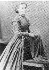
Amelia Wood Robinson
| Birth | : | 6 Aug 1844 East Riding of Yorkshire, England |
| Death | : | 13 Mar 1925 Rhodes, Marshall County, Iowa, USA |
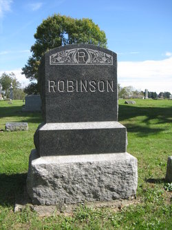
| Burial | : | Antioch Cemetery, Antioch, Miami County, USA |
| Coordinate | : | 38.7161700, -94.9452800 |
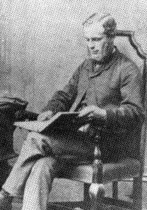
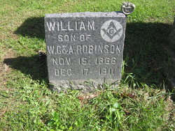
| Description | : | Amelia came to America with baby Billie. She joined her husband William who came to the United States in 1868. The family first settled near Peoria, South of Maxwell, IA., and the next Spring moved to Jasper Co., south of Collins, IA. In the Autumn of 1877, the family moved to a farm that borders the nortwest side of Hendrickson Marsh. It was here they raised their family of six boys and two girls. Two daughters died in infancy. FATHER: John Wood MOTHER: Elizabeth Daniel Wood MARRIED: 1867 England CHILDREN: Maurice Wood, 1/27/1890 - 7/6/1963, (11/6/1910, Collins, IA., Elsie Luing, 9/6/1891 - 5/ /1971) |
frequently asked questions (FAQ):
-
Where is Amelia Wood Robinson's memorial?
Amelia Wood Robinson's memorial is located at: Antioch Cemetery, Antioch, Miami County, USA.
-
When did Amelia Wood Robinson death?
Amelia Wood Robinson death on 13 Mar 1925 in Rhodes, Marshall County, Iowa, USA
-
Where are the coordinates of the Amelia Wood Robinson's memorial?
Latitude: 38.7161700
Longitude: -94.9452800
Family Members:
Spouse
Children
Flowers:
Nearby Cemetories:
1. Antioch Cemetery
Antioch, Miami County, USA
Coordinate: 38.7161700, -94.9452800
2. Chilton Family Cemetery
Edgerton, Johnson County, USA
Coordinate: 38.7236800, -94.9819300
3. Saint Columbine Cemetery
Edgerton, Johnson County, USA
Coordinate: 38.7569008, -94.9916992
4. Rock Creek Cemetery
Antioch, Miami County, USA
Coordinate: 38.7099991, -95.0156021
5. Edgerton Cemetery
Edgerton, Johnson County, USA
Coordinate: 38.7524986, -95.0018997
6. Old Marysville Cemetery
Hillsdale, Miami County, USA
Coordinate: 38.6731500, -94.8897600
7. Scott Valley Cemetery
Paola, Miami County, USA
Coordinate: 38.6521400, -94.9374200
8. Fuller Cemetery
Gardner, Johnson County, USA
Coordinate: 38.7750100, -94.8900300
9. Home Holding Cemetery
Hillsdale, Miami County, USA
Coordinate: 38.6508400, -94.8829000
10. Gardner Cemetery
Gardner, Johnson County, USA
Coordinate: 38.8048096, -94.9372635
11. Springhill Cemetery
Spring Hill, Johnson County, USA
Coordinate: 38.7466393, -94.8360214
12. Hillsdale Cemetery Old
Hillsdale, Miami County, USA
Coordinate: 38.6653500, -94.8481900
13. Hillsdale Cemetery New
Hillsdale, Miami County, USA
Coordinate: 38.6649100, -94.8482800
14. Fisher Family Cemetery
Hillsdale, Miami County, USA
Coordinate: 38.6827200, -94.8292200
15. Walnut Creek Cemetery
Franklin County, USA
Coordinate: 38.6733017, -95.0832977
16. Four Corners Cemetery
Gardner, Johnson County, USA
Coordinate: 38.8314018, -94.9728012
17. Pleasant Valley Cemetery
Stanton, Miami County, USA
Coordinate: 38.6222000, -95.0428009
18. Wellsville Cemetery
Wellsville, Franklin County, USA
Coordinate: 38.7174988, -95.1025009
19. Miami County Poor Farm Cemetery
Paola, Miami County, USA
Coordinate: 38.5943420, -94.9193018
20. Wagstaff Cemetery
Chiles, Miami County, USA
Coordinate: 38.6657200, -94.7964300
21. Saint Columbia Cemetery
Gardner, Johnson County, USA
Coordinate: 38.8405991, -94.9092026
22. Old Black Jack Cemetery
Black Jack, Douglas County, USA
Coordinate: 38.7536150, -95.1124620
23. Black Jack Cemetery
Douglas County, USA
Coordinate: 38.7660400, -95.1159400
24. New Hope Cemetery
Osawatomie, Miami County, USA
Coordinate: 38.6077000, -95.0648900

