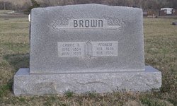
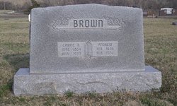
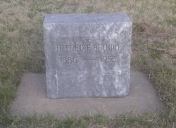
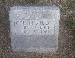
Andrew “Andy” Brown
| Birth | : | 11 Feb 1846 Eugene, Vermillion County, Indiana, USA |
| Death | : | 24 Feb 1924 Woodston, Rooks County, Kansas, USA |
| Burial | : | Greenacres Cemetery, Oldham, Metropolitan Borough of Oldham, England |
| Coordinate | : | 53.5455490, -2.0820510 |
| Description | : | Andrew was born to John Brown and Rachel Peden. His Mother was from a devout Quaker family, Alexander Peden b. 1762 and Abigail Walton b. abt. 1771, last residing at Pike Run Twp, in WA Co. PA. The John Brown family left W. Virginia and moved to Ohio, then went down the Ohio river on a flat boat that John had built, got off before the water fall and went west to Eugene, Vermillion Co. IN., where Andrew was born. Andrew and Sarah E Brown are shown in Osage twp, Miami County, Kansas State census in 1867. Sarah was his... Read More |
frequently asked questions (FAQ):
-
Where is Andrew “Andy” Brown's memorial?
Andrew “Andy” Brown's memorial is located at: Greenacres Cemetery, Oldham, Metropolitan Borough of Oldham, England.
-
When did Andrew “Andy” Brown death?
Andrew “Andy” Brown death on 24 Feb 1924 in Woodston, Rooks County, Kansas, USA
-
Where are the coordinates of the Andrew “Andy” Brown's memorial?
Latitude: 53.5455490
Longitude: -2.0820510
Family Members:
Parent
Spouse
Siblings
Children
Flowers:
Nearby Cemetories:
1. Greenacres Cemetery
Oldham, Metropolitan Borough of Oldham, England
Coordinate: 53.5455490, -2.0820510
2. Greenacres Congregational Church
Oldham, Metropolitan Borough of Oldham, England
Coordinate: 53.5455200, -2.0788100
3. Holy Trinity Churchyard
Waterhead, Metropolitan Borough of Oldham, England
Coordinate: 53.5507100, -2.0738400
4. St. John the Baptist Churchyard
Heybridge, Central Coast Council, Australia
Coordinate: 53.5415973, -2.0699727
5. St. John The Baptist Churchyard
Oldham, Metropolitan Borough of Oldham, England
Coordinate: 53.5424690, -2.0680150
6. St Thomas'
Oldham, Metropolitan Borough of Oldham, England
Coordinate: 53.5366318, -2.0724053
7. Lees Cemetery
Oldham, Metropolitan Borough of Oldham, England
Coordinate: 53.5347540, -2.0739260
8. St. Mary Church of England Churchyard
Oldham, Metropolitan Borough of Oldham, England
Coordinate: 53.5428030, -2.1104030
9. Friends Burial Ground at Turf Lane
Royton, Metropolitan Borough of Oldham, England
Coordinate: 53.5620200, -2.1039660
10. Holy Trinity Churchyard
Shaw, Metropolitan Borough of Oldham, England
Coordinate: 53.5749940, -2.0991780
11. Saint Paul Churchyard
Royton, Metropolitan Borough of Oldham, England
Coordinate: 53.5653330, -2.1261450
12. St. George Parish Churchyard
Mossley, Metropolitan Borough of Tameside, England
Coordinate: 53.5164000, -2.0486200
13. Crompton Cemetery
Shaw, Metropolitan Borough of Oldham, England
Coordinate: 53.5799840, -2.1003410
14. Chadderton Cemetery
Chadderton, Metropolitan Borough of Oldham, England
Coordinate: 53.5464860, -2.1468960
15. Royton Cemetery
Royton, Metropolitan Borough of Oldham, England
Coordinate: 53.5727450, -2.1302850
16. Hollinwood Cemetery
Oldham, Metropolitan Borough of Oldham, England
Coordinate: 53.5178170, -2.1329170
17. Delph Independent Chapelyard
Delph, Metropolitan Borough of Oldham, England
Coordinate: 53.5690839, -2.0225845
18. Oldham Crematorium
Oldham, Metropolitan Borough of Oldham, England
Coordinate: 53.5156810, -2.1332800
19. St Matthew Churchyard
Chadderton, Metropolitan Borough of Oldham, England
Coordinate: 53.5565975, -2.1528452
20. Hurst Cemetery
Ashton-Under-Lyne, Metropolitan Borough of Tameside, England
Coordinate: 53.5011590, -2.0727370
21. St Thomas Churchyard Friarmere
Delph, Metropolitan Borough of Oldham, England
Coordinate: 53.5778800, -2.0285500
22. St. John the Evangelist Churchyard
Hurst, Metropolitan Borough of Tameside, England
Coordinate: 53.5001310, -2.0812490
23. Mossley Cemetery
Mossley, Metropolitan Borough of Tameside, England
Coordinate: 53.5092100, -2.0332700
24. Christ Church Churchyard
Denshaw, Metropolitan Borough of Oldham, England
Coordinate: 53.5918070, -2.0385720


