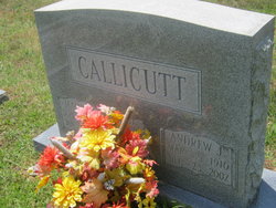
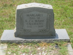
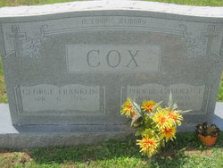
Andrew Jefferson Callicutt
| Birth | : | 2 Mar 1910 Randolph County, North Carolina, USA |
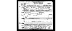
| Death | : | 25 Dec 2002 Asheboro, Randolph County, North Carolina, USA |
| Burial | : | Franklinville United Methodist Church Cemetery, Franklinville, Randolph County, USA |
| Coordinate | : | 35.7462900, -79.7037500 |
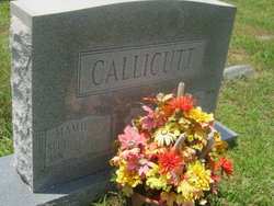
| Description | : | Son of John C and Nettie Callicutt Married Mamie Elizabeth Allred on 26 OCT 1929 FRANKLINVILLE - Andrew Jefferson Callicutt, 92, of Farm Creek Drive, died Wednesday, Dec. 25, 2002, at the Asheboro Health and Rehabilitation Center. Graveside service will be 11 a.m. Friday at the Franklinville United Methodist Church cemetery, with the Rev. Jeff Joyce officiating. He was a native of Randolph County, retired from Founders Furniture and attended Franklinville United Methodist Church. Surviving are son, Charles Callicutt of Franklinville; sister, Nannie Burch of Ramseur; six grandchildren; 13 great-grandchildren. The family will be... Read More |
frequently asked questions (FAQ):
-
Where is Andrew Jefferson Callicutt's memorial?
Andrew Jefferson Callicutt's memorial is located at: Franklinville United Methodist Church Cemetery, Franklinville, Randolph County, USA.
-
When did Andrew Jefferson Callicutt death?
Andrew Jefferson Callicutt death on 25 Dec 2002 in Asheboro, Randolph County, North Carolina, USA
-
Where are the coordinates of the Andrew Jefferson Callicutt's memorial?
Latitude: 35.7462900
Longitude: -79.7037500
Family Members:
Parent
Spouse
Siblings
Children
Flowers:
Nearby Cemetories:
1. Franklinville United Methodist Church Cemetery
Franklinville, Randolph County, USA
Coordinate: 35.7462900, -79.7037500
2. First Baptist Church Cemetery
Franklinville, Randolph County, USA
Coordinate: 35.7482230, -79.6908630
3. Billy Trogdon Cemetery
Asheboro, Randolph County, USA
Coordinate: 35.7392800, -79.7219100
4. Clear View Baptist Church Cemetery
Franklinville, Randolph County, USA
Coordinate: 35.7530800, -79.7234300
5. Old Salem Cemetery
Franklinville, Randolph County, USA
Coordinate: 35.7414017, -79.6742020
6. Cedar Falls United Methodist Church Cemetery
Asheboro, Randolph County, USA
Coordinate: 35.7472920, -79.7338990
7. Cedar Falls Baptist Church Cemetery
Cedar Falls, Randolph County, USA
Coordinate: 35.7480800, -79.7357800
8. Pleasant Cross Christian Church Cemetery
Asheboro, Randolph County, USA
Coordinate: 35.7254000, -79.7268740
9. Providence Baptist Church Cemetery
Asheboro, Randolph County, USA
Coordinate: 35.7231400, -79.7237930
10. Shady Grove Community Cemetery
Asheboro, Randolph County, USA
Coordinate: 35.7192180, -79.7287920
11. Ramseur Wesleyan Church Cemetery
Ramseur, Randolph County, USA
Coordinate: 35.7305670, -79.6593030
12. Sunset Knoll Cemetery
Ramseur, Randolph County, USA
Coordinate: 35.7313995, -79.6500015
13. Whites Memorial Baptist Church Cemetery
Franklinville, Randolph County, USA
Coordinate: 35.7939680, -79.7149760
14. Friendship AME Church Cemetery
Ramseur, Randolph County, USA
Coordinate: 35.7463280, -79.6437970
15. Patterson Grove Christian Church Cemetery
Ramseur, Randolph County, USA
Coordinate: 35.7743940, -79.6536550
16. Pleasant Ridge Christian Church Cemetery
Ramseur, Randolph County, USA
Coordinate: 35.7046860, -79.6670060
17. Odell Trogdon Cemetery
Grays Chapel, Randolph County, USA
Coordinate: 35.7947200, -79.7300200
18. Harmony Baptist Church Cemetery
Ramseur, Randolph County, USA
Coordinate: 35.7241680, -79.6418910
19. Giles Chapel United Methodist Church Cemetery
Asheboro, Randolph County, USA
Coordinate: 35.7462270, -79.7752450
20. Parks-Stout Cemetery
Randolph County, USA
Coordinate: 35.7205460, -79.6373740
21. Mount Tabor Community Church Cemetery
Asheboro, Randolph County, USA
Coordinate: 35.6892900, -79.7318400
22. Whites Chapel United Methodist Church Cemetery
Liberty, Randolph County, USA
Coordinate: 35.7850520, -79.6422990
23. Cool Springs Baptist Church Cemetery
Franklinville, Randolph County, USA
Coordinate: 35.8072420, -79.6805660
24. Faith Temple Baptist Church Cemetery
Franklinville, Randolph County, USA
Coordinate: 35.8023770, -79.7460950

