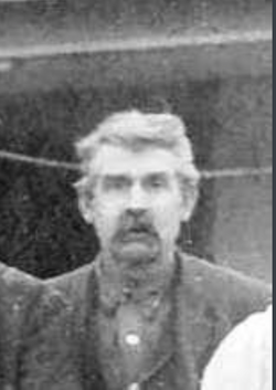
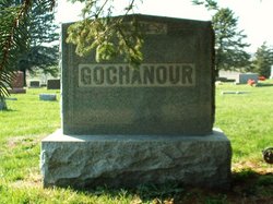
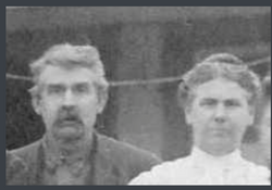
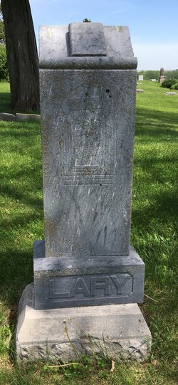
Angus Calvin Gochanour
| Birth | : | 10 Jun 1850 Streator, LaSalle County, Illinois, USA |
| Death | : | 17 Jul 1927 Anita, Cass County, Iowa, USA |
| Burial | : | Evergreen Cemetery, Miamiville, Clermont County, USA |
| Coordinate | : | 39.2113500, -84.3098300 |
| Plot | : | Bk 2 Lot 1 |
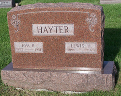
| Description | : | Gochanour, Angus Calvin 10 June 1850 – 17 July 1927 Anita (Iowa) Tribune, Thursday, July 21, 1927, pg. 1 A.C. Gochanour Passes Away Sunday Morning Angus C. Gochanour, a pioneer resident of Cass County, passed away Sunday morning at the home of his daughter, Mrs. Louis Hayter, northwest of the city. Mr. Gochanour has been in poor health for a number of months, suffering from ailments due to advanced age. Deceased was born in Illinois on June 10th, 1850, and was aged 77 years, 1 month and 7 days at the time of his death. His wife passed away several years ago, and since that... Read More |
frequently asked questions (FAQ):
-
Where is Angus Calvin Gochanour's memorial?
Angus Calvin Gochanour's memorial is located at: Evergreen Cemetery, Miamiville, Clermont County, USA.
-
When did Angus Calvin Gochanour death?
Angus Calvin Gochanour death on 17 Jul 1927 in Anita, Cass County, Iowa, USA
-
Where are the coordinates of the Angus Calvin Gochanour's memorial?
Latitude: 39.2113500
Longitude: -84.3098300
Family Members:
Parent
Spouse
Siblings
Children
Flowers:
Nearby Cemetories:
1. Evergreen Cemetery
Miamiville, Clermont County, USA
Coordinate: 39.2113500, -84.3098300
2. Waldschmidt Cemetery
Camp Dennison, Hamilton County, USA
Coordinate: 39.1944900, -84.2882200
3. Laurel Memorial Gardens
Symmes, Hamilton County, USA
Coordinate: 39.2352982, -84.3125000
4. Ranson Family Cemetery
Top-of-the-Ridge, Clermont County, USA
Coordinate: 39.2077220, -84.2719890
5. Brown Family Cemetery
Top-of-the-Ridge, Clermont County, USA
Coordinate: 39.1968980, -84.2695320
6. Milford Cemetery
Milford, Clermont County, USA
Coordinate: 39.1795550, -84.2908500
7. Milford First United Methodist Church Columbarium
Milford, Clermont County, USA
Coordinate: 39.1768880, -84.2910680
8. Jewish Cemeteries of Greater Cincinnati – Loveland
Loveland, Clermont County, USA
Coordinate: 39.2281970, -84.2641830
9. Concord Methodist Episcopal Cemetery
Sundale, Clermont County, USA
Coordinate: 39.2318820, -84.2599380
10. Hopewell Cemetery
Montgomery, Hamilton County, USA
Coordinate: 39.2439003, -84.3482971
11. Covalt Cemetery
Terrace Park, Hamilton County, USA
Coordinate: 39.1671400, -84.3028080
12. Saint Thomas Episcopal Church Columbarium
Terrace Park, Hamilton County, USA
Coordinate: 39.1666300, -84.3029760
13. Indian Hill Episcopal Presbyterian Churchyard
Cincinnati, Hamilton County, USA
Coordinate: 39.1748880, -84.3441490
14. Knox Presbyterian Church Columbarium
Hyde Park, Hamilton County, USA
Coordinate: 39.1846081, -84.3569411
15. Montgomery United Jewish Cemetery
Montgomery, Hamilton County, USA
Coordinate: 39.2441700, -84.3502800
16. Hetzler Family Cemetery
Madeira, Hamilton County, USA
Coordinate: 39.1914024, -84.3625946
17. Chapel of the Rose and Columbarium
Montgomery, Hamilton County, USA
Coordinate: 39.2473160, -84.3460530
18. Jesuit Cemetery
Milford, Clermont County, USA
Coordinate: 39.1655400, -84.2932700
19. Old Indian Hill Baptist Churchyard
Indian Hill, Hamilton County, USA
Coordinate: 39.1628685, -84.3127518
20. Greenlawn Cemetery
Milford, Clermont County, USA
Coordinate: 39.1706009, -84.2758026
21. Saint Andrews Cemetery
Milford, Clermont County, USA
Coordinate: 39.1632996, -84.2941971
22. Kerr Cemetery
Symmes Township, Hamilton County, USA
Coordinate: 39.2574600, -84.2832600
23. Mulberry Cemetery
Milford, Clermont County, USA
Coordinate: 39.1947784, -84.2469864
24. Apgar Farm Cemetery
Loveland, Hamilton County, USA
Coordinate: 39.2622299, -84.2948761

