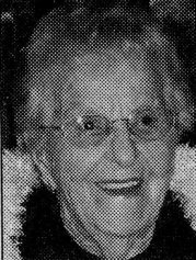
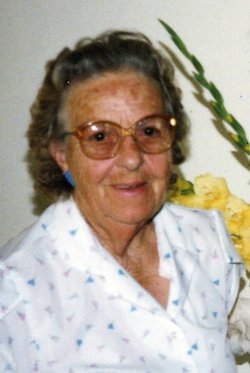
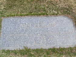
Anita Elizabeth Brown McClellan
| Birth | : | 13 Jan 1910 Fort Collins, Larimer County, Colorado, USA |
| Death | : | 27 Apr 2008 Las Vegas, Clark County, Nevada, USA |
| Burial | : | Oakwood Cemetery, Independence, Buchanan County, USA |
| Coordinate | : | 42.4627991, -91.8927994 |
| Plot | : | South Fraternal Row51BLK50LotS7 |
| Description | : | Anita Elizabeth (Brown) McClellan, 98, passed away at the TLC Care Center in Las Vegas on April 27, 2008. At the time of her death, her three girls were at her bedside. She was born January 13, 1910, at Fort Collins, CO, the daughter of L.V. and Grace (McDavitt) Brown. The family moved to Appleton City, MO, where she graduated from high school in 1927. In 1930, she was married to Grover McClellan and they moved to Manson in 1935. Grover was an orchardist/trucker and Anita was a mother/homemaker. At retirement in 1972, they remained in the Manson/Chelan area. Grover... Read More |
frequently asked questions (FAQ):
-
Where is Anita Elizabeth Brown McClellan's memorial?
Anita Elizabeth Brown McClellan's memorial is located at: Oakwood Cemetery, Independence, Buchanan County, USA.
-
When did Anita Elizabeth Brown McClellan death?
Anita Elizabeth Brown McClellan death on 27 Apr 2008 in Las Vegas, Clark County, Nevada, USA
-
Where are the coordinates of the Anita Elizabeth Brown McClellan's memorial?
Latitude: 42.4627991
Longitude: -91.8927994
Family Members:
Parent
Spouse
Siblings
Children
Flowers:
Nearby Cemetories:
1. Oakwood Cemetery
Independence, Buchanan County, USA
Coordinate: 42.4627991, -91.8927994
2. Mount Hope Cemetery
Independence, Buchanan County, USA
Coordinate: 42.4571991, -91.8914032
3. West Haven Cemetery
Independence, Buchanan County, USA
Coordinate: 42.4588678, -91.8986696
4. Saint Johns Catholic Cemetery
Independence, Buchanan County, USA
Coordinate: 42.4822006, -91.8957977
5. State Hospital Cemetery
Independence, Buchanan County, USA
Coordinate: 42.4455986, -91.9253006
6. Wilson Cemetery
Independence, Buchanan County, USA
Coordinate: 42.4658012, -91.8516998
7. Buchanan County Poor Farm Cemetery
Independence, Buchanan County, USA
Coordinate: 42.4871560, -91.8647280
8. Buchanan County Home Cemetery
Independence, Buchanan County, USA
Coordinate: 42.4903050, -91.8596350
9. Otterville Cemetery
Buchanan County, USA
Coordinate: 42.5158005, -91.9392014
10. Pine Creek Cemetery
Quasqueton, Buchanan County, USA
Coordinate: 42.4172400, -91.7867200
11. Rowley Cemetery
Rowley, Buchanan County, USA
Coordinate: 42.3716621, -91.8530655
12. Cedar Crest Cemetery
Jesup, Buchanan County, USA
Coordinate: 42.4782982, -92.0406036
13. Saint Athanasius Cemetery
Jesup, Buchanan County, USA
Coordinate: 42.4761009, -92.0421982
14. Hickory Grove Cemetery
Quasqueton, Buchanan County, USA
Coordinate: 42.4207598, -91.7534684
15. Fairview Cemetery
Winthrop, Buchanan County, USA
Coordinate: 42.4692001, -91.7407990
16. Quasqueton Cemetery
Quasqueton, Buchanan County, USA
Coordinate: 42.3994370, -91.7621231
17. Littleton Cemetery
Littleton, Buchanan County, USA
Coordinate: 42.5338593, -92.0179520
18. Saint Patricks Cemetery
Winthrop, Buchanan County, USA
Coordinate: 42.4653015, -91.7328033
19. Payne Cemetery
Winthrop, Buchanan County, USA
Coordinate: 42.5203018, -91.7453003
20. Fremont Township Cemetery
Winthrop, Buchanan County, USA
Coordinate: 42.5046997, -91.7264023
21. Byron Township Cemetery
Buchanan County, USA
Coordinate: 42.5271988, -91.7275009
22. Fontana Cemetery
Hazleton, Buchanan County, USA
Coordinate: 42.6046982, -91.9052963
23. Amish Cemetery
Buchanan County, USA
Coordinate: 42.5689011, -92.0224991
24. Shady Grove Cemetery
Jesup, Buchanan County, USA
Coordinate: 42.3805453, -92.0557342


