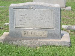
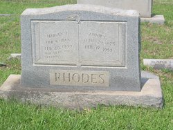
Annie Clifton Rhodes
| Birth | : | 29 Jun 1875 |
| Death | : | 17 Feb 1953 |
| Burial | : | St Laurence Churchyard, South Hinksey, Vale of White Horse District, England |
| Coordinate | : | 51.7319218, -1.2635270 |
frequently asked questions (FAQ):
-
Where is Annie Clifton Rhodes's memorial?
Annie Clifton Rhodes's memorial is located at: St Laurence Churchyard, South Hinksey, Vale of White Horse District, England.
-
When did Annie Clifton Rhodes death?
Annie Clifton Rhodes death on 17 Feb 1953 in
-
Where are the coordinates of the Annie Clifton Rhodes's memorial?
Latitude: 51.7319218
Longitude: -1.2635270
Family Members:
Parent
Spouse
Siblings
Flowers:
Nearby Cemetories:
1. St Laurence Churchyard
South Hinksey, Vale of White Horse District, England
Coordinate: 51.7319218, -1.2635270
2. St Matthews Church
Oxford, City of Oxford, England
Coordinate: 51.7442200, -1.2585480
3. St Mary the Virgin Churchyard
Iffley, City of Oxford, England
Coordinate: 51.7273590, -1.2381680
4. Osney Cathedral
Oxford, City of Oxford, England
Coordinate: 51.7497220, -1.2700000
5. St Ebbe Churchyard
Oxford, City of Oxford, England
Coordinate: 51.7504200, -1.2596030
6. Greyfriars
Oxford, City of Oxford, England
Coordinate: 51.7437920, -1.2401460
7. Christ Church Cathedral
Oxford, City of Oxford, England
Coordinate: 51.7500620, -1.2547160
8. Osney Cemetery
Oxford, City of Oxford, England
Coordinate: 51.7505310, -1.2703040
9. St. Lawrence's Churchyard
North Hinksey, Vale of White Horse District, England
Coordinate: 51.7457590, -1.2848020
10. Saint Thomas the Martyr Churchyard
Oxford, City of Oxford, England
Coordinate: 51.7512222, -1.2679445
11. St Martin's Church, Carfax (Defunct)
Oxford, City of Oxford, England
Coordinate: 51.7513500, -1.2581700
12. Corpus Christi College Chapel
Oxford, City of Oxford, England
Coordinate: 51.7507010, -1.2534236
13. Saint Peter le Bailey Churchyard
Oxford, City of Oxford, England
Coordinate: 51.7516980, -1.2600300
14. St Thomas the Martyr
Oxford, City of Oxford, England
Coordinate: 51.7518100, -1.2683430
15. Oxford Castle and Prison Cemetery
Oxford, City of Oxford, England
Coordinate: 51.7521453, -1.2631165
16. Merton College chapel
Oxford, City of Oxford, England
Coordinate: 51.7510500, -1.2526620
17. Oriel College Ante-Chapel
Oxford, City of Oxford, England
Coordinate: 51.7512420, -1.2531940
18. University Church of St Mary the Virgin
Oxford, City of Oxford, England
Coordinate: 51.7523990, -1.2556000
19. All Saints Churchyard
Oxford, City of Oxford, England
Coordinate: 51.7525000, -1.2555560
20. St Frideswide Churchyard
Oxford, City of Oxford, England
Coordinate: 51.7521560, -1.2748350
21. University College Chapel
Oxford, City of Oxford, England
Coordinate: 51.7522100, -1.2521700
22. St. Michael at the North Gate Church
Oxford, City of Oxford, England
Coordinate: 51.7537210, -1.2583950
23. Jesus College Chapel
Oxford, City of Oxford, England
Coordinate: 51.7536130, -1.2566180
24. Exeter College Chapel
Oxford, City of Oxford, England
Coordinate: 51.7539460, -1.2561170


