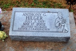
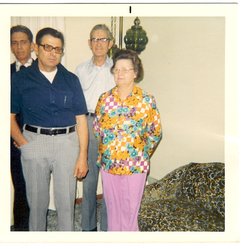
Anthony G. “Tony/Bud” Hilger
| Birth | : | 3 Jul 1919 Cedar Rapids, Boone County, Nebraska, USA |
| Death | : | 17 May 2002 Columbus, Platte County, Nebraska, USA |
| Burial | : | Västra Ingelstad Gamla Kyrkogård, Vastra Ingelstad, Vellinge kommun, Sweden |
| Coordinate | : | 55.4903430, 13.1168530 |
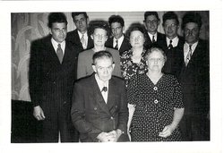
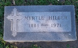
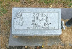
| Description | : | Son of Joseph & Myrtle (Murphy) Hilger. received his education in Cedar Rapids, Nebraska. Bud married Zathea I. Jackson on April 23, 1940 in Little Rock, Ark. He served in the U.S. Army during WWII. He worked along with Walt & Mike Behlen fabricating different steel presses at Behlen Manufacturing. He was a foreman for the tool & die department at Behlen for 34 years. He enjoyed woodworking as a hobby. Bud was a member of St. Bonaventure Catholic Church. He is survived by: Wife Zathea Hilger of Columbus, NE Daughter Kathy (Charles) Ewert of Columbus, Daughter Sheila (Leon) Kuta of Duncan,... Read More |
frequently asked questions (FAQ):
-
Where is Anthony G. “Tony/Bud” Hilger's memorial?
Anthony G. “Tony/Bud” Hilger's memorial is located at: Västra Ingelstad Gamla Kyrkogård, Vastra Ingelstad, Vellinge kommun, Sweden.
-
When did Anthony G. “Tony/Bud” Hilger death?
Anthony G. “Tony/Bud” Hilger death on 17 May 2002 in Columbus, Platte County, Nebraska, USA
-
Where are the coordinates of the Anthony G. “Tony/Bud” Hilger's memorial?
Latitude: 55.4903430
Longitude: 13.1168530
Family Members:
Parent
Spouse
Siblings
Flowers:
Nearby Cemetories:
1. Västra Ingelstad Gamla Kyrkogård
Vastra Ingelstad, Vellinge kommun, Sweden
Coordinate: 55.4903430, 13.1168530
2. Västra Ingelstad Nya Kyrkogård
Vellinge, Vellinge kommun, Sweden
Coordinate: 55.4903817, 13.1168721
3. Västra Ingelstads Kyrkogård
Vellinge, Vellinge kommun, Sweden
Coordinate: 55.4902806, 13.1160125
4. Mellan-Grevie Kyrkogård
Mellan-Grevie, Vellinge kommun, Sweden
Coordinate: 55.4700912, 13.0970274
5. Östra Grevie Kyrkogård
Ostra Grevie, Vellinge kommun, Sweden
Coordinate: 55.4690915, 13.1349324
6. Arrie Kyrkogård
Vellinge, Vellinge kommun, Sweden
Coordinate: 55.5153062, 13.0848378
7. Södra Åkarp Kyrkogård
Sodra Akarp, Vellinge kommun, Sweden
Coordinate: 55.4840714, 13.0510117
8. Hököpinge Nya Kyrkogård
Vellinge, Vellinge kommun, Sweden
Coordinate: 55.5013195, 13.0323886
9. Hököpinge Gamla Kyrkogård
Vellinge, Vellinge kommun, Sweden
Coordinate: 55.5025990, 13.0297430
10. Eskilstorps Kyrkogård
Vellinge, Vellinge kommun, Sweden
Coordinate: 55.4804669, 13.0234034
11. Vellinge Nya Kyrkogård
Vellinge, Vellinge kommun, Sweden
Coordinate: 55.4655504, 13.0196800
12. Gessie Gamla Kyrkogård
Vellinge, Vellinge kommun, Sweden
Coordinate: 55.5018556, 12.9968000
13. Flädie Cemetery
Lomma kommun, Sweden
Coordinate: 55.4333000, 13.0413000
14. Gessie Nya Kyrkogård
Gessie, Vellinge kommun, Sweden
Coordinate: 55.5017280, 12.9882270
15. Trelleborg Northern Cemetery
Trelleborg, Trelleborgs kommun, Sweden
Coordinate: 55.3836510, 13.1555700
16. Norra Kyrkogården
Trelleborg, Trelleborgs kommun, Sweden
Coordinate: 55.3832200, 13.1576600
17. Östra Kyrkogården
Malmö, Malmö kommun, Sweden
Coordinate: 55.5936110, 13.0452780
18. Bara Kyrkogård
Svedala kommun, Sweden
Coordinate: 55.5909233, 13.2014502
19. Bara Ödekyrkogård
Svedala kommun, Sweden
Coordinate: 55.5909945, 13.2017832
20. Bösarp Cemetery
Trelleborgs kommun, Sweden
Coordinate: 55.4117024, 13.2617568
21. Hyllie kyrkogård
Malmö kommun, Sweden
Coordinate: 55.5663535, 12.9632980
22. Sankt Pauli Mellersta Kyrkogård
Malmö, Malmö kommun, Sweden
Coordinate: 55.5976730, 13.0202500
23. Malmo Jewish Cemetery
Malmö, Malmö kommun, Sweden
Coordinate: 55.6023100, 13.0186500
24. Limhamns Kyrkogård
Malmö, Malmö kommun, Sweden
Coordinate: 55.5726990, 12.9453440

