
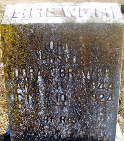
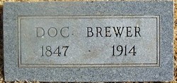
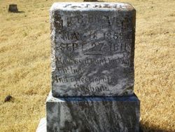
| Birth | : | 1 Jan 1843 Wayne County, Tennessee, USA |
| Death | : | 1914 Myrtle, Oregon County, Missouri, USA |
| Burial | : | Myrtle Cemetery, Myrtle, Oregon County, USA |
| Coordinate | : | 36.5133900, -91.2664300 |
| Description | : | * * * * Archey Brewer United States Census, 1880 Name: Archey Brewer • Event Type: Census Event Date: 1880 • Event Place: Precinct 6, Collin, Texas, United States • Event Place (Original): Precinct 6, Collin, Texas, United States Gender: Male Age: 37 Marital Status: Widowed Race: White Race (Original): W Occupation: Farmer Birth Year (Estimated): 1843 Birthplace: Tennessee, United States • Father's Birthplace: North Carolina, United States Mother's Birthplace: Virginia, United States Relationship to Head of Household: Self Relationship to Head of Household (Original): Self Sheet Letter: C Sheet Number: 243 Person Number:... Read More |
frequently asked questions (FAQ):
-
Where is Archey Lewis “Al” Brewer's memorial?
Archey Lewis “Al” Brewer's memorial is located at: Myrtle Cemetery, Myrtle, Oregon County, USA.
-
When did Archey Lewis “Al” Brewer death?
Archey Lewis “Al” Brewer death on 1914 in Myrtle, Oregon County, Missouri, USA
-
Where are the coordinates of the Archey Lewis “Al” Brewer's memorial?
Latitude: 36.5133900
Longitude: -91.2664300
Family Members:
Parent
Siblings
Children
Flowers:


Nearby Cemetories:
1. Myrtle Cemetery
Myrtle, Oregon County, USA
Coordinate: 36.5133900, -91.2664300
2. Church of God Cemetery
Oregon County, USA
Coordinate: 36.5023500, -91.2580200
3. Byrd Cemetery
Myrtle, Oregon County, USA
Coordinate: 36.5186005, -91.3143997
4. Crass Homestead
Myrtle, Oregon County, USA
Coordinate: 36.5359695, -91.3084671
5. Old Elmore Thomas field
Billmore, Oregon County, USA
Coordinate: 36.5237770, -91.1980250
6. Spring Valley Cemetery
Billmore, Oregon County, USA
Coordinate: 36.5324670, -91.2003420
7. Guiteau-Risner Cemetery
Guiteau, Oregon County, USA
Coordinate: 36.5588074, -91.3156128
8. Walnut Grove Cemetery
Elm Store, Randolph County, USA
Coordinate: 36.4914017, -91.1967010
9. O'Neal
Billmore, Oregon County, USA
Coordinate: 36.5712170, -91.2415410
10. Cotton Creek Cemetery
Jobe, Oregon County, USA
Coordinate: 36.5844002, -91.2652969
11. John Brown Cemetery
Jobe, Oregon County, USA
Coordinate: 36.5812111, -91.2953568
12. James Cemetery
Randolph County, USA
Coordinate: 36.4660988, -91.3435974
13. Old Jobe Cemetery
Jobe, Oregon County, USA
Coordinate: 36.5917015, -91.2517014
14. Mount Carmel Cemetery
Calm, Oregon County, USA
Coordinate: 36.5106010, -91.1643982
15. Taylor Cemetery
Ravenden Springs, Randolph County, USA
Coordinate: 36.4468994, -91.3293991
16. Garfield Cemetery
Garfield, Oregon County, USA
Coordinate: 36.5844400, -91.3253400
17. Mosely Cemetery
Randolph County, USA
Coordinate: 36.4460983, -91.1975021
18. Davis Cemetery
Sharp County, USA
Coordinate: 36.4606018, -91.3574982
19. Reynolds Cemetery
Elm Store, Randolph County, USA
Coordinate: 36.4491997, -91.1860962
20. Pigman Mound Archeological Site
Calm, Oregon County, USA
Coordinate: 36.5717100, -91.1784800
21. Stubblefield Cemetery
Dalton, Randolph County, USA
Coordinate: 36.4597015, -91.1718979
22. Bellah Cemetery
Ravenden Springs, Randolph County, USA
Coordinate: 36.4207993, -91.2825012
23. Arytown Cemetery
Arytown, Oregon County, USA
Coordinate: 36.5539513, -91.3795776
24. Liberty Cemetery
Calm, Oregon County, USA
Coordinate: 36.5586500, -91.1549600