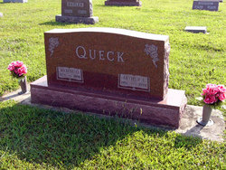
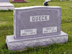
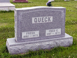
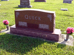
Arthur Lorenz Queck
| Birth | : | 24 Jun 1916 Adair County, Iowa, USA |
| Death | : | 8 Sep 1976 Greenfield, Adair County, Iowa, USA |
| Burial | : | Hill Cemetery, Shelburne, Franklin County, USA |
| Coordinate | : | 42.5984344, -72.6878815 |
| Plot | : | lot 151 sixth addition |
| Description | : | Fontanelle Observer, September, 1976 Arthur Lorenz Queck, son of Fred Queck and his wife Frieda Bredahl Queck, was born Jun 24, 1916, Adair county, Iowa. He was baptized in the Name of the Triune (sic) God on July 30, 1916 at the Emmanuel Lutheran Church, Fontanelle, the Rev. A. Zimmerman, Pastor. His formal education was received in the rural schools of Summerset Township, Adair county and he graduated from the Fontanelle High School in 1934. After being instructed in the chief teachings of God's Word concerning the Way of Salvation, he was confirmed in Emmanuel... Read More |
frequently asked questions (FAQ):
-
Where is Arthur Lorenz Queck's memorial?
Arthur Lorenz Queck's memorial is located at: Hill Cemetery, Shelburne, Franklin County, USA.
-
When did Arthur Lorenz Queck death?
Arthur Lorenz Queck death on 8 Sep 1976 in Greenfield, Adair County, Iowa, USA
-
Where are the coordinates of the Arthur Lorenz Queck's memorial?
Latitude: 42.5984344
Longitude: -72.6878815
Family Members:
Parent
Spouse
Siblings
Children
Flowers:
Nearby Cemetories:
1. Hill Cemetery
Shelburne, Franklin County, USA
Coordinate: 42.5984344, -72.6878815
2. Shelburne Center Cemetery
Shelburne, Franklin County, USA
Coordinate: 42.5830000, -72.6969600
3. East Shelburne Cemetery
Shelburne, Franklin County, USA
Coordinate: 42.6105995, -72.6694031
4. South Cemetery
Shelburne, Franklin County, USA
Coordinate: 42.5819016, -72.6699982
5. Arms Cemetery
Shelburne Falls, Franklin County, USA
Coordinate: 42.6166992, -72.7332993
6. North Shirkshire Cemetery
Conway, Franklin County, USA
Coordinate: 42.5689011, -72.7210999
7. Cosby Family Cemetery
Shelburne, Franklin County, USA
Coordinate: 42.5566400, -72.6702100
8. North Meadows Cemetery
Greenfield, Franklin County, USA
Coordinate: 42.6171989, -72.6333008
9. Hawks Cemetery
Deerfield, Franklin County, USA
Coordinate: 42.5555992, -72.6583023
10. Lower Meadow Cemetery
Greenfield, Franklin County, USA
Coordinate: 42.5945600, -72.6200300
11. East Buckland Cemetery
Buckland, Franklin County, USA
Coordinate: 42.5962500, -72.7610600
12. Mater Dolorosa Cemetery
Greenfield, Franklin County, USA
Coordinate: 42.5758000, -72.6165000
13. North Cemetery
Deerfield, Franklin County, USA
Coordinate: 42.5635100, -72.6249200
14. Calvary Cemetery
Greenfield, Franklin County, USA
Coordinate: 42.5764008, -72.6138992
15. Old East Buckland Cemetery
Buckland, Franklin County, USA
Coordinate: 42.5969400, -72.7677900
16. Baptist Cemetery
Deerfield, Franklin County, USA
Coordinate: 42.5555992, -72.6258011
17. Old Catholic Cemetery
Greenfield, Franklin County, USA
Coordinate: 42.5795753, -72.6064215
18. Green River Cemetery
Greenfield, Franklin County, USA
Coordinate: 42.5804400, -72.6052500
19. Federal Street Cemetery
Greenfield, Franklin County, USA
Coordinate: 42.5941400, -72.5977300
20. Country Farms Cemetery
Greenfield, Franklin County, USA
Coordinate: 42.6393900, -72.6165400
21. Brick School Cemetery
Colrain, Franklin County, USA
Coordinate: 42.6641998, -72.6660995
22. Chandler Hill Cemetery
Colrain, Franklin County, USA
Coordinate: 42.6683006, -72.6832962
23. Baptist Corner Cemetery
Ashfield, Franklin County, USA
Coordinate: 42.5540771, -72.7639313
24. Colrain West Branch Cemetery
Colrain, Franklin County, USA
Coordinate: 42.6671982, -72.7221985

