
| Memorials | : | 97 |
| Location | : | Ashfield, Franklin County, USA |
| Coordinate | : | 42.5540771, -72.7639313 |
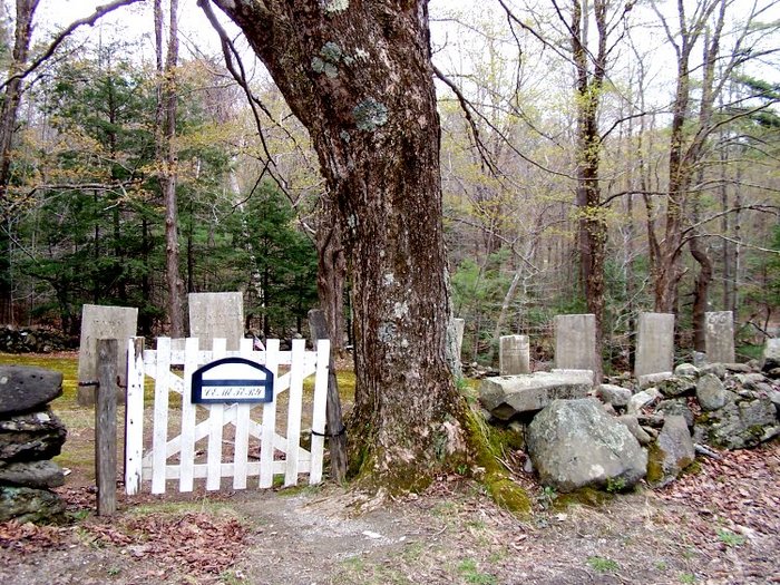
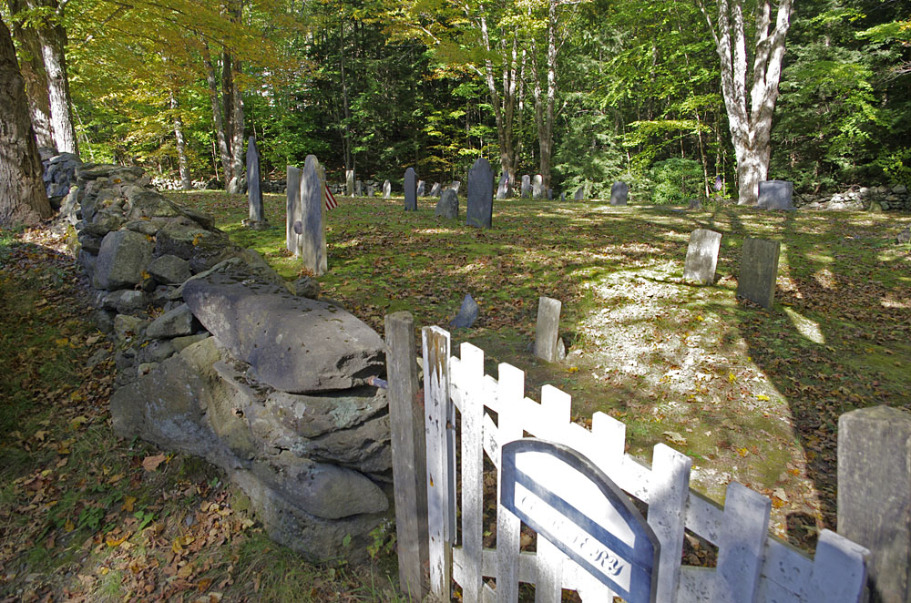
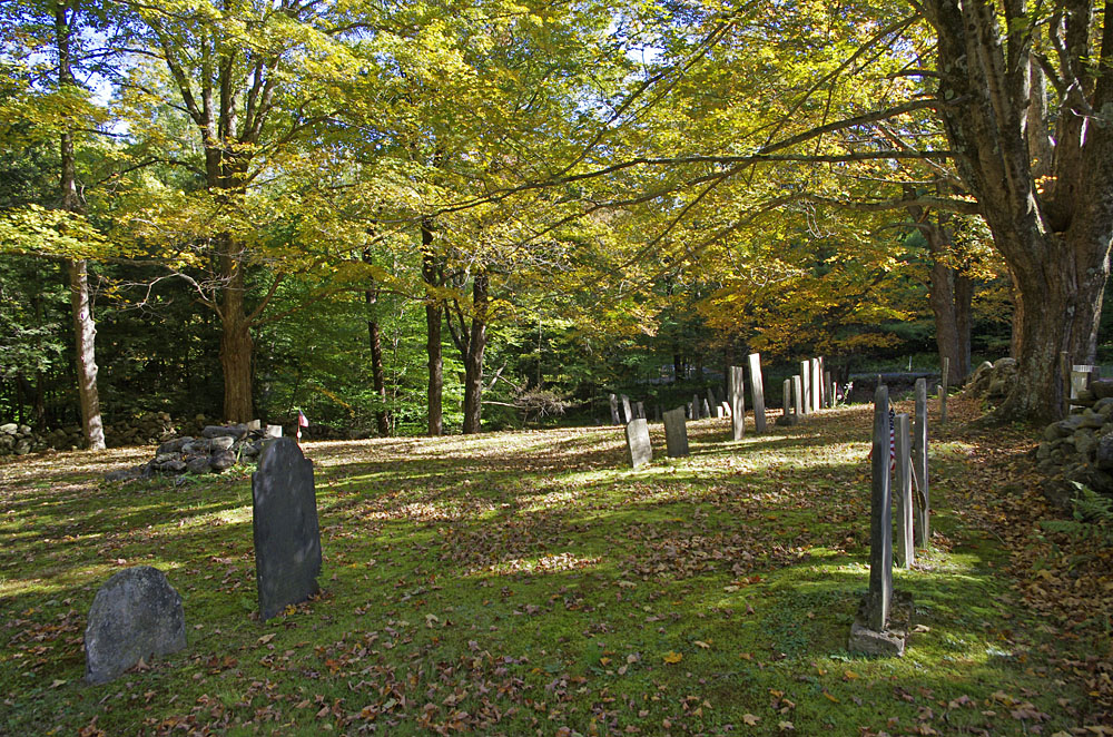
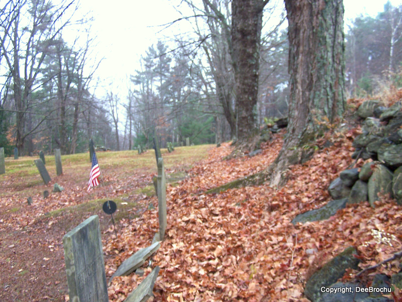
| Description | : | Baptist Corner Cemetery is often confused with Plain Cemetery which is located on Baptist Corner Road. Many of the earliest people buried in this cemetery were members of the Baptist Church. There are many unmarked graves in the Baptist Corner Cemetery. Many of the footstones were reset arbitrarily by a former caretaker, consequently some footstones are not near their respective headstones. Some of the stones are broken or illegible. [from Ashfield Historical Society research] This cemetery is referred to as G.R.7 in the Vital Records Of Ashfield Massachusetts To The Year 1850 Published By The New England... Read More |
frequently asked questions (FAQ):
-
Where is Baptist Corner Cemetery?
Baptist Corner Cemetery is located at March Road Ashfield, Franklin County ,Massachusetts ,USA.
-
Baptist Corner Cemetery cemetery's updated grave count on graveviews.com?
97 memorials
-
Where are the coordinates of the Baptist Corner Cemetery?
Latitude: 42.5540771
Longitude: -72.7639313
Nearby Cemetories:
1. Beldingville Cemetery
Ashfield, Franklin County, USA
Coordinate: 42.5365562, -72.7638016
2. Plain Cemetery
Ashfield, Franklin County, USA
Coordinate: 42.5292015, -72.7889023
3. Saint John's Church
Ashfield, Franklin County, USA
Coordinate: 42.5258600, -72.7894260
4. North Shirkshire Cemetery
Conway, Franklin County, USA
Coordinate: 42.5689011, -72.7210999
5. Hill Cemetery
Ashfield, Franklin County, USA
Coordinate: 42.5208015, -72.7992020
6. East Buckland Cemetery
Buckland, Franklin County, USA
Coordinate: 42.5962500, -72.7610600
7. Old Cemetery #01
Buckland, Franklin County, USA
Coordinate: 42.5918580, -72.7906890
8. Old East Buckland Cemetery
Buckland, Franklin County, USA
Coordinate: 42.5969400, -72.7677900
9. Center Cemetery #03
Buckland, Franklin County, USA
Coordinate: 42.5926950, -72.7898960
10. Trow Cemetery #04
Buckland, Franklin County, USA
Coordinate: 42.5932800, -72.7915000
11. Taylor Cemetery #02
Buckland, Franklin County, USA
Coordinate: 42.5932808, -72.7915039
12. Northwest Cemetery
Ashfield, Franklin County, USA
Coordinate: 42.5587500, -72.8250500
13. South Ashfield Cemetery
Ashfield, Franklin County, USA
Coordinate: 42.5077209, -72.7730026
14. Shelburne Center Cemetery
Shelburne, Franklin County, USA
Coordinate: 42.5830000, -72.6969600
15. Upper City Cemetery
Buckland, Franklin County, USA
Coordinate: 42.5832640, -72.8355360
16. Pine Grove Cemetery
Conway, Franklin County, USA
Coordinate: 42.5222015, -72.6908035
17. Howland Cemetery
Conway, Franklin County, USA
Coordinate: 42.5127983, -72.6967010
18. Arms Cemetery
Shelburne Falls, Franklin County, USA
Coordinate: 42.6166992, -72.7332993
19. Cosby Family Cemetery
Shelburne, Franklin County, USA
Coordinate: 42.5566400, -72.6702100
20. East Charlemont Cemetery
Charlemont, Franklin County, USA
Coordinate: 42.6197853, -72.7932739
21. Hill Cemetery
Shelburne, Franklin County, USA
Coordinate: 42.5984344, -72.6878815
22. South Centre Cemetery
Conway, Franklin County, USA
Coordinate: 42.5015940, -72.6973490
23. South Cemetery
Shelburne, Franklin County, USA
Coordinate: 42.5819016, -72.6699982
24. Maynard Cemetery
Conway, Franklin County, USA
Coordinate: 42.4836630, -72.7195800