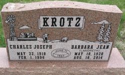
Barbara Jean Landreth Krotz
| Birth | : | 18 May 1928 Sterling, Logan County, Colorado, USA |
| Death | : | 18 Aug 2014 Gordon, Sheridan County, Nebraska, USA |
| Burial | : | Holly Cemetery, Rushville, Sheridan County, USA |
| Coordinate | : | 42.8575120, -102.5370990 |
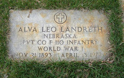
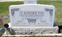
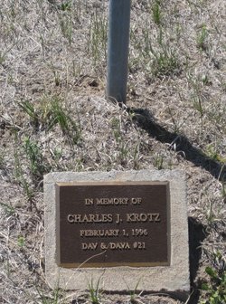
| Description | : | Barbara J. Krotz May 18, 1928 - Aug. 18, 2014 Barbara Jean Krotz, age 86, of Rushville, NE, died August 18, 2014 at the Gordon Memorial Hospital in Gordon, NE. For the last three and a half years she has resided at the Gordon Countryside Care Nursing Home.Barbara Jean Landreth was born May 18, 1928 at Sterling, CO, the sixth of ten children born to Alva and Eva (Polen) Landreth. She married the love of her life, Charles J. Krotz on June 11, 1947. To this union six children were born, Thomas, John, Kathleen, Melvin, Wayne and Rosalie. ... Read More |
frequently asked questions (FAQ):
-
Where is Barbara Jean Landreth Krotz's memorial?
Barbara Jean Landreth Krotz's memorial is located at: Holly Cemetery, Rushville, Sheridan County, USA.
-
When did Barbara Jean Landreth Krotz death?
Barbara Jean Landreth Krotz death on 18 Aug 2014 in Gordon, Sheridan County, Nebraska, USA
-
Where are the coordinates of the Barbara Jean Landreth Krotz's memorial?
Latitude: 42.8575120
Longitude: -102.5370990
Family Members:
Parent
Spouse
Siblings
Children
Flowers:
Nearby Cemetories:
1. Holly Cemetery
Rushville, Sheridan County, USA
Coordinate: 42.8575120, -102.5370990
2. Abold Family Cemetery
Rushville, Sheridan County, USA
Coordinate: 42.8863500, -102.6158000
3. Amity Cemetery
Sheridan County, USA
Coordinate: 42.8036003, -102.4389038
4. Novotny Cemetery
Hay Springs, Sheridan County, USA
Coordinate: 42.7742004, -102.5963974
5. Bomar Cemetery
Hay Springs, Sheridan County, USA
Coordinate: 42.8062000, -102.6459600
6. Saint Aloysius Cemetery
Sheridan County, USA
Coordinate: 42.9015500, -102.4025500
7. White Clay Cemetery
Rushville, Sheridan County, USA
Coordinate: 42.9732820, -102.5667230
8. Saint Marys Cemetery
Rushville, Sheridan County, USA
Coordinate: 42.7174988, -102.4436035
9. Beaver Valley Cemetery
Sheridan County, USA
Coordinate: 42.8880997, -102.7517014
10. Fair View Cemetery
Rushville, Sheridan County, USA
Coordinate: 42.7155991, -102.4325027
11. Holy Cross Cemetery
Pine Ridge, Oglala Lakota County, USA
Coordinate: 43.0194016, -102.5503006
12. Bethel Cemetery
Sheridan County, USA
Coordinate: 42.9011002, -102.3208008
13. Pine Ridge Presbyterian Cemetery
Pine Ridge, Oglala Lakota County, USA
Coordinate: 43.0235200, -102.5506200
14. Preble Cemetery
Sheridan County, USA
Coordinate: 42.6504000, -102.5765000
15. Wolf Creek Community Cemetery
Oglala Lakota County, USA
Coordinate: 43.0405750, -102.3966490
16. St. Mary's Cemetery
Hay Springs, Sheridan County, USA
Coordinate: 42.6721992, -102.7035980
17. Red Cloud Cemetery
Pine Ridge, Oglala Lakota County, USA
Coordinate: 43.0776839, -102.5837514
18. Hay Springs Cemetery
Hay Springs, Sheridan County, USA
Coordinate: 42.6702995, -102.7033005
19. Highland Cemetery
Hay Springs, Sheridan County, USA
Coordinate: 42.7145500, -102.7727500
20. Antelope Cemetery
Hay Springs, Sheridan County, USA
Coordinate: 42.7144970, -102.7727290
21. Gordon Cemetery
Gordon, Sheridan County, USA
Coordinate: 42.7858009, -102.2102966
22. Spotted Bear Family Cemetery
Denby, Oglala Lakota County, USA
Coordinate: 43.0608200, -102.3376600
23. Lamont Cemetery
Wounded Knee, Oglala Lakota County, USA
Coordinate: 43.1006012, -102.4107971
24. Cortier Family Cemetery
Oglala Lakota County, USA
Coordinate: 43.1160000, -102.6210000

