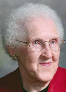
Berniece Irene Wilhelmina Glawe Johnson
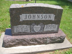
| Birth | : | 16 Oct 1923 Boardman Township, Clayton County, Iowa, USA |
| Death | : | 25 Mar 2019 Elkader, Clayton County, Iowa, USA |
| Burial | : | Elkader Cemetery, Elkader, Clayton County, USA |
| Coordinate | : | 42.8541718, -91.4000015 |
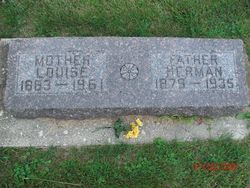
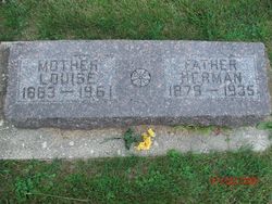
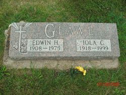
| Description | : | Berniece Irene Wilhelmina (Glawe) Johnson, 95, of Elkader passed away Monday, March 25, 2019, at the Elkader Care Center. She was the daughter of Herman and Louisa (Polkow) Glawe, born on October 16, 1923, in Boardman Township in rural Elkader, Iowa. She was born and raised in Clayton County. She was united in marriage to Orville N.T. Johnson on September 4th, 1941. Besides raising ten children and farming with her husband, she used her love of cooking to establish two restaurants, which she owned and operated, first in Monona and then Elkader. The Cedar Rapids... Read More |
frequently asked questions (FAQ):
-
Where is Berniece Irene Wilhelmina Glawe Johnson's memorial?
Berniece Irene Wilhelmina Glawe Johnson's memorial is located at: Elkader Cemetery, Elkader, Clayton County, USA.
-
When did Berniece Irene Wilhelmina Glawe Johnson death?
Berniece Irene Wilhelmina Glawe Johnson death on 25 Mar 2019 in Elkader, Clayton County, Iowa, USA
-
Where are the coordinates of the Berniece Irene Wilhelmina Glawe Johnson's memorial?
Latitude: 42.8541718
Longitude: -91.4000015
Family Members:
Parent
Spouse
Siblings
Flowers:
Nearby Cemetories:
1. Elkader Cemetery
Elkader, Clayton County, USA
Coordinate: 42.8541718, -91.4000015
2. Saint Josephs Cemetery
Elkader, Clayton County, USA
Coordinate: 42.8488998, -91.4021988
3. Hartman Cemetery
Cox Creek Township, Clayton County, USA
Coordinate: 42.8155360, -91.3880840
4. Colony Catholic Cemetery (Defunct)
Read Township, Clayton County, USA
Coordinate: 42.8830000, -91.3580000
5. County Home Cemetery
Clayton Center, Clayton County, USA
Coordinate: 42.8916702, -91.3499985
6. Dohrer Cemetery
Osborne, Clayton County, USA
Coordinate: 42.8124846, -91.4584734
7. Meenan Cemetery
Communia, Clayton County, USA
Coordinate: 42.7999862, -91.3584693
8. Zion Lutheran Cemetery
Clayton Center, Clayton County, USA
Coordinate: 42.8841705, -91.3249969
9. Cords Cemetery
Osborne, Clayton County, USA
Coordinate: 42.7973308, -91.4377662
10. Clayton Center Cemetery
Clayton Center, Clayton County, USA
Coordinate: 42.8841705, -91.3225021
11. Communia Cemetery
Volga Township, Clayton County, USA
Coordinate: 42.7868996, -91.3630981
12. Patterson Pioneer Cemetery
Saint Olaf, Clayton County, USA
Coordinate: 42.9216000, -91.4489000
13. Watkins Cemetery
Osborne, Clayton County, USA
Coordinate: 42.7833180, -91.4584733
14. Clark Family Cemetery
Beulah, Clayton County, USA
Coordinate: 42.9166505, -91.4751415
15. Norway Lutheran Church Cemetery
Saint Olaf, Clayton County, USA
Coordinate: 42.9352798, -91.4302826
16. Weymouth Cemetery
Saint Olaf, Clayton County, USA
Coordinate: 42.9278799, -91.4583559
17. Mederville Cemetery
Elkader, Clayton County, USA
Coordinate: 42.7638893, -91.4194412
18. Krumm Cemetery
Garber, Clayton County, USA
Coordinate: 42.7913760, -91.3023559
19. Farmersburg-Wagner Cemetery
Farmersburg, Clayton County, USA
Coordinate: 42.9481010, -91.3700027
20. Blanchaine Cemetery
Volga, Clayton County, USA
Coordinate: 42.7676210, -91.3389040
21. Cook Family Cemetery
Elkader, Clayton County, USA
Coordinate: 42.9209880, -91.5091230
22. Wagner Township Cemetery
Saint Olaf, Clayton County, USA
Coordinate: 42.9519386, -91.4513931
23. Eberhard Cemetery
Littleport, Clayton County, USA
Coordinate: 42.7583201, -91.3418020
24. Highland Lutheran Cemetery
Highland Township, Clayton County, USA
Coordinate: 42.8987000, -91.5330000


