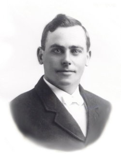
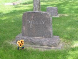
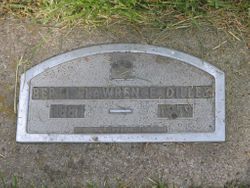
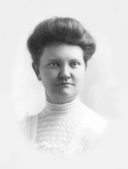
Bert L. Dilley
| Birth | : | 22 Oct 1881 Red Oak, Montgomery County, Iowa, USA |
| Death | : | 9 Jan 1959 Redfield, Spink County, South Dakota, USA |
| Burial | : | Holy Trinity Churchyard, Messingham, North Lincolnshire Unitary Authority, England |
| Coordinate | : | 53.5323250, -0.6583030 |
| Plot | : | Division G, Block 043, Grave 005 |
| Description | : | Bert L. Dilley was born October 22, 1881 at Red Oak, Iowa. He married Zella (Spicer) in Iowa. He brought his family to Tulare, Spink Co., South Dakota in 1927 and farmed there until ill health caused him to retire. He was a member of the Tulare Methodist Church and IOOF Lodge at Redfield. Bert died January 9, 1959 at a Redfield Rest Home. Survivors include three sons, Clark Dilley, Huron; Marshall Dilley, Redfield; Glendon Dilly, Hitchcock; one sister, Mrs. Myrtle Gordon, Sacramento, California; nine grandchildren; one great-grandchild. He was preceded in death... Read More |
frequently asked questions (FAQ):
-
Where is Bert L. Dilley's memorial?
Bert L. Dilley's memorial is located at: Holy Trinity Churchyard, Messingham, North Lincolnshire Unitary Authority, England.
-
When did Bert L. Dilley death?
Bert L. Dilley death on 9 Jan 1959 in Redfield, Spink County, South Dakota, USA
-
Where are the coordinates of the Bert L. Dilley's memorial?
Latitude: 53.5323250
Longitude: -0.6583030
Family Members:
Spouse
Children
Flowers:
Nearby Cemetories:
1. Holy Trinity Churchyard
Messingham, North Lincolnshire Unitary Authority, England
Coordinate: 53.5323250, -0.6583030
2. St Peter Ad Vincula Church
Bottesford, North Lincolnshire Unitary Authority, England
Coordinate: 53.5533120, -0.6448410
3. St Peter Churchyard
Scotter, West Lindsey District, England
Coordinate: 53.4966600, -0.6636500
4. Scotter Cemetery
Scotter, West Lindsey District, England
Coordinate: 53.4942000, -0.6665520
5. Saint Hybald Churchyard
Manton, North Lincolnshire Unitary Authority, England
Coordinate: 53.5125000, -0.5931000
6. Brumby Cemetery
Scunthorpe, North Lincolnshire Unitary Authority, England
Coordinate: 53.5799400, -0.6448700
7. Woodlands Cemetery and Crematorium
Scunthorpe, North Lincolnshire Unitary Authority, England
Coordinate: 53.5810900, -0.6744900
8. St Mary the Virgin Churchyard
West Butterwick, North Lincolnshire Unitary Authority, England
Coordinate: 53.5426407, -0.7412120
9. Baptist Burial Ground
West Butterwick, North Lincolnshire Unitary Authority, England
Coordinate: 53.5432720, -0.7423210
10. St Genewys Churchyard
Scotton, West Lindsey District, England
Coordinate: 53.4810900, -0.6597690
11. St Lawrence Churchyard
Scunthorpe, North Lincolnshire Unitary Authority, England
Coordinate: 53.5864180, -0.6554010
12. Scunthorpe Cemetery
Scunthorpe, North Lincolnshire Unitary Authority, England
Coordinate: 53.5932400, -0.6512140
13. St John The Baptist Churchyard Extension
Burringham, North Lincolnshire Unitary Authority, England
Coordinate: 53.5708230, -0.7439800
14. Crosby Cemetery
Scunthorpe, North Lincolnshire Unitary Authority, England
Coordinate: 53.5978800, -0.6639600
15. St Oswald Churchyard
Althorpe, North Lincolnshire Unitary Authority, England
Coordinate: 53.5765570, -0.7408910
16. Kirton-in-Lindsey Cemetery
Kirton in Lindsey, North Lincolnshire Unitary Authority, England
Coordinate: 53.4765050, -0.5963870
17. St Andrews Church
Kirton in Lindsey, North Lincolnshire Unitary Authority, England
Coordinate: 53.4755000, -0.5940000
18. St. John's Churchyard
Gainsborough, West Lindsey District, England
Coordinate: 53.4635280, -0.6538310
19. Saint Hybald's Churchyard
Scawby, North Lincolnshire Unitary Authority, England
Coordinate: 53.5384500, -0.5395500
20. St Marys Churchyard
Broughton, North Lincolnshire Unitary Authority, England
Coordinate: 53.5654330, -0.5514190
21. Broughton Church Cemetery
Broughton, North Lincolnshire Unitary Authority, England
Coordinate: 53.5649200, -0.5504110
22. Broughton Cemetery
Broughton, North Lincolnshire Unitary Authority, England
Coordinate: 53.5732500, -0.5582900
23. Laughton Cemetery
Laughton, West Lindsey District, England
Coordinate: 53.4681287, -0.7228939
24. All Saints Churchyard
Laughton, West Lindsey District, England
Coordinate: 53.4656600, -0.7224400

