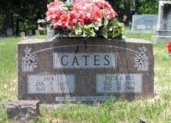
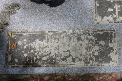
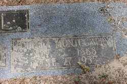
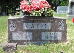
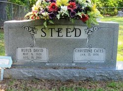
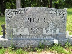
Bessie Beatrice Hill Cates
| Birth | : | 22 Dec 1908 Arkansas, USA |
| Death | : | 10 Dec 1994 Union County, Arkansas, USA |
| Burial | : | Old Parkers Chapel Cemetery, Parkers Chapel, Union County, USA |
| Coordinate | : | 33.1470000, -92.7258300 |
frequently asked questions (FAQ):
-
Where is Bessie Beatrice Hill Cates's memorial?
Bessie Beatrice Hill Cates's memorial is located at: Old Parkers Chapel Cemetery, Parkers Chapel, Union County, USA.
-
When did Bessie Beatrice Hill Cates death?
Bessie Beatrice Hill Cates death on 10 Dec 1994 in Union County, Arkansas, USA
-
Where are the coordinates of the Bessie Beatrice Hill Cates's memorial?
Latitude: 33.1470000
Longitude: -92.7258300
Family Members:
Parent
Spouse
Siblings
Children
Flowers:
Nearby Cemetories:
1. Old Parkers Chapel Cemetery
Parkers Chapel, Union County, USA
Coordinate: 33.1470000, -92.7258300
2. Shady Grove Cemetery
Parkers Chapel, Union County, USA
Coordinate: 33.1350000, -92.7093000
3. Meek-Traylor Cemetery
Parkers Chapel, Union County, USA
Coordinate: 33.1333677, -92.7002846
4. Parkers Chapel Church Cemetery
Parkers Chapel, Union County, USA
Coordinate: 33.1724500, -92.7217700
5. Galilee Cemetery
El Dorado, Union County, USA
Coordinate: 33.1716995, -92.6841965
6. Beulah Grove Cemetery
El Dorado, Union County, USA
Coordinate: 33.1954000, -92.7133000
7. Wesson Cemetery
Wesson, Union County, USA
Coordinate: 33.1074300, -92.7642700
8. Wyatt-Parnell Cemetery
El Dorado, Union County, USA
Coordinate: 33.1958008, -92.7442017
9. Cummings Cemetery
Junction City, Union County, USA
Coordinate: 33.0989000, -92.7037800
10. Rogers Family Cemetery
El Dorado, Union County, USA
Coordinate: 33.2010440, -92.7245660
11. Hammond Cemetery
El Dorado, Union County, USA
Coordinate: 33.1988983, -92.7071991
12. Beulah Grove Wesson Cemetery
Wesson, Union County, USA
Coordinate: 33.1063995, -92.7696991
13. Friendship Cemetery
El Dorado, Union County, USA
Coordinate: 33.1936000, -92.6818000
14. Stamps Cemetery
El Dorado, Union County, USA
Coordinate: 33.1490000, -92.6539000
15. Mount Calvary Cemetery
El Dorado, Union County, USA
Coordinate: 33.1900000, -92.6645000
16. Lott-Burgy Cemetery
El Dorado, Union County, USA
Coordinate: 33.1917000, -92.6649000
17. Saint Marks Cemetery
Union County, USA
Coordinate: 33.1006000, -92.6639000
18. Carroll Cemetery
Wesson, Union County, USA
Coordinate: 33.1724000, -92.8037000
19. Pleasant Hill Cemetery
Wesson, Union County, USA
Coordinate: 33.1025000, -92.7946000
20. Centre Point Cemetery
El Dorado, Union County, USA
Coordinate: 33.2198982, -92.7304993
21. Presbyterian Cemetery
El Dorado, Union County, USA
Coordinate: 33.2085991, -92.6631012
22. Harris Cemetery
El Dorado, Union County, USA
Coordinate: 33.1966600, -92.8031000
23. Smyrna Cemetery
El Dorado, Union County, USA
Coordinate: 33.1143990, -92.6342010
24. Warner Brown Cemetery
El Dorado, Union County, USA
Coordinate: 33.2108002, -92.6614990

