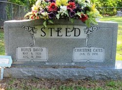
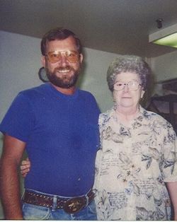
Christine Cates Steed
| Birth | : | 15 Jan 1936 El Dorado, Union County, Arkansas, USA |
| Death | : | 24 Nov 2011 El Dorado, Union County, Arkansas, USA |
| Burial | : | Old Parkers Chapel Cemetery, Parkers Chapel, Union County, USA |
| Coordinate | : | 33.1470000, -92.7258300 |
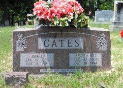
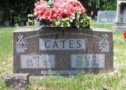
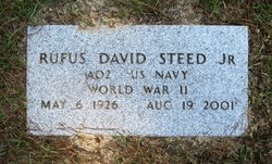
| Description | : | Christine Steed, 75, died Thursday, Nov. 24, 2011, at the Medical Center of South Arkansas. She was born Jan. 15, 1936, to Jack Cates and Beatrice Hill Cates in El Dorado. Christine was a homemaker and a member of Parkers Chapel First Baptist Church. Preceding her in death were her parents; her husband, R. D. Steed; son, Eddie Welch; grandson, Cody Wayne Martindale; one brother; and three sisters. Survivors include children, Dennis and Marsha Martindale, Jackie and Joyce Martindale, David and Connie Welch, all of El Dorado; grandchildren, Lauri Fruge' and her husband, Milton; Lindsey Griffin and her husband, Lane;... Read More |
frequently asked questions (FAQ):
-
Where is Christine Cates Steed's memorial?
Christine Cates Steed's memorial is located at: Old Parkers Chapel Cemetery, Parkers Chapel, Union County, USA.
-
When did Christine Cates Steed death?
Christine Cates Steed death on 24 Nov 2011 in El Dorado, Union County, Arkansas, USA
-
Where are the coordinates of the Christine Cates Steed's memorial?
Latitude: 33.1470000
Longitude: -92.7258300
Family Members:
Parent
Spouse
Siblings
Children
Flowers:
Nearby Cemetories:
1. Old Parkers Chapel Cemetery
Parkers Chapel, Union County, USA
Coordinate: 33.1470000, -92.7258300
2. Shady Grove Cemetery
Parkers Chapel, Union County, USA
Coordinate: 33.1350000, -92.7093000
3. Meek-Traylor Cemetery
Parkers Chapel, Union County, USA
Coordinate: 33.1333677, -92.7002846
4. Parkers Chapel Church Cemetery
Parkers Chapel, Union County, USA
Coordinate: 33.1724500, -92.7217700
5. Galilee Cemetery
El Dorado, Union County, USA
Coordinate: 33.1716995, -92.6841965
6. Beulah Grove Cemetery
El Dorado, Union County, USA
Coordinate: 33.1954000, -92.7133000
7. Wesson Cemetery
Wesson, Union County, USA
Coordinate: 33.1074300, -92.7642700
8. Wyatt-Parnell Cemetery
El Dorado, Union County, USA
Coordinate: 33.1958008, -92.7442017
9. Cummings Cemetery
Junction City, Union County, USA
Coordinate: 33.0989000, -92.7037800
10. Rogers Family Cemetery
El Dorado, Union County, USA
Coordinate: 33.2010440, -92.7245660
11. Hammond Cemetery
El Dorado, Union County, USA
Coordinate: 33.1988983, -92.7071991
12. Beulah Grove Wesson Cemetery
Wesson, Union County, USA
Coordinate: 33.1063995, -92.7696991
13. Friendship Cemetery
El Dorado, Union County, USA
Coordinate: 33.1936000, -92.6818000
14. Stamps Cemetery
El Dorado, Union County, USA
Coordinate: 33.1490000, -92.6539000
15. Mount Calvary Cemetery
El Dorado, Union County, USA
Coordinate: 33.1900000, -92.6645000
16. Lott-Burgy Cemetery
El Dorado, Union County, USA
Coordinate: 33.1917000, -92.6649000
17. Saint Marks Cemetery
Union County, USA
Coordinate: 33.1006000, -92.6639000
18. Carroll Cemetery
Wesson, Union County, USA
Coordinate: 33.1724000, -92.8037000
19. Pleasant Hill Cemetery
Wesson, Union County, USA
Coordinate: 33.1025000, -92.7946000
20. Centre Point Cemetery
El Dorado, Union County, USA
Coordinate: 33.2198982, -92.7304993
21. Presbyterian Cemetery
El Dorado, Union County, USA
Coordinate: 33.2085991, -92.6631012
22. Harris Cemetery
El Dorado, Union County, USA
Coordinate: 33.1966600, -92.8031000
23. Smyrna Cemetery
El Dorado, Union County, USA
Coordinate: 33.1143990, -92.6342010
24. Warner Brown Cemetery
El Dorado, Union County, USA
Coordinate: 33.2108002, -92.6614990

